Estimated Value: $266,141 - $330,000
3
Beds
2
Baths
1,234
Sq Ft
$246/Sq Ft
Est. Value
About This Home
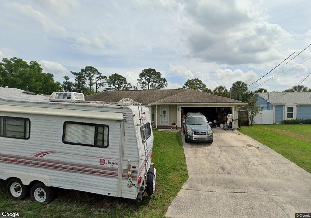
This home is located at 5045 Carter St, Cocoa, FL 32927 and is currently estimated at $303,535, approximately $245 per square foot. 5045 Carter St is a home located in Brevard County with nearby schools including Atlantis Elementary School, Space Coast Junior/Senior High School, and Sculptor Charter School.
Ownership History
Date
Name
Owned For
Owner Type
Purchase Details
Closed on
Jan 29, 2008
Sold by
Johnson Horace B and Johnson Deborah K
Bought by
Rash Christopher G and Rash Rachel D
Current Estimated Value
Home Financials for this Owner
Home Financials are based on the most recent Mortgage that was taken out on this home.
Original Mortgage
$148,000
Outstanding Balance
$93,890
Interest Rate
6.17%
Estimated Equity
$209,645
Purchase Details
Closed on
Jun 5, 1997
Sold by
Tumeo Chandler Edward Scott and Tumeo Chandler Faith
Bought by
Johnson Horace B and Johnson Deborah K
Home Financials for this Owner
Home Financials are based on the most recent Mortgage that was taken out on this home.
Original Mortgage
$66,810
Interest Rate
8.13%
Create a Home Valuation Report for This Property
The Home Valuation Report is an in-depth analysis detailing your home's value as well as a comparison with similar homes in the area
Home Values in the Area
Average Home Value in this Area
Purchase History
| Date | Buyer | Sale Price | Title Company |
|---|---|---|---|
| Rash Christopher G | $185,000 | Coast Title Of Volusia Inc | |
| Johnson Horace B | $65,500 | -- |
Source: Public Records
Mortgage History
| Date | Status | Borrower | Loan Amount |
|---|---|---|---|
| Open | Rash Christopher G | $148,000 | |
| Previous Owner | Johnson Horace B | $66,810 |
Source: Public Records
Tax History Compared to Growth
Tax History
| Year | Tax Paid | Tax Assessment Tax Assessment Total Assessment is a certain percentage of the fair market value that is determined by local assessors to be the total taxable value of land and additions on the property. | Land | Improvement |
|---|---|---|---|---|
| 2025 | $1,000 | $70,680 | -- | -- |
| 2024 | $980 | $68,690 | -- | -- |
| 2023 | $980 | $66,690 | $0 | $0 |
| 2022 | $929 | $64,750 | $0 | $0 |
| 2021 | $930 | $62,870 | $0 | $0 |
| 2020 | $884 | $62,010 | $0 | $0 |
| 2019 | $832 | $60,620 | $0 | $0 |
| 2018 | $832 | $59,490 | $0 | $0 |
| 2017 | $833 | $58,270 | $0 | $0 |
| 2016 | $839 | $57,080 | $18,000 | $39,080 |
| 2015 | $844 | $56,690 | $15,000 | $41,690 |
| 2014 | $849 | $56,240 | $11,000 | $45,240 |
Source: Public Records
Map
Nearby Homes
- 5090 Market St
- 5155 Mayflower St
- 6840 Anecia Ave
- 7155 Export Ave
- 6735 Grissom Pkwy
- 4859 Horton St
- 7275 Durban Ave
- 5170 Everett St
- 7035 Jasmine Ave
- 4760 Ivan St
- 7065 Hundred Acre Dr
- 7302 Bumelia Dr
- 7310 Joshua Place
- 5149 Arlington Rd Unit 104
- 0000 Grissom Pkwy
- 7230 Venus Ave
- 00 Unknown
- 7545 Fringe Place
- 7635 Fringe Place
- 6615 Dock Ave
- 5055 Carter St
- 5025 Carter St
- 5065 Carter St
- 5040 Carter St
- 5040 Market St
- 5030 Market St
- 5050 Carter St
- 5030 Carter St
- 5020 Market St
- 5060 Carter St
- 5075 Carter St
- 5020 Carter St
- 5060 Market St
- 5055 Mayflower St
- 5010 Carter St
- 5045 Mayflower St
- 5070 Market St
- 5085 Carter St
- 5075 Mayflower St
- 5035 Market St