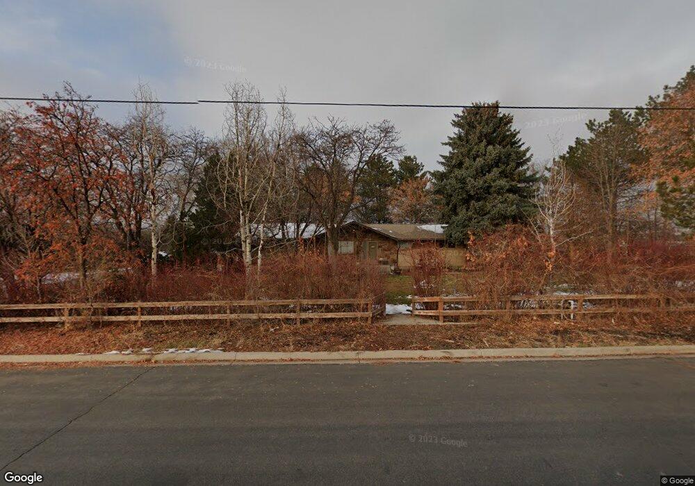
5046 W 11200 N Highland, UT 84003
Estimated Value: $1,017,000 - $1,295,696
6
Beds
3
Baths
2,914
Sq Ft
$407/Sq Ft
Est. Value
About This Home
This home is located at 5046 W 11200 N, Highland, UT 84003 and is currently estimated at $1,187,232, approximately $407 per square foot. 5046 W 11200 N is a home located in Utah County with nearby schools including Highland Elementary School, Timberline Middle School, and Lone Peak High School.
Ownership History
Date
Name
Owned For
Owner Type
Purchase Details
Closed on
Jun 12, 2001
Sold by
Hullinger Gordon and Hullinger Ann
Bought by
Hullinger Gordon and Hullinger Ann
Current Estimated Value
Purchase Details
Closed on
Feb 1, 2001
Sold by
Butt Gordon V and Butt Kittryn A
Bought by
Hullinger Gordon and Hullinger Ann
Purchase Details
Closed on
Sep 30, 1997
Sold by
Bennion Spencer M and Bennion Karen B
Bought by
Butt Gordon V and Butt Kittryn A
Home Financials for this Owner
Home Financials are based on the most recent Mortgage that was taken out on this home.
Original Mortgage
$205,000
Interest Rate
7.44%
Create a Home Valuation Report for This Property
The Home Valuation Report is an in-depth analysis detailing your home's value as well as a comparison with similar homes in the area
Home Values in the Area
Average Home Value in this Area
Purchase History
| Date | Buyer | Sale Price | Title Company |
|---|---|---|---|
| Hullinger Gordon | -- | Superior Title Company | |
| Hullinger Gordon | -- | Superior Title Company | |
| Butt Gordon V | -- | -- |
Source: Public Records
Mortgage History
| Date | Status | Borrower | Loan Amount |
|---|---|---|---|
| Previous Owner | Butt Gordon V | $205,000 |
Source: Public Records
Tax History Compared to Growth
Tax History
| Year | Tax Paid | Tax Assessment Tax Assessment Total Assessment is a certain percentage of the fair market value that is determined by local assessors to be the total taxable value of land and additions on the property. | Land | Improvement |
|---|---|---|---|---|
| 2025 | $7,164 | $923,975 | $965,500 | $264,700 |
| 2024 | $7,164 | $884,850 | $0 | $0 |
| 2023 | $6,227 | $829,660 | $0 | $0 |
| 2022 | $6,758 | $1,179,500 | $876,100 | $303,400 |
| 2021 | $5,229 | $766,200 | $529,200 | $237,000 |
| 2020 | $4,751 | $688,000 | $460,100 | $227,900 |
| 2019 | $4,391 | $658,300 | $460,100 | $198,200 |
| 2018 | $4,543 | $643,700 | $455,100 | $188,600 |
| 2017 | $4,012 | $401,800 | $0 | $0 |
| 2016 | $3,500 | $327,590 | $0 | $0 |
| 2015 | $3,631 | $322,090 | $0 | $0 |
| 2014 | $3,511 | $308,725 | $0 | $0 |
Source: Public Records
Map
Nearby Homes
- 5077 W 11000 N
- 5984 W 11200 N Unit 1
- 5159 W 11000 N
- 868 S Braddock Ln
- 5377 W Evergreen Way
- 10861 N Panorama Dr
- 88 W Cascade Ave
- 629 S Pheasant Ridge Cir
- 10685 N Jerling Dr
- 5548 W 11350 N
- 10905 N Vercelli Dr
- 10925 N Marsala Dr
- 682 Healey Blvd
- 10763 N Dosh Ln
- 5983 W 11270 N Unit 4
- 5976 W 11270 N Unit 5
- 5509 W Sicily Ln
- Villa A Plan at TEN700
- Villa D Plan at TEN700
- Cottonwood Villa Plan at TEN700
- 5066 W 11200 N
- 5026 W 11200 N
- 5025 W 11200 N
- 11190 N 5100 W
- 4995 W 11200 N
- 4990 W 11200 N
- 11187 N 5100 W
- 11164 N 5100 W
- 11160 N 5100 W
- 5142 W 11200 N
- 11167 N 5100 W
- 4978 W 11200 N
- 11140 N 5100 W
- 11143 N 5100 W
- 11145 N 5100 W
- 11089 N 5020 W
- 4946 W 11200 N
- 11116 N 5100 W
- 11291 N Emerson Cir Unit 12
- 5168 W 11200 N