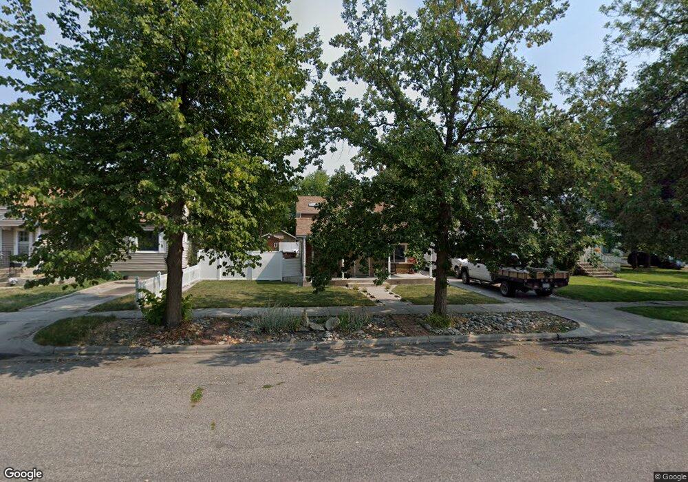
505 4th Ave Laurel, MT 59044
Estimated Value: $339,000 - $405,000
5
Beds
2
Baths
3,135
Sq Ft
$118/Sq Ft
Est. Value
About This Home
This home is located at 505 4th Ave, Laurel, MT 59044 and is currently estimated at $368,428, approximately $117 per square foot. 505 4th Ave is a home located in Yellowstone County with nearby schools including West School, Fred W. Graff School, and Laurel Middle School.
Ownership History
Date
Name
Owned For
Owner Type
Purchase Details
Closed on
Mar 8, 2021
Sold by
May Ellestad Kathy
Bought by
Ellestad Kathy May and Ellestad Shawn M
Current Estimated Value
Home Financials for this Owner
Home Financials are based on the most recent Mortgage that was taken out on this home.
Original Mortgage
$180,880
Interest Rate
3.22%
Mortgage Type
New Conventional
Purchase Details
Closed on
Jul 23, 2020
Sold by
Canon Morgan A and Canon Carrie L
Bought by
Ellestad Shawn
Create a Home Valuation Report for This Property
The Home Valuation Report is an in-depth analysis detailing your home's value as well as a comparison with similar homes in the area
Home Values in the Area
Average Home Value in this Area
Purchase History
| Date | Buyer | Sale Price | Title Company |
|---|---|---|---|
| Ellestad Kathy May | -- | Rosenberg Lpa | |
| Ellestad Shawn | -- | First Montana Title Co |
Source: Public Records
Mortgage History
| Date | Status | Borrower | Loan Amount |
|---|---|---|---|
| Previous Owner | Ellestad Kathy May | $180,880 |
Source: Public Records
Tax History Compared to Growth
Tax History
| Year | Tax Paid | Tax Assessment Tax Assessment Total Assessment is a certain percentage of the fair market value that is determined by local assessors to be the total taxable value of land and additions on the property. | Land | Improvement |
|---|---|---|---|---|
| 2025 | $3,024 | $339,900 | $59,950 | $279,950 |
| 2024 | $3,024 | $311,100 | $39,017 | $272,083 |
| 2023 | $2,787 | $311,100 | $39,017 | $272,083 |
| 2022 | $2,140 | $221,500 | $0 | $0 |
| 2021 | $2,157 | $221,500 | $0 | $0 |
| 2020 | $1,979 | $200,600 | $0 | $0 |
| 2019 | $1,989 | $200,600 | $0 | $0 |
| 2018 | $1,942 | $186,000 | $0 | $0 |
| 2017 | $1,489 | $174,800 | $0 | $0 |
| 2016 | $1,667 | $172,200 | $0 | $0 |
| 2015 | $1,647 | $172,200 | $0 | $0 |
| 2014 | $1,212 | $63,494 | $0 | $0 |
Source: Public Records
Map
Nearby Homes
- 110 E 5th St
- 116 4th Ave
- 516 Pennsylvania Ave
- 102 8th Ave Unit B
- 1003 Montana Ave
- 211 Woodland Ave
- 1036 9th Ave
- 1109 10th Ave
- 403 Grandview Blvd
- 717 E 5th, 506 Alder Ave
- 109 E 12th St
- 301 West Ave
- 316 Durland Ave
- 801 E 4th St
- 1106 W 12th St
- 1013 W 12th St
- 419 Durland Ave
- 512 W 14th St
- 1004 E 8th St
- TBD Block 3 Lot 9