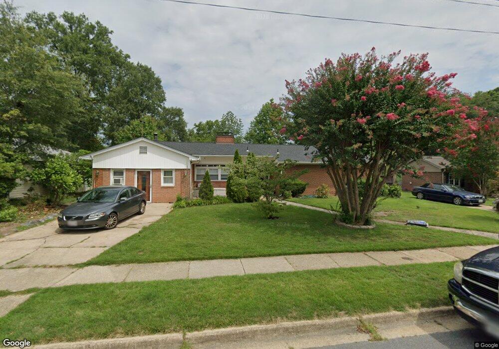
505 Carroll Ave Laurel, MD 20707
Estimated Value: $474,000 - $549,000
Studio
2
Baths
2,192
Sq Ft
$235/Sq Ft
Est. Value
About This Home
This home is located at 505 Carroll Ave, Laurel, MD 20707 and is currently estimated at $515,931, approximately $235 per square foot. 505 Carroll Ave is a home located in Prince George's County with nearby schools including Laurel Elementary School, Dwight D. Eisenhower Middle School, and Laurel High School.
Ownership History
Date
Name
Owned For
Owner Type
Purchase Details
Closed on
Jun 28, 2006
Sold by
Nichols Nichols C
Bought by
Mahesh Tom
Current Estimated Value
Home Financials for this Owner
Home Financials are based on the most recent Mortgage that was taken out on this home.
Original Mortgage
$70,400
Interest Rate
6.58%
Mortgage Type
Stand Alone Second
Purchase Details
Closed on
Jun 14, 2006
Sold by
Nichols Nichols C
Bought by
Mahesh Tom
Home Financials for this Owner
Home Financials are based on the most recent Mortgage that was taken out on this home.
Original Mortgage
$70,400
Interest Rate
6.58%
Mortgage Type
Stand Alone Second
Purchase Details
Closed on
Sep 1, 1992
Sold by
Schlosser Emily S
Bought by
Nichols Nichols C and Nichols Joyce B
Create a Home Valuation Report for This Property
The Home Valuation Report is an in-depth analysis detailing your home's value as well as a comparison with similar homes in the area
Home Values in the Area
Average Home Value in this Area
Purchase History
| Date | Buyer | Sale Price | Title Company |
|---|---|---|---|
| Mahesh Tom | $352,000 | -- | |
| Mahesh Tom | $352,000 | -- | |
| Nichols Nichols C | $150,000 | -- |
Source: Public Records
Mortgage History
| Date | Status | Borrower | Loan Amount |
|---|---|---|---|
| Closed | Mahesh Tom | $70,400 | |
| Open | Mahesh Tom | $281,600 | |
| Closed | Mahesh Tom | $281,600 |
Source: Public Records
Tax History
| Year | Tax Paid | Tax Assessment Tax Assessment Total Assessment is a certain percentage of the fair market value that is determined by local assessors to be the total taxable value of land and additions on the property. | Land | Improvement |
|---|---|---|---|---|
| 2025 | $8,144 | $551,700 | $101,600 | $450,100 |
| 2024 | $8,144 | $518,233 | -- | -- |
| 2023 | $7,691 | $484,767 | $0 | $0 |
| 2022 | $7,442 | $451,300 | $101,600 | $349,700 |
| 2021 | $13,984 | $431,433 | $0 | $0 |
| 2020 | $13,180 | $411,567 | $0 | $0 |
| 2019 | $7,673 | $391,700 | $75,800 | $315,900 |
| 2018 | $5,652 | $355,700 | $0 | $0 |
| 2017 | $5,205 | $319,700 | $0 | $0 |
| 2016 | -- | $283,700 | $0 | $0 |
| 2015 | $4,751 | $281,600 | $0 | $0 |
| 2014 | $4,751 | $279,500 | $0 | $0 |
Source: Public Records
Map
Nearby Homes
- 413 Talbott Ave
- 509 4th St
- 505A Montgomery St
- 501 8th St
- 322 Laurel Ave
- 19 Post Office Ave Unit 203
- 910 Montgomery St Unit A
- 903 Montrose Ave
- 1000 8th St
- 1002 7th St
- 916 Philip Powers Dr
- 1004 Marton St
- 1016 Phillip Powers Dr
- 120 2nd St
- 9401 Riverbrink Ct
- 1012 Ward St
- 1103 Montgomery St
- 9560 Cissell Ave
- 9575 Cissell Ave
- 15012 Wheatland Place
Your Personal Tour Guide
Ask me questions while you tour the home.