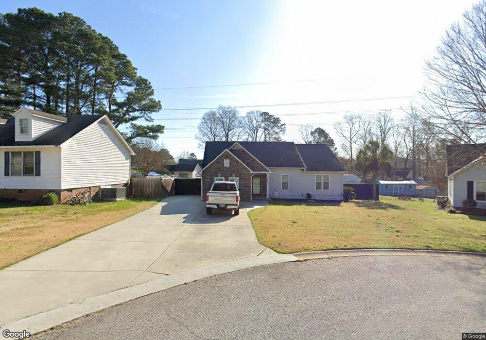
505 Cranford Ct Lexington, SC 29072
Estimated Value: $235,000 - $252,574
3
Beds
2
Baths
1,258
Sq Ft
$196/Sq Ft
Est. Value
About This Home
This home is located at 505 Cranford Ct, Lexington, SC 29072 and is currently estimated at $246,644, approximately $196 per square foot. 505 Cranford Ct is a home located in Lexington County with nearby schools including Midway Elementary School, River Bluff High School, and Lake Murray Montessori School.
Ownership History
Date
Name
Owned For
Owner Type
Purchase Details
Closed on
May 31, 2007
Sold by
Blevins David M and Blevins Alison J
Bought by
Kussro John J
Current Estimated Value
Home Financials for this Owner
Home Financials are based on the most recent Mortgage that was taken out on this home.
Original Mortgage
$118,044
Outstanding Balance
$72,113
Interest Rate
6.16%
Mortgage Type
FHA
Estimated Equity
$174,531
Purchase Details
Closed on
Jun 2, 2004
Sold by
Sullivan Vincent N
Bought by
Blevins David M
Create a Home Valuation Report for This Property
The Home Valuation Report is an in-depth analysis detailing your home's value as well as a comparison with similar homes in the area
Home Values in the Area
Average Home Value in this Area
Purchase History
| Date | Buyer | Sale Price | Title Company |
|---|---|---|---|
| Kussro John J | $119,900 | None Available | |
| Blevins David M | $109,000 | -- | |
| Anderson Kevin C | $164,605 | -- |
Source: Public Records
Mortgage History
| Date | Status | Borrower | Loan Amount |
|---|---|---|---|
| Open | Kussro John J | $118,044 |
Source: Public Records
Tax History Compared to Growth
Tax History
| Year | Tax Paid | Tax Assessment Tax Assessment Total Assessment is a certain percentage of the fair market value that is determined by local assessors to be the total taxable value of land and additions on the property. | Land | Improvement |
|---|---|---|---|---|
| 2024 | $909 | $6,092 | $1,509 | $4,583 |
| 2023 | $909 | $6,092 | $1,509 | $4,583 |
| 2022 | $907 | $6,092 | $1,509 | $4,583 |
| 2020 | $930 | $6,092 | $1,509 | $4,583 |
| 2019 | $824 | $5,298 | $1,120 | $4,178 |
| 2018 | $809 | $5,298 | $1,120 | $4,178 |
| 2017 | $785 | $5,298 | $1,120 | $4,178 |
| 2016 | $777 | $5,297 | $1,120 | $4,177 |
| 2014 | $665 | $4,740 | $1,120 | $3,620 |
| 2013 | -- | $4,740 | $1,120 | $3,620 |
Source: Public Records
Map
Nearby Homes
- 113 Silverstone Rd
- 712 Bentley Dr
- 109 Armanda Rd
- 488 Forest Edge Trail
- 481 Forest Edge Trail
- 2440 Thode Ln
- 108 Hunters Ridge Dr
- 476 Forest Edge Trail
- 1442 Trailhead Ln
- 1423 Trailhead Ln
- 441 Forest Edge Trail
- 1453 Trailhead Ln
- 433 Forest Edge Trail
- 425 Forest Edge Trail
- 305 Saddlebrooke Rd
- 417 Forest Edge Trail
- DARBY Plan at Cross Creek
- BRADFORD Plan at Cross Creek
- LITCHFIELD Plan at Cross Creek
- EATON Plan at Cross Creek
- 779 Parkhurst Ln
- 509 Cranford Ct
- 775 Parkhurst Ln
- 508 Cranford Ct
- 771 Parkhurst Ln
- 504 Cranford Ct
- 500 Cranford Ct
- 208 Malden Ct
- 209 Malden Ct
- 780 Parkhurst Ln
- 204 Malden Ct
- 785 Parkhurst Ln
- 612 Whitland Rd
- 768 Parkhurst Ln
- 840 Bentley Dr
- 616 Whitland Rd
- 784 Parkhurst Ln
- 620 Whitland Rd
- 844 Bentley Dr
- 834 Bentley Dr