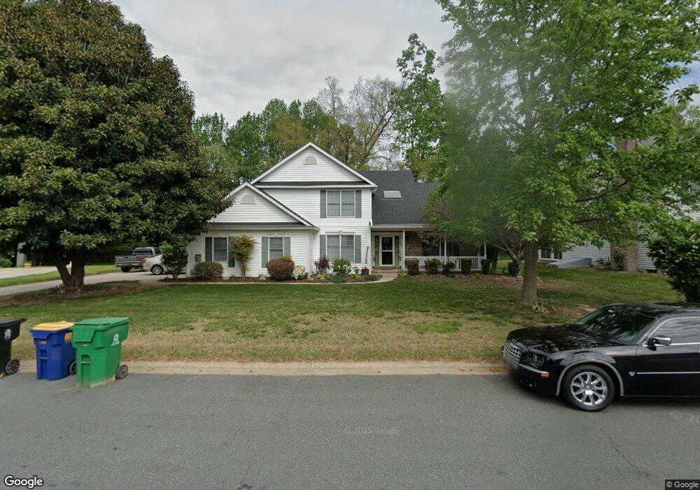
505 Eagle Nest Dr Camden Wyoming, DE 19934
Estimated Value: $417,000 - $431,000
3
Beds
3
Baths
2,479
Sq Ft
$171/Sq Ft
Est. Value
About This Home
This home is located at 505 Eagle Nest Dr, Camden Wyoming, DE 19934 and is currently estimated at $424,550, approximately $171 per square foot. 505 Eagle Nest Dr is a home located in Kent County with nearby schools including Allen Frear Elementary School, F. Niel Postlethwait Middle School, and Caesar Rodney High School.
Ownership History
Date
Name
Owned For
Owner Type
Purchase Details
Closed on
Jun 22, 2006
Sold by
Mcnulty John K and Mcnulty Kathleen
Bought by
Matthews Charles C and Coulbourine Josephine V P
Current Estimated Value
Home Financials for this Owner
Home Financials are based on the most recent Mortgage that was taken out on this home.
Original Mortgage
$133,900
Interest Rate
6.6%
Mortgage Type
Future Advance Clause Open End Mortgage
Create a Home Valuation Report for This Property
The Home Valuation Report is an in-depth analysis detailing your home's value as well as a comparison with similar homes in the area
Home Values in the Area
Average Home Value in this Area
Purchase History
| Date | Buyer | Sale Price | Title Company |
|---|---|---|---|
| Matthews Charles C | $283,900 | None Available |
Source: Public Records
Mortgage History
| Date | Status | Borrower | Loan Amount |
|---|---|---|---|
| Previous Owner | Matthews Charles C | $133,900 |
Source: Public Records
Tax History Compared to Growth
Tax History
| Year | Tax Paid | Tax Assessment Tax Assessment Total Assessment is a certain percentage of the fair market value that is determined by local assessors to be the total taxable value of land and additions on the property. | Land | Improvement |
|---|---|---|---|---|
| 2025 | $1,456 | $369,200 | $94,500 | $274,700 |
| 2024 | $1,456 | $369,200 | $94,500 | $274,700 |
| 2023 | $1,722 | $68,300 | $11,500 | $56,800 |
| 2022 | $1,606 | $68,300 | $11,500 | $56,800 |
| 2021 | $1,684 | $68,300 | $11,500 | $56,800 |
| 2020 | $1,640 | $68,300 | $11,500 | $56,800 |
| 2019 | $1,576 | $68,300 | $11,500 | $56,800 |
| 2018 | $1,521 | $68,300 | $11,500 | $56,800 |
| 2017 | $1,492 | $68,900 | $0 | $0 |
| 2016 | $1,306 | $68,900 | $0 | $0 |
| 2015 | $1,144 | $68,900 | $0 | $0 |
| 2014 | $1,134 | $68,900 | $0 | $0 |
Source: Public Records
Map
Nearby Homes
- 103 Osprey Ct
- 45 Brookfield Dr
- 42 Brookfield Dr
- 106 Steffens Blvd
- 256 Headstart Ln
- 464 Orchard Grove Dr
- 224 King Henry Ct
- 19 S Main St
- 55 Orchard Grove Ct
- 272 King Henry Ct
- Lot 22 Bee Brookfield Dr
- 16 Lone Tree Dr
- 83 Homestead Dr
- 870 Brookfield Dr
- Aster Plan at Brookfield
- Linden Plan at Brookfield
- Beech Plan at Brookfield
- Garrett Plan at Brookfield
- Sycamore Plan at Brookfield
- Red Maple Plan at Brookfield
- 503 Eagle Nest Dr
- 507 Eagle Nest Dr
- 34 Deer Jump Cir
- 501 Eagle Nest Dr
- 504 Eagle Nest Dr
- 508 Eagle Nest Dr
- 31 Deer Jump Cir
- 500 Eagle Nest Dr
- 506 Eagle Nest Dr
- 411 Eagle Nest Dr
- 28 Deer Jump Cir
- 302 Peregrine Place
- 410 Eagle Nest Dr
- 11 Deer Jump Cir
- 409 Eagle Nest Dr
- 504 Falcon Dr
- 16 Deer Jump Cir
- 506 Falcon Dr
- 684 Sandy Hill Trail
- 303 Peregrine Place