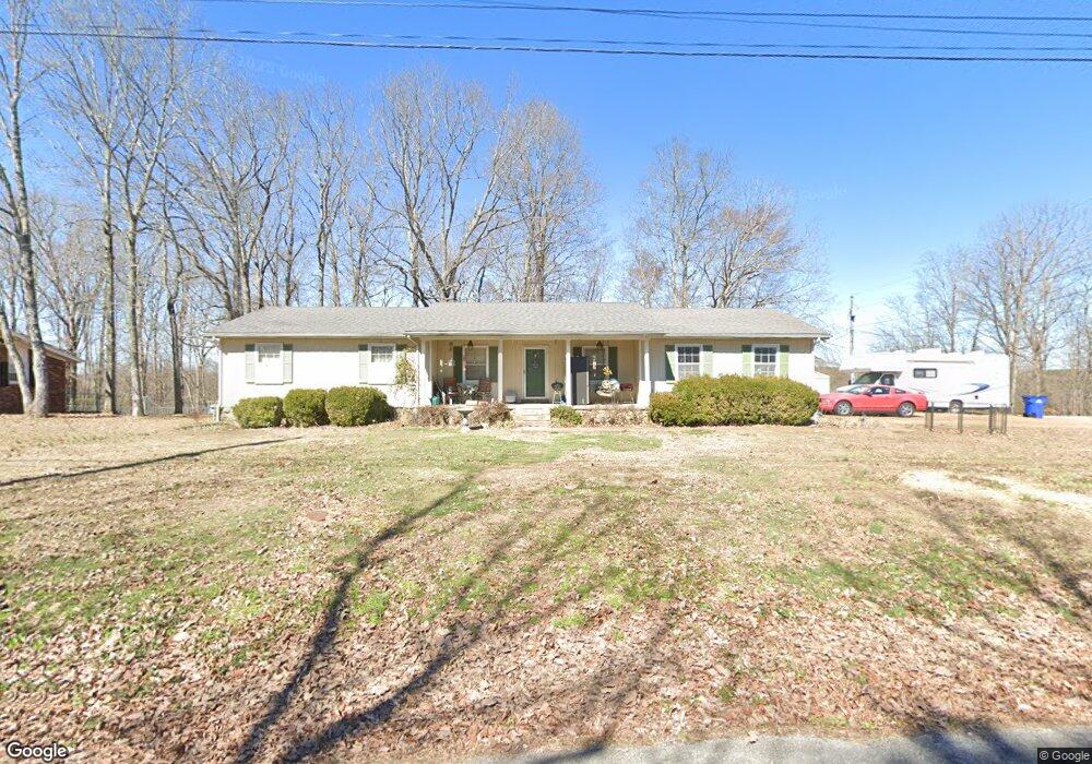
505 Joe Sevier Dr Waynesboro, TN 38485
Estimated Value: $155,413 - $229,000
--
Bed
2
Baths
1,452
Sq Ft
$141/Sq Ft
Est. Value
About This Home
This home is located at 505 Joe Sevier Dr, Waynesboro, TN 38485 and is currently estimated at $204,853, approximately $141 per square foot. 505 Joe Sevier Dr is a home located in Wayne County with nearby schools including Wayne Academy.
Ownership History
Date
Name
Owned For
Owner Type
Purchase Details
Closed on
Oct 20, 2009
Sold by
Marrs Brenda G
Bought by
Harris Matthew J
Current Estimated Value
Home Financials for this Owner
Home Financials are based on the most recent Mortgage that was taken out on this home.
Original Mortgage
$76,500
Outstanding Balance
$38,917
Interest Rate
5.01%
Estimated Equity
$165,936
Purchase Details
Closed on
Feb 28, 1997
Sold by
Ricky Cameron and Ricky Susan
Bought by
Jason Camfield and Jason Susan
Purchase Details
Closed on
Oct 13, 1981
Bought by
Cameron Ricky John and Susan Jean
Purchase Details
Closed on
Aug 18, 1977
Purchase Details
Closed on
Apr 24, 1977
Purchase Details
Closed on
Jan 1, 1977
Create a Home Valuation Report for This Property
The Home Valuation Report is an in-depth analysis detailing your home's value as well as a comparison with similar homes in the area
Home Values in the Area
Average Home Value in this Area
Purchase History
| Date | Buyer | Sale Price | Title Company |
|---|---|---|---|
| Harris Matthew J | $85,000 | -- | |
| Jason Camfield | $65,000 | -- | |
| Cameron Ricky John | -- | -- | |
| -- | -- | -- | |
| -- | -- | -- | |
| -- | $42,500 | -- |
Source: Public Records
Mortgage History
| Date | Status | Borrower | Loan Amount |
|---|---|---|---|
| Open | Not Available | $76,500 |
Source: Public Records
Tax History Compared to Growth
Tax History
| Year | Tax Paid | Tax Assessment Tax Assessment Total Assessment is a certain percentage of the fair market value that is determined by local assessors to be the total taxable value of land and additions on the property. | Land | Improvement |
|---|---|---|---|---|
| 2024 | $668 | $30,825 | $2,750 | $28,075 |
| 2023 | $960 | $30,825 | $2,750 | $28,075 |
| 2022 | $960 | $30,825 | $2,750 | $28,075 |
| 2021 | $766 | $30,825 | $2,750 | $28,075 |
| 2020 | $766 | $20,450 | $2,500 | $17,950 |
| 2019 | $592 | $20,450 | $2,500 | $17,950 |
| 2018 | $766 | $20,450 | $2,500 | $17,950 |
| 2017 | $766 | $20,450 | $2,500 | $17,950 |
| 2016 | $715 | $20,450 | $2,500 | $17,950 |
| 2014 | $760 | $21,592 | $0 | $0 |
Source: Public Records
Map
Nearby Homes
- 711 Hurricane Hill Dr
- 131 Susan Ln
- 418 Moore St
- 1027 Highway 99
- 0 Waynesboro Hwy Unit RTC2991221
- 0 Waynesboro Hwy Unit RTC2806893
- 0 Waynesboro Hwy Unit RTC2821045
- 123 Brewer Dr
- 117 N High St
- 117 Belew Cir
- 104 Mink Branch Acres Dr
- 310 W Hill St
- 110 Turman St
- 120 Wallace Dr
- 202 Morris St
- 214 Mcwilliams St
- 107 W Songer St
- 308 S High St
- 0 Simmons Branch Rd Unit 10181446
- 408 Poplar St
- 503 Joe Sevier Dr
- 601 Joe Sevier Dr
- 501 Joe Sevier Dr
- 425 Joe Sevier Dr
- 607 Joe Sevier Dr
- 401 Joe Sevier Dr
- 806 Hurricane Hill Dr
- 802 Hurricane Hill Dr
- 431 Joe Sevier Dr
- 803 Hurricane Hill Dr
- 0 Melonie Dr
- 102 Melonie Dr
- 814 Hurricane Hill Dr
- 718 Hurricane Hill Dr
- 711 Hurricane Hill Dr Unit 1
- 313 Joe Sevier Dr
- 106 Melonie Dr
- 557 Michael Dr
- 807 Hurricane Hill Dr
- 551 Michael Dr