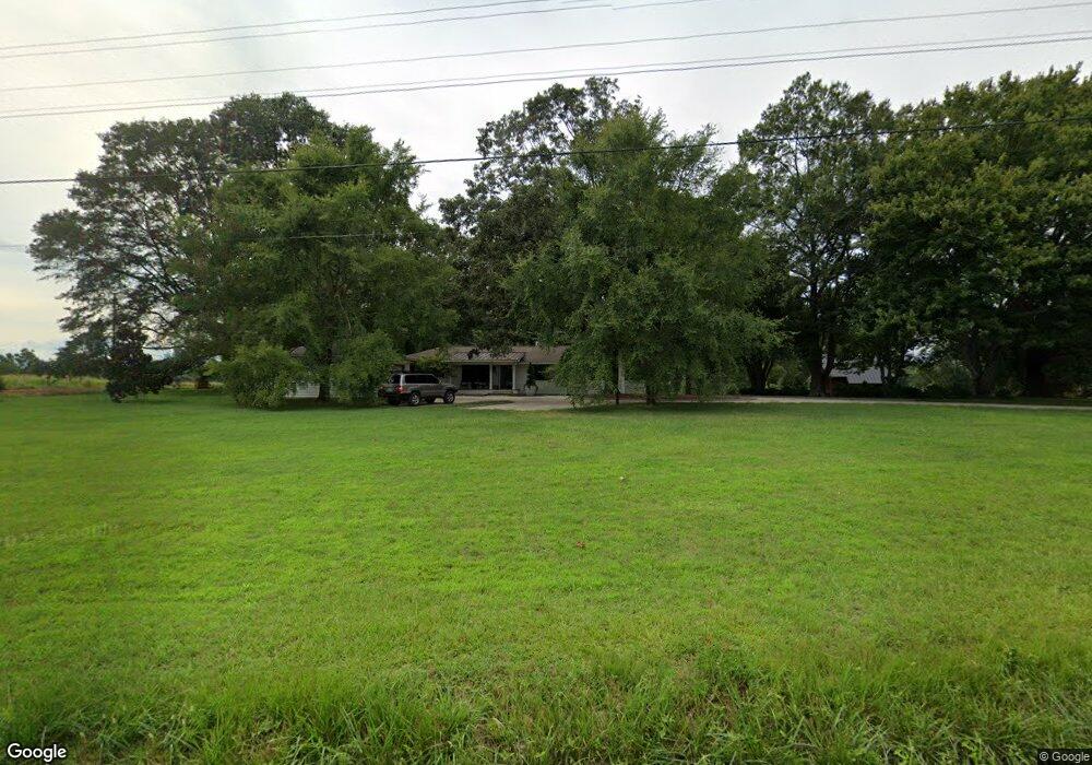
505 Link Rd Pendleton, SC 29670
Estimated Value: $404,049 - $483,000
3
Beds
--
Bath
2,136
Sq Ft
$200/Sq Ft
Est. Value
About This Home
This home is located at 505 Link Rd, Pendleton, SC 29670 and is currently estimated at $428,262, approximately $200 per square foot. 505 Link Rd is a home with nearby schools including Pendleton High School.
Ownership History
Date
Name
Owned For
Owner Type
Purchase Details
Closed on
Aug 10, 2016
Sold by
Rollins Albert A
Bought by
Collins Kenneth W and Collins Jennifer Allen
Current Estimated Value
Purchase Details
Closed on
Aug 21, 2015
Sold by
Simpson Phyllis L
Bought by
Rollins Albert A
Home Financials for this Owner
Home Financials are based on the most recent Mortgage that was taken out on this home.
Original Mortgage
$100,000
Interest Rate
4.16%
Mortgage Type
New Conventional
Purchase Details
Closed on
Oct 9, 2009
Sold by
Simpson Phyllis L
Bought by
Cheek Patrick F and Cheek Sherri L
Home Financials for this Owner
Home Financials are based on the most recent Mortgage that was taken out on this home.
Original Mortgage
$28,284
Interest Rate
5.05%
Mortgage Type
Purchase Money Mortgage
Create a Home Valuation Report for This Property
The Home Valuation Report is an in-depth analysis detailing your home's value as well as a comparison with similar homes in the area
Home Values in the Area
Average Home Value in this Area
Purchase History
| Date | Buyer | Sale Price | Title Company |
|---|---|---|---|
| Collins Kenneth W | $134,000 | None Available | |
| Rollins Albert A | $125,000 | -- | |
| Cheek Patrick F | $19,000 | -- |
Source: Public Records
Mortgage History
| Date | Status | Borrower | Loan Amount |
|---|---|---|---|
| Previous Owner | Rollins Albert A | $100,000 | |
| Previous Owner | Cheek Patrick F | $28,284 |
Source: Public Records
Tax History
| Year | Tax Paid | Tax Assessment Tax Assessment Total Assessment is a certain percentage of the fair market value that is determined by local assessors to be the total taxable value of land and additions on the property. | Land | Improvement |
|---|---|---|---|---|
| 2024 | $3,700 | $11,420 | $1,210 | $10,210 |
| 2023 | $3,700 | $11,420 | $1,210 | $10,210 |
| 2022 | $1,573 | $11,420 | $1,210 | $10,210 |
| 2021 | $1,370 | $9,730 | $950 | $8,780 |
| 2020 | $1,379 | $9,960 | $1,180 | $8,780 |
| 2019 | $1,379 | $9,960 | $1,180 | $8,780 |
| 2018 | $773 | $5,300 | $1,180 | $4,120 |
| 2017 | -- | $5,300 | $1,180 | $4,120 |
| 2016 | $2,278 | $4,660 | $1,020 | $3,640 |
| 2015 | $559 | $4,660 | $1,020 | $3,640 |
| 2014 | $572 | $4,660 | $1,020 | $3,640 |
Source: Public Records
Map
Nearby Homes
- 00 Liberty Hwy
- 354 Harper Rd
- 6620 Liberty Hwy
- 2921 Old Greenville Hwy
- 2923 Old Greenville Hwy
- 2925 Old Greenville Hwy
- 139 Louise Dr
- 616 Anderson Rd
- 102 Rogers Rd
- 540 Seaborn Cir
- 538 Seaborn Cir
- 145 Old Sanders Rd
- 208 Rogers Rd
- 00 Danenhower Rd
- 150 Queens Mill Ct
- 156 Queens Mill Ct
- Lot 3 Rogers Rd
- 0 Cherry Street Extension
- 119 Mcalister Dr
- 168 Queens Mill Ct
- 501 Link Rd
- 508 Link Rd
- 517 Link Rd
- 511 Link Rd
- 242 McMurtrey Rd
- 432 Link Rd
- 491 Link Rd
- 430 Link Rd
- 1410 Bishops Branch Rd
- 247 McMurtrey Rd
- 254 McMurtrey Rd
- 264 McMurtrey Rd
- 526 Link Rd
- 1500 Bishops Branch Rd
- 237 A McMurtrey Rd
- 237 McMurtrey Rd
- 315 Link Rd
- NA Link Rd
- 100 Creekside Dr Unit Lot 11 Creekside
- 1516 Bishop Branch Rd
Your Personal Tour Guide
Ask me questions while you tour the home.