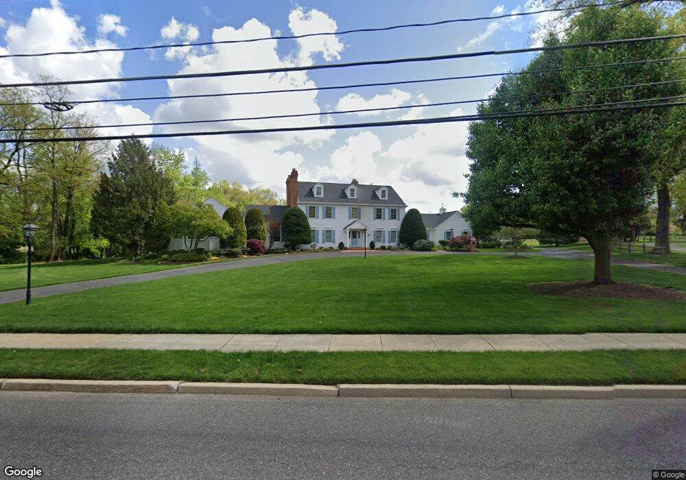
505 N Stanwick Rd Moorestown, NJ 08057
Estimated Value: $1,589,000 - $2,455,000
--
Bed
--
Bath
5,273
Sq Ft
$369/Sq Ft
Est. Value
About This Home
This home is located at 505 N Stanwick Rd, Moorestown, NJ 08057 and is currently estimated at $1,944,878, approximately $368 per square foot. 505 N Stanwick Rd is a home located in Burlington County with nearby schools including South Valley Elementary School, Moorestown Upper Elementary School, and William Allen Middle School.
Ownership History
Date
Name
Owned For
Owner Type
Purchase Details
Closed on
Jan 18, 2002
Sold by
Santaspirt John S and Santaspirt Colleen M
Bought by
Santaspirt Colleen M
Current Estimated Value
Create a Home Valuation Report for This Property
The Home Valuation Report is an in-depth analysis detailing your home's value as well as a comparison with similar homes in the area
Home Values in the Area
Average Home Value in this Area
Purchase History
| Date | Buyer | Sale Price | Title Company |
|---|---|---|---|
| Santaspirt Colleen M | -- | -- |
Source: Public Records
Tax History Compared to Growth
Tax History
| Year | Tax Paid | Tax Assessment Tax Assessment Total Assessment is a certain percentage of the fair market value that is determined by local assessors to be the total taxable value of land and additions on the property. | Land | Improvement |
|---|---|---|---|---|
| 2025 | $35,043 | $1,235,200 | $337,400 | $897,800 |
| 2024 | $33,980 | $1,235,200 | $337,400 | $897,800 |
| 2023 | $33,980 | $1,235,200 | $337,400 | $897,800 |
| 2022 | $33,635 | $1,235,200 | $337,400 | $897,800 |
| 2021 | $32,190 | $1,235,200 | $337,400 | $897,800 |
| 2020 | $32,980 | $1,235,200 | $337,400 | $897,800 |
| 2019 | $32,399 | $1,235,200 | $337,400 | $897,800 |
| 2018 | $31,522 | $1,235,200 | $337,400 | $897,800 |
| 2017 | $31,794 | $1,235,200 | $337,400 | $897,800 |
| 2016 | $31,683 | $1,235,200 | $337,400 | $897,800 |
| 2015 | $31,300 | $1,235,200 | $337,400 | $897,800 |
| 2014 | $29,719 | $1,235,200 | $337,400 | $897,800 |
Source: Public Records
Map
Nearby Homes
- 401 E Oak Ave
- 508 N Stanwick Rd
- 507 N Stanwick Rd
- 403 E Oak Ave
- 504 N Stanwick Rd
- 500 N Stanwick Rd
- 400 Pond View Dr
- 333 E Oak Ave
- 516 N Stanwick Rd
- 329 E Oak Ave
- 400 E Oak Ave
- 401 N Stanwick Rd
- 332 E Oak Ave
- 402 E Oak Ave
- 350 Park Dr
- 325 E Oak Ave
- 400 Park Ln
- 415 E Oak Ave
- 402 Pond View Dr
- 330 E Oak Ave