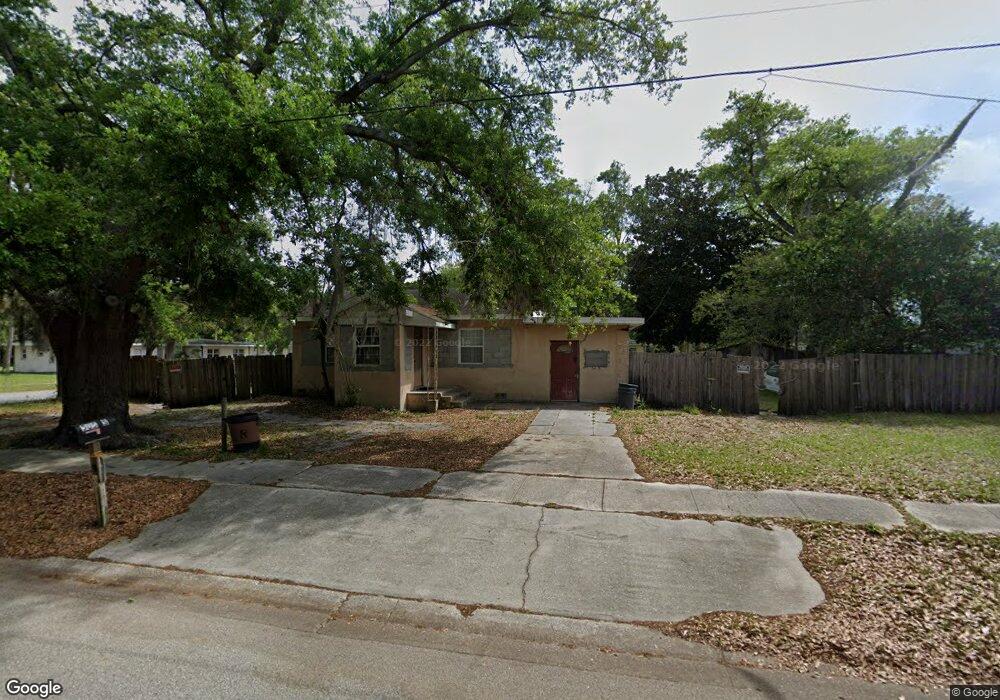
505 S Robbins Ave Titusville, FL 32796
Estimated Value: $141,468 - $182,000
2
Beds
1
Bath
896
Sq Ft
$181/Sq Ft
Est. Value
About This Home
This home is located at 505 S Robbins Ave, Titusville, FL 32796 and is currently estimated at $162,617, approximately $181 per square foot. 505 S Robbins Ave is a home located in Brevard County with nearby schools including Oak Park Elementary School, James Madison Middle School, and Astronaut High School.
Ownership History
Date
Name
Owned For
Owner Type
Purchase Details
Closed on
Jun 26, 2024
Sold by
Strozier David Floyd
Bought by
Strozier David Floyd and Strozier Christopher
Current Estimated Value
Purchase Details
Closed on
Dec 15, 2010
Sold by
Strozier Dave Floyd and Haynes Deodies
Bought by
Strozier Davie Floyd and Strozier Christopher
Purchase Details
Closed on
Oct 27, 2009
Sold by
Strozier Dave Floyd and Haynes Deodies
Bought by
Strozier Dave Floyd and Haynes Deodies
Create a Home Valuation Report for This Property
The Home Valuation Report is an in-depth analysis detailing your home's value as well as a comparison with similar homes in the area
Home Values in the Area
Average Home Value in this Area
Purchase History
| Date | Buyer | Sale Price | Title Company |
|---|---|---|---|
| Strozier David Floyd | $100 | None Listed On Document | |
| Strozier David Floyd | $100 | None Listed On Document | |
| Strozier Davie Floyd | -- | Attorney | |
| Strozier Dave Floyd | -- | Attorney |
Source: Public Records
Tax History Compared to Growth
Tax History
| Year | Tax Paid | Tax Assessment Tax Assessment Total Assessment is a certain percentage of the fair market value that is determined by local assessors to be the total taxable value of land and additions on the property. | Land | Improvement |
|---|---|---|---|---|
| 2025 | $264 | $35,000 | -- | -- |
| 2024 | $224 | $33,320 | -- | -- |
| 2023 | $224 | $32,350 | $0 | $0 |
| 2022 | $266 | $31,410 | $0 | $0 |
| 2021 | $244 | $30,500 | $0 | $0 |
| 2020 | $238 | $30,080 | $0 | $0 |
| 2019 | $228 | $29,410 | $0 | $0 |
| 2018 | $218 | $28,870 | $0 | $0 |
| 2017 | $204 | $28,280 | $0 | $0 |
| 2016 | $106 | $27,700 | $6,360 | $21,340 |
| 2015 | $103 | $27,510 | $6,360 | $21,150 |
| 2014 | $99 | $27,300 | $6,360 | $20,940 |
Source: Public Records
Map
Nearby Homes
- 1219 Pine St
- 470 S Robbins Ave
- 903 Pine St
- 1019 Main St
- 1104 Main St
- 1104 E Main St
- 910 Tropic St
- 505 Roderick A Harris Sr Ave
- 414 Dummitt Ave
- 537 Rockpit Rd
- 0 Dummitt Ave
- 553 Rockpit Rd
- 405 Dummitt Ave
- 918 Wager Ave
- 1713 N Eden Cir
- 0 N Brown Ave
- 27 Garnet Ave
- 0000 Unknown N Park Ave
- 130 Forrell Ave
- 1006 1st Ave
- 509 S Robbins Ave Unit B
- 509 S Robbins Ave Unit A
- 520 S Brown Ave
- 513 S Robbins Ave
- 515 S Robbins Ave
- 511 S Robbins Ave
- 490 S Robbins Ave
- 1211 Pine St
- 519 S Robbins Ave
- 550 S Brown Ave
- 1206 Pine St
- 1210 Palmetto St
- 1215 Pine St
- 475 Grannis Ave S
- 555 S Brown Ave
- 0 Tbd Robbins Ave Unit 949423
- Tbd Robbins Ave
- 460 S Brown Ave
- 485 S Brown Ave
- 503 S Brown Ave