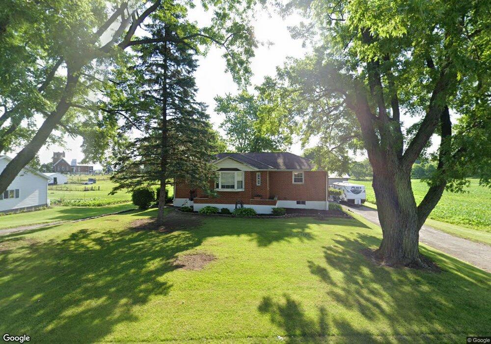
505 State Route 503 Arcanum, OH 45304
Estimated Value: $190,000 - $239,000
3
Beds
2
Baths
1,379
Sq Ft
$157/Sq Ft
Est. Value
About This Home
This home is located at 505 State Route 503, Arcanum, OH 45304 and is currently estimated at $217,172, approximately $157 per square foot. 505 State Route 503 is a home located in Darke County with nearby schools including Arcanum Elementary School, Butler Middle School, and Arcanum High School.
Ownership History
Date
Name
Owned For
Owner Type
Purchase Details
Closed on
Oct 31, 2007
Sold by
Todd Thomas A and Todd Angie M
Bought by
Tegtmeyer Amanda L and Tegtmeyer Travis C
Current Estimated Value
Home Financials for this Owner
Home Financials are based on the most recent Mortgage that was taken out on this home.
Original Mortgage
$136,918
Outstanding Balance
$86,897
Interest Rate
6.44%
Mortgage Type
FHA
Estimated Equity
$130,275
Purchase Details
Closed on
Dec 22, 1992
Bought by
Tegtmeyer Amanda L and Tegtmeyer Travis C
Create a Home Valuation Report for This Property
The Home Valuation Report is an in-depth analysis detailing your home's value as well as a comparison with similar homes in the area
Home Values in the Area
Average Home Value in this Area
Purchase History
| Date | Buyer | Sale Price | Title Company |
|---|---|---|---|
| Tegtmeyer Amanda L | $138,000 | Attorney | |
| Tegtmeyer Amanda L | -- | -- |
Source: Public Records
Mortgage History
| Date | Status | Borrower | Loan Amount |
|---|---|---|---|
| Open | Tegtmeyer Amanda L | $136,918 |
Source: Public Records
Tax History Compared to Growth
Tax History
| Year | Tax Paid | Tax Assessment Tax Assessment Total Assessment is a certain percentage of the fair market value that is determined by local assessors to be the total taxable value of land and additions on the property. | Land | Improvement |
|---|---|---|---|---|
| 2024 | $1,955 | $56,330 | $5,170 | $51,160 |
| 2023 | $1,967 | $56,580 | $5,420 | $51,160 |
| 2022 | $1,773 | $45,870 | $4,520 | $41,350 |
| 2021 | $1,788 | $45,870 | $4,520 | $41,350 |
| 2020 | $1,733 | $45,870 | $4,520 | $41,350 |
| 2019 | $1,470 | $38,980 | $4,520 | $34,460 |
| 2018 | $1,377 | $38,980 | $4,520 | $34,460 |
| 2017 | $1,228 | $36,920 | $4,520 | $32,400 |
| 2016 | $1,229 | $34,790 | $4,520 | $30,270 |
| 2015 | $1,229 | $34,790 | $4,520 | $30,270 |
| 2014 | $1,244 | $34,790 | $4,520 | $30,270 |
| 2013 | $1,202 | $31,820 | $4,300 | $27,520 |
Source: Public Records
Map
Nearby Homes
- 610 Pearl St
- 620 Pearl St
- 0 Ohio 722 Unit 10051560
- 0 Ohio 722 Unit 10 Acres 1040185
- 0 Ohio 722 Unit 938536
- 0 Ohio 722
- 693 Friday Rd
- 0 Friday Rd
- 140 State Route 503
- 6254 State Route 722
- 6806 Darke-Preble County Line Rd
- 10995 Rockridge Rd
- 6051 Sonora Rd
- 7163 Georgetown Verona Rd
- 246 N Main St
- 404 W 1st St
- 406 W South St
- 6977 Alternate State Route 49
- 604 W North St
- Oh-722
- 515 State Route 503
- 500 State Route 503
- 521 State Route 503
- 544 Pearl St
- 559 Main St
- 528 State Route 503
- 567 S Main St
- 567 Main St
- 464 State Route 503
- 446 State Route 503
- 562 Main St
- 555 Pearl St
- 571 Main St
- 572 Main St
- 6855 State Route 722
- 577 Main St
- 581 Main St
- 582 Pearl St
- 582 Main St
- 577 Pearl St