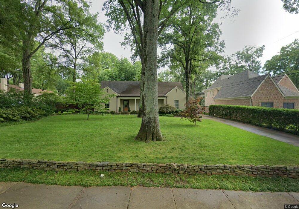
5055 Shady Grove Rd Memphis, TN 38117
Audubon Park NeighborhoodEstimated Value: $434,775 - $508,000
4
Beds
2
Baths
2,528
Sq Ft
$184/Sq Ft
Est. Value
About This Home
This home is located at 5055 Shady Grove Rd, Memphis, TN 38117 and is currently estimated at $464,444, approximately $183 per square foot. 5055 Shady Grove Rd is a home located in Shelby County with nearby schools including White Station Elementary School, White Station High, and White Station Middle.
Ownership History
Date
Name
Owned For
Owner Type
Purchase Details
Closed on
May 27, 2004
Sold by
James Alan W
Bought by
Denegri Mark L and Denegri Angela R
Current Estimated Value
Home Financials for this Owner
Home Financials are based on the most recent Mortgage that was taken out on this home.
Original Mortgage
$219,900
Outstanding Balance
$107,351
Interest Rate
5.98%
Mortgage Type
Purchase Money Mortgage
Estimated Equity
$357,093
Purchase Details
Closed on
Feb 5, 1999
Sold by
Bray Charles Wesley and Anderson Carole Bray
Bought by
James Alan W
Home Financials for this Owner
Home Financials are based on the most recent Mortgage that was taken out on this home.
Original Mortgage
$202,025
Interest Rate
6.85%
Create a Home Valuation Report for This Property
The Home Valuation Report is an in-depth analysis detailing your home's value as well as a comparison with similar homes in the area
Home Values in the Area
Average Home Value in this Area
Purchase History
| Date | Buyer | Sale Price | Title Company |
|---|---|---|---|
| Denegri Mark L | $274,900 | -- | |
| James Alan W | $200,000 | -- |
Source: Public Records
Mortgage History
| Date | Status | Borrower | Loan Amount |
|---|---|---|---|
| Open | Denegri Mark L | $219,900 | |
| Previous Owner | James Alan W | $202,025 |
Source: Public Records
Tax History Compared to Growth
Tax History
| Year | Tax Paid | Tax Assessment Tax Assessment Total Assessment is a certain percentage of the fair market value that is determined by local assessors to be the total taxable value of land and additions on the property. | Land | Improvement |
|---|---|---|---|---|
| 2025 | $3,100 | $115,775 | $37,600 | $78,175 |
| 2024 | $3,100 | $91,450 | $34,425 | $57,025 |
| 2023 | $5,571 | $91,450 | $34,425 | $57,025 |
| 2022 | $4,744 | $77,875 | $34,425 | $43,450 |
| 2021 | $4,799 | $77,875 | $34,425 | $43,450 |
| 2020 | $5,078 | $70,075 | $34,425 | $35,650 |
| 2019 | $5,078 | $70,075 | $34,425 | $35,650 |
| 2018 | $5,078 | $70,075 | $34,425 | $35,650 |
| 2017 | $2,880 | $70,075 | $34,425 | $35,650 |
| 2016 | $2,686 | $61,475 | $0 | $0 |
| 2014 | $2,686 | $61,475 | $0 | $0 |
Source: Public Records
Map
Nearby Homes
- 5071 Anchor Cove
- 267 Barry Rd
- 5094 Cole Rd
- 5055 Greenway Rd
- 264 Barry Rd
- 380 Greenway Place
- 5157 S Angela Rd
- 4859 Gwynne Rd
- 65 Laverne Ln
- 4926 Greenway Ave
- 50 Grove Creek Place
- 4916 Greenway Ave
- 5068 Walnut Grove Rd
- 4903 Greenway Ave
- 5188 Gwynne Rd
- 5280 Cole Rd
- 435 Fairfield Cir
- 4948 Fairfield Cir
- 4975 Brookwood Cove
- 5264 S Angela Rd
- 5047 Shady Grove Rd
- 5041 Shady Grove Rd
- 253 Greenway Rd
- 5047 Shady Hall Ct
- 5044 Shady Grove Rd
- 5056 Shady Grove Rd
- 5035 Shady Grove Rd
- 265 Greenway Rd
- 5037 Shady Hall Ct
- 5060 Shady Grove Rd
- 260 S Mendenhall Rd
- 5030 Shady Grove Rd
- 5045 Anchor Cove
- 5087 Shady Grove Rd
- 5074 Shady Grove Rd
- 254 Greenway Rd
- 277 Greenway Rd
- 270 S Mendenhall Rd
- 5031 Anchor Cove
- 264 Greenway Rd