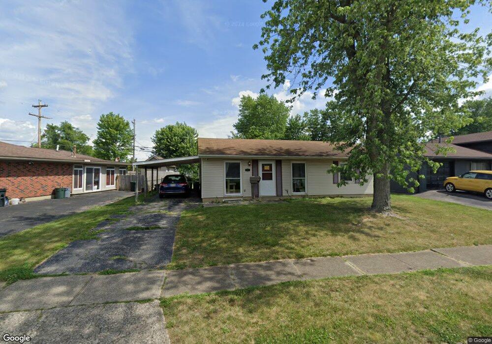
5056 Benham Dr Columbus, OH 43232
East Columbus-White Ash NeighborhoodEstimated Value: $190,705 - $228,000
3
Beds
1
Bath
1,224
Sq Ft
$175/Sq Ft
Est. Value
About This Home
This home is located at 5056 Benham Dr, Columbus, OH 43232 and is currently estimated at $214,426, approximately $175 per square foot. 5056 Benham Dr is a home located in Franklin County with nearby schools including Groveport Madison High School, Eastland Preparatory Academy, and A+ Arts Academy.
Ownership History
Date
Name
Owned For
Owner Type
Purchase Details
Closed on
Oct 29, 2007
Sold by
Bower James D and Bower Diane S
Bought by
Bower Diana S
Current Estimated Value
Home Financials for this Owner
Home Financials are based on the most recent Mortgage that was taken out on this home.
Original Mortgage
$76,000
Outstanding Balance
$47,428
Interest Rate
6.47%
Mortgage Type
Purchase Money Mortgage
Estimated Equity
$166,998
Purchase Details
Closed on
Dec 26, 1990
Bought by
Bower James D
Purchase Details
Closed on
Oct 11, 1988
Purchase Details
Closed on
Sep 1, 1986
Create a Home Valuation Report for This Property
The Home Valuation Report is an in-depth analysis detailing your home's value as well as a comparison with similar homes in the area
Home Values in the Area
Average Home Value in this Area
Purchase History
| Date | Buyer | Sale Price | Title Company |
|---|---|---|---|
| Bower Diana S | -- | Amtrust Ti | |
| Bower James D | $45,900 | -- | |
| -- | $44,000 | -- | |
| -- | -- | -- |
Source: Public Records
Mortgage History
| Date | Status | Borrower | Loan Amount |
|---|---|---|---|
| Open | Bower Diana S | $76,000 |
Source: Public Records
Tax History
| Year | Tax Paid | Tax Assessment Tax Assessment Total Assessment is a certain percentage of the fair market value that is determined by local assessors to be the total taxable value of land and additions on the property. | Land | Improvement |
|---|---|---|---|---|
| 2025 | $2,554 | $52,750 | $16,350 | $36,400 |
| 2024 | $2,554 | $52,750 | $16,350 | $36,400 |
| 2023 | $2,538 | $52,750 | $16,350 | $36,400 |
| 2022 | $1,542 | $25,380 | $6,130 | $19,250 |
| 2021 | $1,584 | $25,380 | $6,130 | $19,250 |
| 2020 | $1,587 | $25,380 | $6,130 | $19,250 |
| 2019 | $1,575 | $22,160 | $5,360 | $16,800 |
| 2018 | $1,611 | $22,160 | $5,360 | $16,800 |
| 2017 | $1,617 | $22,160 | $5,360 | $16,800 |
| 2016 | $1,639 | $20,690 | $3,960 | $16,730 |
| 2015 | $1,638 | $20,690 | $3,960 | $16,730 |
| 2014 | $1,498 | $20,690 | $3,960 | $16,730 |
| 2013 | $729 | $22,995 | $4,410 | $18,585 |
Source: Public Records
Map
Nearby Homes
- 3275 Faycrest Rd
- 4878 Amber Crossing Dr
- 5143 Rutledge Dr N
- 3246 Latonia Rd
- 5323 Sundale Place S
- 3455 Tremaine Rd
- 2932 Renfro Rd
- 3492 Rodell Rd
- 2908 Renfro Rd
- 3493 Tremaine Rd
- 4942 Talbert Dr
- 5422 Everson Rd N
- 4925 Wymore Dr
- 3302 Everson Rd E
- 5361 Parkline Dr
- 3314 Fontaine Rd
- 4995 Talford Ct
- 2998 Osgood Rd E
- 5290 Quincy Dr
- 4980 Harbor Blvd
- 5064 Benham Dr
- 3150 Noe Bixby Rd
- 3138 Noe Bixby Rd
- 5072 Benham Dr
- 5057 Hatfield Dr
- 3191 Benham Ct
- 5049 Benham Dr
- 3128 Noe Bixby Rd
- 5080 Benham Dr
- 3176 Noe Bixby Rd
- 3190 Benham Ct
- 5088 Benham Dr
- 5063 Hatfield Dr
- 3197 Benham Ct
- 3142 Amberfield Dr
- 3136 Amberfield Dr
- 3154 Amberfield Dr
- 5071 Hatfield Dr
- 5083 Benham Dr
- 3184 Noe Bixby Rd
Your Personal Tour Guide
Ask me questions while you tour the home.