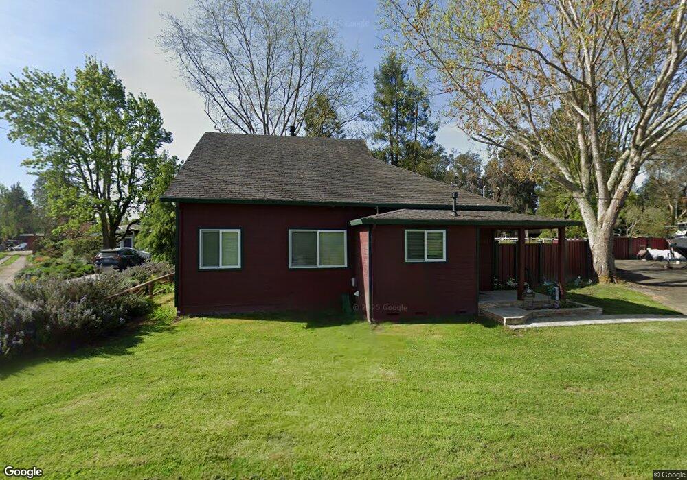
5059 Mcfarland Rd Sebastopol, CA 95472
Estimated Value: $835,720 - $986,000
3
Beds
1
Bath
1,101
Sq Ft
$809/Sq Ft
Est. Value
About This Home
This home is located at 5059 Mcfarland Rd, Sebastopol, CA 95472 and is currently estimated at $891,180, approximately $809 per square foot. 5059 Mcfarland Rd is a home located in Sonoma County with nearby schools including Analy High School, Gravenstein Elementary School, and Dunham Charter School.
Ownership History
Date
Name
Owned For
Owner Type
Purchase Details
Closed on
Mar 7, 1996
Sold by
Olson Thomas K and Olson Laurie K
Bought by
Olson Thomas and Olson Laurie
Current Estimated Value
Home Financials for this Owner
Home Financials are based on the most recent Mortgage that was taken out on this home.
Original Mortgage
$157,500
Outstanding Balance
$6,167
Interest Rate
7.01%
Estimated Equity
$885,013
Purchase Details
Closed on
Apr 22, 1994
Sold by
Kesecker Richard and Kesecker Rene
Bought by
Olson Thomas and Olson Laurie
Home Financials for this Owner
Home Financials are based on the most recent Mortgage that was taken out on this home.
Original Mortgage
$108,000
Interest Rate
7.62%
Create a Home Valuation Report for This Property
The Home Valuation Report is an in-depth analysis detailing your home's value as well as a comparison with similar homes in the area
Home Values in the Area
Average Home Value in this Area
Purchase History
| Date | Buyer | Sale Price | Title Company |
|---|---|---|---|
| Olson Thomas | -- | Old Republic Title Company | |
| Olson Thomas | $208,000 | Placer Title Co |
Source: Public Records
Mortgage History
| Date | Status | Borrower | Loan Amount |
|---|---|---|---|
| Open | Olson Thomas | $157,500 | |
| Closed | Olson Thomas | $108,000 |
Source: Public Records
Tax History Compared to Growth
Tax History
| Year | Tax Paid | Tax Assessment Tax Assessment Total Assessment is a certain percentage of the fair market value that is determined by local assessors to be the total taxable value of land and additions on the property. | Land | Improvement |
|---|---|---|---|---|
| 2025 | $4,317 | $353,516 | $195,456 | $158,060 |
| 2024 | $4,317 | $346,585 | $191,624 | $154,961 |
| 2023 | $4,317 | $339,790 | $187,867 | $151,923 |
| 2022 | $4,181 | $333,129 | $184,184 | $148,945 |
| 2021 | $4,140 | $326,598 | $180,573 | $146,025 |
| 2020 | $4,176 | $323,250 | $178,722 | $144,528 |
| 2019 | $3,874 | $316,913 | $175,218 | $141,695 |
| 2018 | $3,820 | $310,700 | $171,783 | $138,917 |
| 2017 | $3,663 | $304,609 | $168,415 | $136,194 |
| 2016 | $3,601 | $298,637 | $165,113 | $133,524 |
| 2015 | $3,488 | $294,152 | $162,633 | $131,519 |
| 2014 | $3,423 | $288,391 | $159,448 | $128,943 |
Source: Public Records
Map
Nearby Homes
- 3920 Gravenstein Hwy S
- 5301 Hutchinson Rd
- 3790 Gravenstein Hwy S
- 3765 Twig Ave
- 5227 Wendell Ln
- 5111 Todd Rd
- 5300 Gravenstein Hwy S
- 5611 Blank Rd
- 3960 Llano Rd
- 5601 S Gravenstein Hwy
- 4001 Walker Ave
- 2550 Hwy 116 S
- 1415 Schaeffer Rd
- 6000 Petersen Rd
- 447 Sparkes Rd
- 4165 Stony Point Rd
- 6675 Petersen Rd
- 1466 Cooper Rd
- 5816 Lowell Ct
- 3980 Stony Point Rd
- 5037 Mcfarland Rd
- 5101 Mcfarland Rd
- 5045 Mcfarland Rd
- 4100 Hessel Rd
- 4160 Hessel Rd
- 5060 Mcfarland Rd
- 5100 Mcfarland Rd
- 5109 Mcfarland Rd
- 5030 Mcfarland Rd
- 5120 Mcfarlane Rd
- 5120 Mcfarlane Rd
- 5106 Lupine Ln
- 4086 Hessel Rd
- 5090 Lupine Ln
- 4121 Hessel Rd
- 4162 Hessel Rd
- 4091 Hessel Rd
- 5128 Mcfarlane Rd
- 4129 Hessel Rd