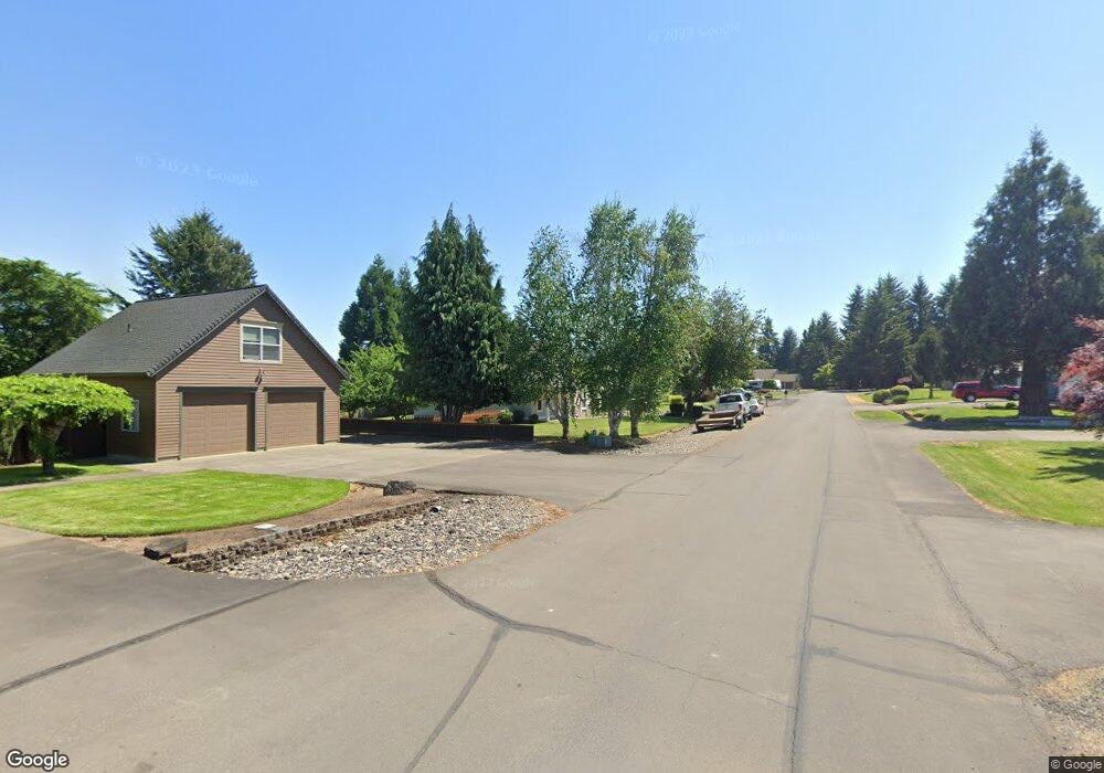
50592 Hillcrest Dr Scappoose, OR 97056
Estimated Value: $585,072 - $754,000
3
Beds
2
Baths
1,889
Sq Ft
$343/Sq Ft
Est. Value
About This Home
This home is located at 50592 Hillcrest Dr, Scappoose, OR 97056 and is currently estimated at $647,018, approximately $342 per square foot. 50592 Hillcrest Dr is a home located in Columbia County with nearby schools including Scappoose High School and Scappoose Adventist School.
Ownership History
Date
Name
Owned For
Owner Type
Purchase Details
Closed on
Aug 22, 2006
Sold by
Bacon Michael A and Bacon Kimberly L
Bought by
Bacon Michael A and Bacon Kimberly L
Current Estimated Value
Purchase Details
Closed on
Feb 23, 2006
Sold by
Vlastelicia Joseph M and Vlastelicia Jean M
Bought by
Bacon Michael A and Bacon Kimberly L
Create a Home Valuation Report for This Property
The Home Valuation Report is an in-depth analysis detailing your home's value as well as a comparison with similar homes in the area
Home Values in the Area
Average Home Value in this Area
Purchase History
| Date | Buyer | Sale Price | Title Company |
|---|---|---|---|
| Bacon Michael A | -- | None Available | |
| Bacon Michael A | $359,000 | Ticor Title |
Source: Public Records
Tax History Compared to Growth
Tax History
| Year | Tax Paid | Tax Assessment Tax Assessment Total Assessment is a certain percentage of the fair market value that is determined by local assessors to be the total taxable value of land and additions on the property. | Land | Improvement |
|---|---|---|---|---|
| 2025 | $4,521 | $341,470 | $131,970 | $209,500 |
| 2024 | $4,397 | $331,530 | $128,130 | $203,400 |
| 2023 | $4,377 | $321,880 | $123,440 | $198,440 |
| 2022 | $4,179 | $312,510 | $119,850 | $192,660 |
| 2021 | $4,060 | $303,410 | $113,580 | $189,830 |
| 2020 | $3,723 | $294,580 | $99,630 | $194,950 |
| 2019 | $3,628 | $286,000 | $95,740 | $190,260 |
| 2018 | $3,530 | $277,670 | $99,280 | $178,390 |
| 2017 | $3,477 | $269,590 | $96,390 | $173,200 |
| 2016 | $3,447 | $261,740 | $93,580 | $168,160 |
| 2015 | $3,254 | $254,120 | $82,750 | $171,370 |
| 2014 | $3,176 | $246,720 | $71,480 | $175,240 |
Source: Public Records
Map
Nearby Homes
- 50551 Bark Way Unit 47
- 50316 Columbia River Hwy
- 33281 Kammeyer Rd
- 51082 SW Klompen St
- 51086 SW Klompen St
- 33366 SW Rokin Way
- 33362 SW Rokin Way
- 51096 SW Klompen St
- 51096 SW Klompen St Unit H138
- 33340 SW Rokin Way
- Hillsdale Plan at Dutch Canyon
- Aubrey Plan at Dutch Canyon
- Carmichael Plan at Dutch Canyon
- Carlton Plan at Dutch Canyon
- 51350 SW Randstad St
- 33410 Meadowbrook Dr
- 50350 Cowens Rd Unit 8
- 27001 NW Saint Helens Rd
- 34326 Johnson's Landing Rd Unit E-1
- 33279 SW Havlik Dr
- 50562 Hillcrest Dr
- 50573 Hillcrest Dr
- 50595 Chestnut Ave
- 50624 Hillcrest Dr
- 50615 Hillcrest Dr
- 50570 Elder Ave
- 50625 Chestnut Ave
- 50541 Hillcrest Dr
- 50648 Elder Ave
- 50536 Hillcrest Dr
- 50551 Bark Way
- 50558 Elder Ave
- 33456 Bonneville Dr
- 33456 Bonneville Dr
- 50541 Bark Way
- 50541 Bark Way Unit 48
- 50600 Chestnut Ave
- 50576 Chestnut Ave
- 33384 Bonneville Dr
- 50528 Hillcrest Dr