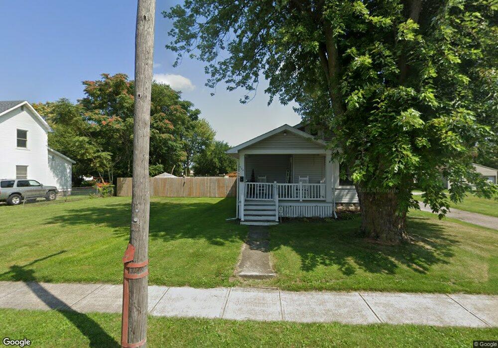
506 Avondale Ave Marion, OH 43302
Estimated Value: $76,000 - $134,000
--
Bed
--
Bath
--
Sq Ft
5,706
Sq Ft Lot
About This Home
This home is located at 506 Avondale Ave, Marion, OH 43302 and is currently estimated at $95,667. 506 Avondale Ave is a home located in Marion County with nearby schools including Rutherford B. Hayes Elementary School, Ulysses S. Grant Middle School, and Harding High School.
Ownership History
Date
Name
Owned For
Owner Type
Purchase Details
Closed on
Jan 3, 2020
Sold by
Kimerbling David S and Kimerbling Toni C
Bought by
Sopher Steve J
Current Estimated Value
Home Financials for this Owner
Home Financials are based on the most recent Mortgage that was taken out on this home.
Original Mortgage
$53,927
Outstanding Balance
$47,647
Interest Rate
3.6%
Mortgage Type
FHA
Estimated Equity
$48,020
Purchase Details
Closed on
May 30, 2018
Sold by
Kimberling Judith A and Kimberling Mark E
Bought by
Kimberling Toni C and Kimberling David E
Purchase Details
Closed on
Oct 23, 2012
Sold by
Kimberling Helen B
Bought by
Kimberling David S and Kimberling Mark E
Create a Home Valuation Report for This Property
The Home Valuation Report is an in-depth analysis detailing your home's value as well as a comparison with similar homes in the area
Home Values in the Area
Average Home Value in this Area
Purchase History
| Date | Buyer | Sale Price | Title Company |
|---|---|---|---|
| Sopher Steve J | $65,000 | None Available | |
| Kimberling Toni C | $11,000 | None Available | |
| Kimberling David S | -- | None Available | |
| Kimberling Helen B | -- | None Available |
Source: Public Records
Mortgage History
| Date | Status | Borrower | Loan Amount |
|---|---|---|---|
| Open | Sopher Steve J | $53,927 |
Source: Public Records
Tax History Compared to Growth
Tax History
| Year | Tax Paid | Tax Assessment Tax Assessment Total Assessment is a certain percentage of the fair market value that is determined by local assessors to be the total taxable value of land and additions on the property. | Land | Improvement |
|---|---|---|---|---|
| 2024 | $53 | $1,340 | $1,340 | $0 |
| 2023 | $53 | $1,340 | $1,340 | $0 |
| 2022 | $50 | $1,340 | $1,340 | $0 |
| 2021 | $48 | $1,160 | $1,160 | $0 |
| 2020 | $48 | $1,160 | $1,160 | $0 |
| 2019 | $48 | $1,160 | $1,160 | $0 |
| 2018 | $48 | $1,150 | $1,150 | $0 |
| 2017 | $48 | $1,150 | $1,150 | $0 |
| 2016 | $46 | $1,150 | $1,150 | $0 |
| 2015 | $44 | $1,090 | $1,090 | $0 |
| 2014 | $46 | $1,090 | $1,090 | $0 |
| 2012 | $48 | $1,160 | $1,160 | $0 |
Source: Public Records
Map
Nearby Homes
- 485 Avondale Ave
- 468 Avondale Ave
- 520 Toledo Ave
- 641 Blake Ave
- 531 Toledo Ave
- 523 Thompson St
- 551 Universal Ave Unit 555
- 636 Mary St
- 343 Commercial St
- 355 Lee St
- 347 Mary St
- 233 Tully St
- 178 Leader St
- 552 N Prospect St
- 395 N Main St
- 593 N State St
- 736 N Main St
- 134 Waterloo St
- 434 N State St
- 325 Holmes Place
- 502 Avondale Ave
- 512 Avondale Ave
- 516 Avondale Ave
- 498 Avondale Ave
- 490 Avondale Ave
- 484 Avondale Ave
- 509 Avondale Ave
- 503 Avondale Ave
- 513 Avondale Ave
- 534 Avondale Ave
- 517 Avondale Ave
- 478 Avondale Ave
- 495 Avondale Ave
- 523 Avondale Ave
- 538 Avondale Ave
- 535 Bartram Ave
- 529 Avondale Ave
- 474 Avondale Ave
- 535 Avondale Ave
- 473 Avondale Ave(p)