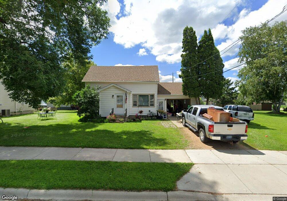
506 N Birch Ave New Richland, MN 56072
Estimated Value: $145,000 - $183,000
3
Beds
1
Bath
1,142
Sq Ft
$148/Sq Ft
Est. Value
About This Home
This home is located at 506 N Birch Ave, New Richland, MN 56072 and is currently estimated at $169,040, approximately $148 per square foot. 506 N Birch Ave is a home located in Waseca County with nearby schools including NRHEG Elementary School and NRHEG Secondary School.
Ownership History
Date
Name
Owned For
Owner Type
Purchase Details
Closed on
Aug 7, 2013
Sold by
Secretary Of Housing And Urban Developme
Bought by
Possin Michael J
Current Estimated Value
Purchase Details
Closed on
Jan 28, 2012
Sold by
Liberty Savings Bank Fsb
Bought by
The Secretary Of Housing And Urban Devel
Purchase Details
Closed on
Aug 13, 2008
Sold by
Jacobson Gregory A and Jacobson Janalilee J
Bought by
Butler Casey W
Home Financials for this Owner
Home Financials are based on the most recent Mortgage that was taken out on this home.
Original Mortgage
$78,471
Interest Rate
6.87%
Mortgage Type
FHA
Purchase Details
Closed on
Oct 17, 2007
Sold by
Jacobson Gregory A and Jacobson Janalee J
Bought by
Hitt Kari A
Create a Home Valuation Report for This Property
The Home Valuation Report is an in-depth analysis detailing your home's value as well as a comparison with similar homes in the area
Home Values in the Area
Average Home Value in this Area
Purchase History
| Date | Buyer | Sale Price | Title Company |
|---|---|---|---|
| Possin Michael J | -- | -- | |
| The Secretary Of Housing And Urban Devel | -- | -- | |
| Butler Casey W | -- | Edina Realty Title | |
| Hitt Kari A | -- | -- |
Source: Public Records
Mortgage History
| Date | Status | Borrower | Loan Amount |
|---|---|---|---|
| Previous Owner | Butler Casey W | $78,471 | |
| Closed | Hitt Kari A | $0 |
Source: Public Records
Tax History Compared to Growth
Tax History
| Year | Tax Paid | Tax Assessment Tax Assessment Total Assessment is a certain percentage of the fair market value that is determined by local assessors to be the total taxable value of land and additions on the property. | Land | Improvement |
|---|---|---|---|---|
| 2024 | $2,560 | $120,500 | $19,900 | $100,600 |
| 2023 | $2,432 | $115,500 | $17,300 | $98,200 |
| 2022 | $2,384 | $99,100 | $12,400 | $86,700 |
| 2021 | $2,014 | $82,800 | $10,400 | $72,400 |
| 2020 | $2,000 | $63,900 | $9,600 | $54,300 |
| 2019 | $1,866 | $63,900 | $9,600 | $54,300 |
| 2018 | $1,748 | $56,700 | $8,500 | $48,200 |
| 2017 | $1,728 | $52,000 | $7,800 | $44,200 |
| 2016 | $1,694 | $52,000 | $7,800 | $44,200 |
| 2015 | -- | $49,400 | $7,800 | $41,600 |
| 2012 | -- | $34,100 | $5,043 | $29,057 |
Source: Public Records
Map
Nearby Homes
- 310 7th St NW
- 301 7th St NW
- 508 4th St NW
- 303 1st St NW
- 420 Aspen Ave N
- 503 1st St SW
- 404 1st St SW
- 420 1st St SW
- 515 2nd St SW
- 358 Cypress Ave S
- 27345 170th St
- 13198 290 Ave
- 8113 SW 158th St
- 68540 300th St
- 13461 SW 72nd Ave
- 11809 SW 72nd Ave
- 5424 Thompson Dr
- 809 Dale Ct
- 715 Simplicity Dr
- 802 Dutton Dr
- 506 Birch Ave N
- 502 Birch Ave N
- 309 4th St NW
- 510 Birch Ave N
- 510 N Birch Ave
- 505 Birch Ave N
- 302 6th St NW
- 317 4th St NW
- 501 Birch Ave N
- 221 5th St NW
- 217 4th St NW
- 501 Cedar Ave N
- 420 Birch Ave N
- 304 6th St NW
- 600 Birch Ave N
- 600 Birch Ave N
- 421 Birch Ave N
- 209 4th St NW
- 23550 135th St
- 215 5th St NW