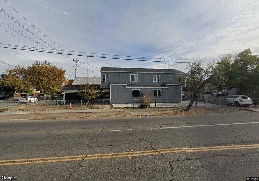
506 S Airport Way Stockton, CA 95205
East Stockton NeighborhoodEstimated Value: $310,000 - $491,000
20
Beds
4
Baths
2,411
Sq Ft
$177/Sq Ft
Est. Value
About This Home
This home is located at 506 S Airport Way, Stockton, CA 95205 and is currently estimated at $425,973, approximately $176 per square foot. 506 S Airport Way is a home located in San Joaquin County with nearby schools including John C. Fremont Elementary School, King Elementary School, and Fillmore Elementary School.
Ownership History
Date
Name
Owned For
Owner Type
Purchase Details
Closed on
Sep 5, 2023
Sold by
Trust Of Zenia S Villamejor
Bought by
Dhaliwal Amritpal Singh and Kaur Jaspreet
Current Estimated Value
Purchase Details
Closed on
Jun 20, 2023
Sold by
Villamejor Xenia S
Bought by
Trust Of Xenia S Villamejor
Purchase Details
Closed on
Jan 6, 2006
Sold by
Villamejor Xenia S
Bought by
Villamejor Xenia S
Home Financials for this Owner
Home Financials are based on the most recent Mortgage that was taken out on this home.
Original Mortgage
$234,500
Interest Rate
6.25%
Mortgage Type
New Conventional
Create a Home Valuation Report for This Property
The Home Valuation Report is an in-depth analysis detailing your home's value as well as a comparison with similar homes in the area
Home Values in the Area
Average Home Value in this Area
Purchase History
| Date | Buyer | Sale Price | Title Company |
|---|---|---|---|
| Dhaliwal Amritpal Singh | $295,000 | Chicago Title | |
| Trust Of Xenia S Villamejor | -- | None Listed On Document | |
| Villamejor Xenia S | -- | Fidelity Natl Title Ins Co |
Source: Public Records
Mortgage History
| Date | Status | Borrower | Loan Amount |
|---|---|---|---|
| Previous Owner | Villamejor Xenia S | $234,500 |
Source: Public Records
Tax History Compared to Growth
Tax History
| Year | Tax Paid | Tax Assessment Tax Assessment Total Assessment is a certain percentage of the fair market value that is determined by local assessors to be the total taxable value of land and additions on the property. | Land | Improvement |
|---|---|---|---|---|
| 2025 | $2,319 | $184,740 | $25,188 | $159,552 |
| 2024 | $2,282 | $181,119 | $24,695 | $156,424 |
| 2023 | $2,231 | $177,568 | $24,211 | $153,357 |
| 2022 | $2,188 | $174,087 | $23,737 | $150,350 |
| 2021 | $2,103 | $170,674 | $23,272 | $147,402 |
| 2020 | $2,144 | $168,925 | $23,034 | $145,891 |
| 2019 | $2,135 | $165,614 | $22,583 | $143,031 |
| 2018 | $2,096 | $162,368 | $22,141 | $140,227 |
| 2017 | $1,986 | $159,185 | $21,707 | $137,478 |
| 2016 | $1,691 | $130,000 | $35,000 | $95,000 |
Source: Public Records
Map
Nearby Homes
- 336 S Airport Way
- 1224 E Lafayette St
- 835 S Airport Way
- 832 S Pilgrim St
- 1211 E Main St
- 1816 E Sonora St
- 1636 E Anderson St
- 921 S Aurora St
- 709 E Sonora St
- 1200 E Miner Ave
- 28 S American St
- 144 N Grant St
- 1145 S Grant St
- 525 S California St
- 609 E Jefferson St
- 312 Florence St
- 323 E Church St
- 446 E Anderson St
- 322 E Sonora St
- 328 Florence St
- 1308 E Church St
- 520 S Airport Way
- 1316 E Church St
- 1246 E Church St
- 1330 E Church St
- 1305 E Church St
- 1238 E Church St
- 1317 E Church St
- 519 S Airport Way
- 1338 E Church St
- 445 S Airport Way
- 1307 E Hazelton Ave
- 1311 E Hazelton Ave
- 517 S Sierra Nevada St
- 527 S Airport Way
- 1331 E Church St
- 1315 E Hazelton Ave
- 525 S Sierra Nevada St
- 441 S Airport Way
- 1230 E Church St