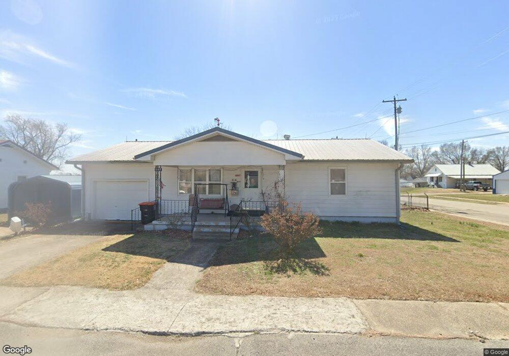
506 W Gabriel St Advance, MO 63730
Estimated Value: $101,000 - $153,000
2
Beds
1
Bath
1,200
Sq Ft
$108/Sq Ft
Est. Value
About This Home
This home is located at 506 W Gabriel St, Advance, MO 63730 and is currently estimated at $129,024, approximately $107 per square foot. 506 W Gabriel St is a home located in Stoddard County with nearby schools including Advance Elementary School, Advance High School, and Crowley Ridge Mennonite School.
Ownership History
Date
Name
Owned For
Owner Type
Purchase Details
Closed on
Jul 10, 2025
Sold by
Blanton Doris J and Blanton Aaron
Bought by
Holman Dale
Current Estimated Value
Home Financials for this Owner
Home Financials are based on the most recent Mortgage that was taken out on this home.
Original Mortgage
$82,135
Outstanding Balance
$81,997
Interest Rate
6.89%
Mortgage Type
Construction
Estimated Equity
$47,027
Purchase Details
Closed on
Jun 3, 2024
Sold by
Durrow Heather and Durrow George
Bought by
Red House Investments Llc
Create a Home Valuation Report for This Property
The Home Valuation Report is an in-depth analysis detailing your home's value as well as a comparison with similar homes in the area
Home Values in the Area
Average Home Value in this Area
Purchase History
| Date | Buyer | Sale Price | Title Company |
|---|---|---|---|
| Holman Dale | $102,669 | National Title & Escrow Inc | |
| Red House Investments Llc | -- | -- |
Source: Public Records
Mortgage History
| Date | Status | Borrower | Loan Amount |
|---|---|---|---|
| Open | Holman Dale | $82,135 |
Source: Public Records
Tax History Compared to Growth
Tax History
| Year | Tax Paid | Tax Assessment Tax Assessment Total Assessment is a certain percentage of the fair market value that is determined by local assessors to be the total taxable value of land and additions on the property. | Land | Improvement |
|---|---|---|---|---|
| 2025 | $665 | $15,808 | $0 | $0 |
| 2024 | $665 | $14,611 | $0 | $0 |
| 2023 | $662 | $14,611 | $0 | $0 |
| 2022 | $619 | $13,699 | $0 | $0 |
| 2021 | $619 | $13,699 | $0 | $0 |
| 2020 | $585 | $12,616 | $0 | $0 |
| 2019 | $581 | $12,730 | $0 | $0 |
| 2018 | $575 | $12,616 | $0 | $0 |
| 2016 | $544 | $12,255 | $0 | $0 |
| 2015 | -- | $12,179 | $0 | $0 |
| 2014 | -- | $12,046 | $0 | $0 |
| 2013 | -- | $0 | $0 | $0 |
Source: Public Records
Map
Nearby Homes
- 611 W 2nd St
- 712 W Duckett St
- 709 W Sand Rd
- 105 Tupelo St
- 19085 State Highway C
- 34182 State Highway 25
- 21212 State Highway O
- 17748 State Highway C
- 30913 State Highway 25
- 31197 County Road 219
- 17708 State Highway K
- 27859 State Highway K
- 000 State Highway K
- 16313 State Highway K
- 117 Thompson St
- 0 Tract 5 County Road 260 262
- 0 Tract 3 County Road 260 262
- 0 Tract 2 County Road 260 262
- 0 Tract 4 County Road 260 262
- 0 County Road 261
- 504 W Gabriel St
- 204 S Vine St
- 203 S Vine St
- 505 W Gabriel St
- 503 W Gabriel St
- 501 W Gabriel St
- 604 W Gabriel St
- 208 210
- 107 S Vine St
- 205 S Vine St
- 207 Poplar St
- 407 W Gabriel St
- 605 W Gabriel St
- 102 S Vine St
- 601 W Masters St
- 502 W Sturdivant St
- 405 W Gabriel St
- 603 W Masters St
- 302 S Vine St
- 605 W Masters St