Estimated Value: $218,000 - $270,000
4
Beds
3
Baths
1,890
Sq Ft
$131/Sq Ft
Est. Value
About This Home
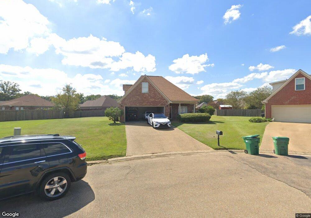
This home is located at 506 Westbridge Cove, Byram, MS 39272 and is currently estimated at $248,097, approximately $131 per square foot. 506 Westbridge Cove is a home located in Hinds County with nearby schools including Gary Road Elementary School, Gary Road Intermediate School, and Byram Middle School.
Ownership History
Date
Name
Owned For
Owner Type
Purchase Details
Closed on
Jun 8, 2012
Sold by
Pierce Ronnie and Pierce Rebecca
Bought by
Davis Latae S
Current Estimated Value
Home Financials for this Owner
Home Financials are based on the most recent Mortgage that was taken out on this home.
Original Mortgage
$158,163
Outstanding Balance
$109,767
Interest Rate
3.86%
Mortgage Type
New Conventional
Estimated Equity
$138,330
Create a Home Valuation Report for This Property
The Home Valuation Report is an in-depth analysis detailing your home's value as well as a comparison with similar homes in the area
Home Values in the Area
Average Home Value in this Area
Purchase History
| Date | Buyer | Sale Price | Title Company |
|---|---|---|---|
| Davis Latae S | -- | -- | |
| Davis Latae S | -- | -- |
Source: Public Records
Mortgage History
| Date | Status | Borrower | Loan Amount |
|---|---|---|---|
| Open | Davis Latae S | $158,163 |
Source: Public Records
Tax History
| Year | Tax Paid | Tax Assessment Tax Assessment Total Assessment is a certain percentage of the fair market value that is determined by local assessors to be the total taxable value of land and additions on the property. | Land | Improvement |
|---|---|---|---|---|
| 2025 | $1,881 | $14,320 | $2,500 | $11,820 |
| 2024 | $1,881 | $13,940 | $2,500 | $11,440 |
| 2023 | $1,881 | $13,940 | $2,500 | $11,440 |
| 2022 | $2,144 | $13,940 | $2,500 | $11,440 |
| 2021 | $1,817 | $13,940 | $2,500 | $11,440 |
| 2020 | $1,758 | $13,732 | $2,500 | $11,232 |
| 2019 | $1,747 | $13,732 | $2,500 | $11,232 |
| 2018 | $1,747 | $13,732 | $2,500 | $11,232 |
| 2017 | $1,710 | $13,732 | $2,500 | $11,232 |
| 2016 | $1,710 | $13,732 | $2,500 | $11,232 |
| 2015 | $1,688 | $13,587 | $2,500 | $11,087 |
| 2014 | $1,661 | $13,587 | $2,500 | $11,087 |
Source: Public Records
Map
Nearby Homes
- 0 Crossbridge Blvd Unit 4139885
- 0 Crossbridge Blvd Unit 4139884
- 0 S Siwell Rd Unit 4088750
- 0 S Siwell Rd Unit 24872982
- 6760 S Siwell Rd
- 0 Hinds Pkwy Unit 4079577
- 2723 Davis Rd
- 125 Churchill Place
- 2720 Davis Rd
- 0 Hinds Pkwy
- 6126 Kaybrook Dr
- 107 Davis Road Cove
- 2120 Meagan Dr
- 904 W Lake Dockery Dr
- 217 Raulston Dr
- 220 Raulston Dr
- 224 Raulston Dr
- 228 Raulston Dr
- 244 Raulston Dr
- 252 Raulston Dr
- 506 W Bridge St
- 506 W Bridge Cove
- 510 W Bridge Cove
- 510 Westbridge Cove
- 502 W Bridge Cove
- 502 Westbridge Cove
- 729 Meadows Way
- 729 Meadows Way
- 505 W Bridge Cove
- 505 Westbridge Cove
- 733 Meadows Way
- 733 Meadows Way
- 501 W Bridge Cove
- 725 Meadows Way
- 725 Meadows Way
- 501 Westbridge Cove
- 4286 Summerton Dr
- 4282 Summerton Dr
- 4214 Summerton Dr
- 4218 Summerton Dr
Your Personal Tour Guide
Ask me questions while you tour the home.