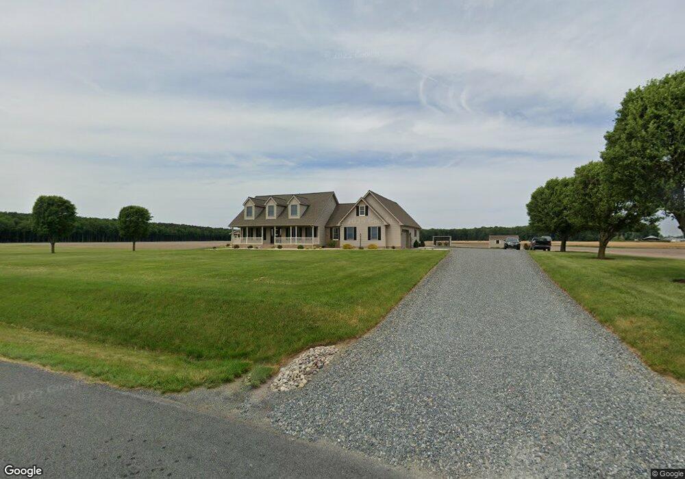
5061 Brownsville Rd Harrington, DE 19952
Estimated Value: $540,629 - $670,000
3
Beds
3
Baths
3,431
Sq Ft
$182/Sq Ft
Est. Value
About This Home
This home is located at 5061 Brownsville Rd, Harrington, DE 19952 and is currently estimated at $625,907, approximately $182 per square foot. 5061 Brownsville Rd is a home located in Kent County with nearby schools including Lake Forest South Elementary School, Lake Forest Central Elementary School, and W.T. Chipman Middle School.
Ownership History
Date
Name
Owned For
Owner Type
Purchase Details
Closed on
Sep 1, 2021
Sold by
Carter Shane B and Carter Danna L
Bought by
Carter Danna L and Carter Shane B
Current Estimated Value
Home Financials for this Owner
Home Financials are based on the most recent Mortgage that was taken out on this home.
Original Mortgage
$337,500
Interest Rate
2.1%
Mortgage Type
New Conventional
Purchase Details
Closed on
Dec 29, 2008
Sold by
Carter Shane B and Carter Danna L
Bought by
Carter Shane B and Carter Danna L
Create a Home Valuation Report for This Property
The Home Valuation Report is an in-depth analysis detailing your home's value as well as a comparison with similar homes in the area
Home Values in the Area
Average Home Value in this Area
Purchase History
| Date | Buyer | Sale Price | Title Company |
|---|---|---|---|
| Carter Danna L | -- | None Available | |
| Carter Shane B | -- | None Available |
Source: Public Records
Mortgage History
| Date | Status | Borrower | Loan Amount |
|---|---|---|---|
| Closed | Carter Danna L | $337,500 |
Source: Public Records
Tax History Compared to Growth
Tax History
| Year | Tax Paid | Tax Assessment Tax Assessment Total Assessment is a certain percentage of the fair market value that is determined by local assessors to be the total taxable value of land and additions on the property. | Land | Improvement |
|---|---|---|---|---|
| 2025 | $1,840 | $504,600 | $67,500 | $437,100 |
| 2024 | $1,840 | $504,600 | $67,500 | $437,100 |
| 2023 | $2,042 | $85,500 | $8,400 | $77,100 |
| 2022 | $1,572 | $85,500 | $8,400 | $77,100 |
| 2021 | $1,729 | $85,500 | $8,400 | $77,100 |
| 2020 | $1,804 | $85,500 | $8,400 | $77,100 |
| 2019 | $1,756 | $83,100 | $8,400 | $74,700 |
| 2018 | $1,737 | $83,100 | $8,400 | $74,700 |
| 2017 | $1,807 | $83,100 | $0 | $0 |
| 2016 | $1,656 | $83,100 | $0 | $0 |
| 2015 | $1,629 | $83,100 | $0 | $0 |
| 2014 | $1,606 | $83,100 | $0 | $0 |
Source: Public Records
Map
Nearby Homes
- 480 Hemping Rd
- 590 Lobo Rd
- 170 Sugar Stick Rd
- 1008 Redwood Ct
- 442 Melrose St
- 123 W Mispillion St
- 219 S West St
- 21 W Mispillion St
- 223 Commerce St
- 104 Wolcott St
- 2235 Vernon Rd
- 1 W Liberty St
- 112 Dorman St
- 205 Harrington Ave
- 2 Ward St
- 205 Delaware Ave
- Lot TBD Harrington Ave
- 115 East St
- 304 Second Ave
- 66 Meadow Wood Ln
- 5023 Brownsville Rd
- 4666 Brownsville Rd
- 4564 Brownsville Rd
- 969 Cornish Rd
- 371 Hemping Rd
- 5918 Whiteleysburg Rd
- 5593 Brownsville Rd
- 4580 Brownsville Rd Unit 1
- 4580 Brownsville Rd
- 5880 Whiteleysburg Rd
- 4536 Brownsville Rd
- 5875 Whiteleysburg Rd
- 5742 Brownsville Rd
- 521 Hemping Rd
- 4490 Brownsville Rd
- 5513 Whiteleysburg Rd
- 5354 Whiteleysburg Rd
- 5415 Whiteleysburg Rd
- 4452 Brownsville Rd Unit 87335
- 4452 Brownsville Rd