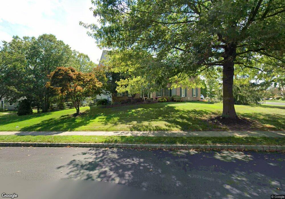
5061 Mead Dr Doylestown, PA 18902
Estimated Value: $803,000 - $989,000
4
Beds
3
Baths
3,132
Sq Ft
$289/Sq Ft
Est. Value
About This Home
This home is located at 5061 Mead Dr, Doylestown, PA 18902 and is currently estimated at $904,183, approximately $288 per square foot. 5061 Mead Dr is a home located in Bucks County with nearby schools including Cold Spring Elementary School, Holicong Middle School, and Central Bucks High School - East.
Ownership History
Date
Name
Owned For
Owner Type
Purchase Details
Closed on
Dec 23, 1998
Sold by
Cold Spring Hunt Lp
Bought by
Hoey Peter F and Hoey Elizabeth A
Current Estimated Value
Home Financials for this Owner
Home Financials are based on the most recent Mortgage that was taken out on this home.
Original Mortgage
$240,000
Outstanding Balance
$54,139
Interest Rate
6.7%
Estimated Equity
$850,044
Create a Home Valuation Report for This Property
The Home Valuation Report is an in-depth analysis detailing your home's value as well as a comparison with similar homes in the area
Home Values in the Area
Average Home Value in this Area
Purchase History
| Date | Buyer | Sale Price | Title Company |
|---|---|---|---|
| Hoey Peter F | $308,014 | Lawyers Title Insurance Corp |
Source: Public Records
Mortgage History
| Date | Status | Borrower | Loan Amount |
|---|---|---|---|
| Open | Hoey Peter F | $240,000 |
Source: Public Records
Tax History
| Year | Tax Paid | Tax Assessment Tax Assessment Total Assessment is a certain percentage of the fair market value that is determined by local assessors to be the total taxable value of land and additions on the property. | Land | Improvement |
|---|---|---|---|---|
| 2025 | $9,684 | $59,480 | $10,600 | $48,880 |
| 2024 | $9,684 | $59,480 | $10,600 | $48,880 |
| 2023 | $9,356 | $59,480 | $10,600 | $48,880 |
| 2022 | $9,244 | $59,480 | $10,600 | $48,880 |
| 2021 | $9,133 | $59,480 | $10,600 | $48,880 |
| 2020 | $9,133 | $59,480 | $10,600 | $48,880 |
| 2019 | $9,074 | $59,480 | $10,600 | $48,880 |
| 2018 | $9,074 | $59,480 | $10,600 | $48,880 |
| 2017 | $8,999 | $59,480 | $10,600 | $48,880 |
| 2016 | $9,089 | $59,480 | $10,600 | $48,880 |
| 2015 | -- | $59,480 | $10,600 | $48,880 |
| 2014 | -- | $59,480 | $10,600 | $48,880 |
Source: Public Records
Map
Nearby Homes
- 4925 Redfield Rd
- 5087 Raintree Ct
- 4783 Landisville Rd
- 3960 S Mallard Ln
- 5491 Long Ln
- 4533 Deep Creek Way
- 4745 Nottingham Way
- 4990 Point Pleasant Pike
- 5182 Point Pleasant Pike
- 6680 Point Pleasant Pike
- 3689 Hancock Ln
- 5380 Point Pleasant Pike
- 3468 Holicong Rd
- 5829 Ridgeview Dr
- 5805 Ridgeview Dr
- 4525 Deep Glen Way
- 6185 Mechanicsville Rd
- 4215 Ferguson Dr
- 3039 Durham Rd
- 4306 Kleinot Dr
- 5051 Mead Dr
- 4180 Leslie Dr
- 4185 Leslie Dr
- 4210 Leslie Dr
- 4195 Leslie Dr
- 5040 Redfield Rd
- 5041 Mead Dr
- 4175 Leslie Dr
- 4205 Leslie Dr
- 5030 Redfield Rd
- 4220 Leslie Dr
- 4215 Leslie Dr
- 5103 Grundy Way
- 5031 Mead Dr
- 5045 Redfield Rd
- 5099 Grundy Way
- 4215 Michener Rd
- 5090 Redfield Rd
- 5055 Redfield Rd
- 5020 Redfield Rd
Your Personal Tour Guide
Ask me questions while you tour the home.