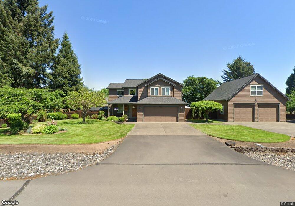
50624 Hillcrest Dr Scappoose, OR 97056
Estimated Value: $556,000 - $632,000
3
Beds
3
Baths
1,525
Sq Ft
$395/Sq Ft
Est. Value
About This Home
This home is located at 50624 Hillcrest Dr, Scappoose, OR 97056 and is currently estimated at $602,480, approximately $395 per square foot. 50624 Hillcrest Dr is a home located in Columbia County with nearby schools including Scappoose High School and Scappoose Adventist School.
Ownership History
Date
Name
Owned For
Owner Type
Purchase Details
Closed on
Apr 18, 2007
Sold by
Laird Robert G and Stratford Faye K
Bought by
Taylor Michael J and Taylor Laura J
Current Estimated Value
Home Financials for this Owner
Home Financials are based on the most recent Mortgage that was taken out on this home.
Original Mortgage
$308,000
Outstanding Balance
$185,815
Interest Rate
6.11%
Mortgage Type
Purchase Money Mortgage
Estimated Equity
$416,665
Create a Home Valuation Report for This Property
The Home Valuation Report is an in-depth analysis detailing your home's value as well as a comparison with similar homes in the area
Home Values in the Area
Average Home Value in this Area
Purchase History
| Date | Buyer | Sale Price | Title Company |
|---|---|---|---|
| Taylor Michael J | $385,000 | Ticor Title |
Source: Public Records
Mortgage History
| Date | Status | Borrower | Loan Amount |
|---|---|---|---|
| Open | Taylor Michael J | $308,000 |
Source: Public Records
Tax History Compared to Growth
Tax History
| Year | Tax Paid | Tax Assessment Tax Assessment Total Assessment is a certain percentage of the fair market value that is determined by local assessors to be the total taxable value of land and additions on the property. | Land | Improvement |
|---|---|---|---|---|
| 2024 | $4,948 | $373,090 | $130,540 | $242,550 |
| 2023 | $4,926 | $362,230 | $125,620 | $236,610 |
| 2022 | $4,703 | $351,680 | $121,960 | $229,720 |
| 2021 | $4,569 | $341,441 | $117,200 | $224,241 |
| 2020 | $4,190 | $331,500 | $100,800 | $230,700 |
| 2019 | $4,083 | $321,850 | $96,830 | $225,020 |
| 2018 | $3,972 | $312,480 | $103,000 | $209,480 |
| 2017 | $3,913 | $303,380 | $100,000 | $203,380 |
| 2016 | $3,880 | $294,550 | $97,080 | $197,470 |
| 2015 | $3,661 | $285,980 | $85,500 | $200,480 |
| 2014 | $3,574 | $277,660 | $86,720 | $190,940 |
Source: Public Records
Map
Nearby Homes
- 50551 Bark Way Unit 47
- 33366 SW Rokin Way
- 33362 SW Rokin Way
- 33344 SW Rokin Way
- 33340 SW Rokin Way
- 33596 Goss Way
- 33321 SW Holland Dr
- Aubrey Plan at Dutch Canyon
- Hillsdale Plan at Dutch Canyon
- Carmichael Plan at Dutch Canyon
- Carlton Plan at Dutch Canyon
- 33283 SW Rotterdam St
- 19300 NW Watson Rd
- 33337 SW Havlik Dr
- 50350 Cowens Rd Unit 40
- 50350 Cowens Rd Unit 8
- 50350 Cowens Rd Unit 26/27
- 33279 SW Havlik Dr
- 34326 Johnson's Landing Rd Unit E-1
- 34326 Johnsons Landing Rd Unit B1
- 50625 Chestnut Ave
- 33456 Bonneville Dr
- 33456 Bonneville Dr
- 50595 Chestnut Ave
- 50615 Hillcrest Dr
- 50592 Hillcrest Dr
- 33433 Bonneville Dr
- 50573 Hillcrest Dr
- 33384 Bonneville Dr
- 50648 Elder Ave
- 50660 Chestnut Ave
- 33383 Bonneville Dr
- 50570 Elder Ave
- 50562 Hillcrest Dr
- 50600 Chestnut Ave
- 33440 Bonneville Dr
- 50674 Chestnut Ave
- 50643 Birch Ave
- 33369 Bonneville Dr
- 50607 Elder Ave