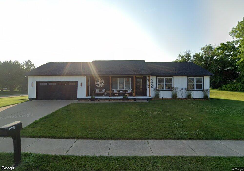
5065 Fillmore Ln Davenport, IA 52806
North Side NeighborhoodEstimated Value: $286,000 - $297,603
2
Beds
5
Baths
1,296
Sq Ft
$225/Sq Ft
Est. Value
About This Home
This home is located at 5065 Fillmore Ln, Davenport, IA 52806 and is currently estimated at $291,651, approximately $225 per square foot. 5065 Fillmore Ln is a home located in Scott County with nearby schools including Cumberland Hall School, Harrison Elementary School, and Academy Of Continuing Education.
Ownership History
Date
Name
Owned For
Owner Type
Purchase Details
Closed on
Jul 18, 2013
Sold by
Redington Mary D
Bought by
Johnson Walter J and Johnson Angela D
Current Estimated Value
Home Financials for this Owner
Home Financials are based on the most recent Mortgage that was taken out on this home.
Original Mortgage
$158,650
Outstanding Balance
$115,848
Interest Rate
4.02%
Mortgage Type
New Conventional
Estimated Equity
$175,803
Create a Home Valuation Report for This Property
The Home Valuation Report is an in-depth analysis detailing your home's value as well as a comparison with similar homes in the area
Home Values in the Area
Average Home Value in this Area
Purchase History
| Date | Buyer | Sale Price | Title Company |
|---|---|---|---|
| Johnson Walter J | $167,000 | None Available |
Source: Public Records
Mortgage History
| Date | Status | Borrower | Loan Amount |
|---|---|---|---|
| Open | Johnson Walter J | $158,650 |
Source: Public Records
Tax History Compared to Growth
Tax History
| Year | Tax Paid | Tax Assessment Tax Assessment Total Assessment is a certain percentage of the fair market value that is determined by local assessors to be the total taxable value of land and additions on the property. | Land | Improvement |
|---|---|---|---|---|
| 2025 | $4,208 | $262,970 | $47,480 | $215,490 |
| 2024 | $3,952 | $245,650 | $47,480 | $198,170 |
| 2023 | $4,098 | $237,020 | $47,480 | $189,540 |
| 2022 | $4,116 | $200,740 | $44,090 | $156,650 |
| 2021 | $4,116 | $200,740 | $44,090 | $156,650 |
| 2020 | $3,644 | $188,690 | $44,090 | $144,600 |
| 2019 | $3,574 | $167,800 | $44,090 | $123,710 |
| 2018 | $3,494 | $167,800 | $44,090 | $123,710 |
| 2017 | $933 | $167,800 | $44,090 | $123,710 |
| 2016 | $3,484 | $167,800 | $0 | $0 |
| 2015 | $3,484 | $162,790 | $0 | $0 |
| 2014 | $3,422 | $162,790 | $0 | $0 |
| 2013 | $3,478 | $0 | $0 | $0 |
| 2012 | -- | $171,690 | $45,030 | $126,660 |
Source: Public Records
Map
Nearby Homes
- 4705 N Sturdevant St
- 4618 Fillmore Ln
- 4757 Willow Cir
- 4743 Willow Cir
- 4804 Northwest Blvd
- 5210 N Division St
- 4612 Warren St Unit 5
- 1729 Welshire Dr
- 4449 Royal Oaks Dr
- 5436 N Division St
- 825 Northbrook Dr
- 4942 Brown St
- 5510 N Division St
- 1453 W 41st St
- 5721 Taylor St
- 5735 Taylor St
- 7 Vista Ct
- 28 W Village Cir
- 1415 W 59th St
- 710 Northbrook Dr
- 3716 Joyce Ln
- 3712 Joyce Ln
- 3709 Joyce Ln
- 1425 W 51st St
- 1432 W 49th St
- 1419 W 51st St
- 1424 W 49th St
- 5078 Fillmore Ln
- 5050 Fillmore Ln
- 1504 W 49th St
- 1418 W 49th St
- 1411 W 51st St
- 5104 Fillmore Ct
- 5111 Fillmore Ct
- 1410 W 51st St
- 1512 W 49th St
- 1410 W 49th St
- 5071 Garner Ct
- 5061 Garner Ct
- 1405 W 51st St