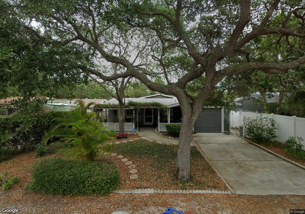
5067 Sandy Beach Ave Sarasota, FL 34242
Estimated Value: $613,679 - $878,000
2
Beds
2
Baths
1,603
Sq Ft
$461/Sq Ft
Est. Value
About This Home
This home is located at 5067 Sandy Beach Ave, Sarasota, FL 34242 and is currently estimated at $738,920, approximately $460 per square foot. 5067 Sandy Beach Ave is a home located in Sarasota County with nearby schools including Phillippi Shores Elementary School, Brookside Middle School, and Sarasota High School.
Ownership History
Date
Name
Owned For
Owner Type
Purchase Details
Closed on
Apr 21, 2022
Sold by
Fechter Essie P
Bought by
Essie P Fechter Revocable Trust
Current Estimated Value
Purchase Details
Closed on
Nov 26, 2007
Sold by
Stromick Ralph E and Stromick Rita D
Bought by
Fechter Melvin A and Fechter Essie
Home Financials for this Owner
Home Financials are based on the most recent Mortgage that was taken out on this home.
Original Mortgage
$250,000
Interest Rate
6.5%
Mortgage Type
Seller Take Back
Create a Home Valuation Report for This Property
The Home Valuation Report is an in-depth analysis detailing your home's value as well as a comparison with similar homes in the area
Home Values in the Area
Average Home Value in this Area
Purchase History
| Date | Buyer | Sale Price | Title Company |
|---|---|---|---|
| Essie P Fechter Revocable Trust | -- | John West Pllc | |
| Fechter Melvin A | $350,000 | Siesta Key Title |
Source: Public Records
Mortgage History
| Date | Status | Borrower | Loan Amount |
|---|---|---|---|
| Previous Owner | Fechter Melvin A | $250,000 |
Source: Public Records
Tax History Compared to Growth
Tax History
| Year | Tax Paid | Tax Assessment Tax Assessment Total Assessment is a certain percentage of the fair market value that is determined by local assessors to be the total taxable value of land and additions on the property. | Land | Improvement |
|---|---|---|---|---|
| 2024 | $2,400 | $206,722 | -- | -- |
| 2023 | $2,400 | $200,701 | $0 | $0 |
| 2022 | $2,354 | $194,855 | $0 | $0 |
| 2021 | $2,340 | $189,180 | $0 | $0 |
| 2020 | $2,334 | $186,568 | $0 | $0 |
| 2019 | $2,246 | $182,373 | $0 | $0 |
| 2018 | $2,065 | $169,647 | $0 | $0 |
| 2017 | $2,052 | $166,158 | $0 | $0 |
| 2016 | $2,051 | $295,800 | $176,000 | $119,800 |
| 2015 | $2,084 | $327,800 | $225,600 | $102,200 |
| 2014 | $2,074 | $157,957 | $0 | $0 |
Source: Public Records
Map
Nearby Homes
- 5141 Saint Albans Ave
- 795 Plymouth St
- 4964 Commonwealth Dr
- 5024 Commonwealth Dr
- 746 Plymouth St
- 4931 Oxford Dr
- 4929 Oxford Dr
- 5019 Commonwealth Dr
- 717 Treasure Boat Way
- 782 Birdsong Ln
- 4894 Oxford Dr
- 5169 Oxford Dr
- 4903 Commonwealth Dr
- 681 Avenida de Mayo
- 711 Birdsong Ln
- 4879 Commonwealth Dr
- 5112 Oakmont Place
- 5215 Cape Leyte Dr
- 635 Tropical Cir
- 5174 Sandy Cove Ave
- 5064 Saint Albans Ave
- 5112 Saint Albans Ave
- 5042 Oxford Dr
- 5107 Saint Albans Ave
- 5066 Sandy Beach Ave
- 5054 Sandy Beach Ave
- 5125 Sandy Beach Ave
- 5041 Sandy Beach Ave
- 5078 Sandy Beach Ave
- 5042 Sandy Beach Ave
- 5121 Saint Albans Ave
- 5116 Oxford Dr
- 5116 Drive
- 5045 Oxford Dr
- 5110 Sandy Beach Ave
- 5035 Sandy Beach Ave
- 5029 Oxford Dr
- 5105 Oxford Dr
- 5030 Sandy Beach Ave
- 5113 Oxford Dr