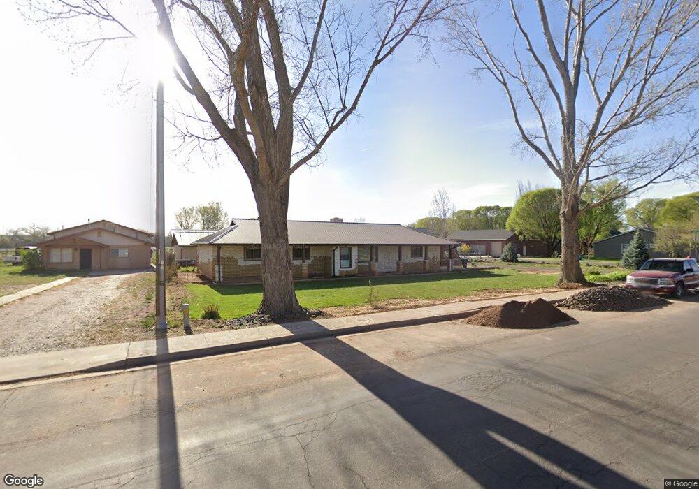
507 N 1st St E Snowflake, AZ 85937
Estimated Value: $332,000 - $480,000
3
Beds
2
Baths
2,065
Sq Ft
$201/Sq Ft
Est. Value
About This Home
This home is located at 507 N 1st St E, Snowflake, AZ 85937 and is currently estimated at $414,962, approximately $200 per square foot. 507 N 1st St E is a home located in Navajo County with nearby schools including Snowflake Intermediate School, Highland Primary School, and Snowflake Junior High School.
Ownership History
Date
Name
Owned For
Owner Type
Purchase Details
Closed on
Jan 29, 2016
Sold by
Spillman Erich and Peterson Stephanie L
Bought by
Peterson Stephanie L
Current Estimated Value
Purchase Details
Closed on
Apr 28, 2009
Sold by
Dutcher Aaron and Dutcher Randa
Bought by
Citibank Na
Purchase Details
Closed on
Dec 2, 2005
Sold by
Jones Timothy G and Jones Lisa M
Bought by
Dutcher Aaron and Dutcher Randa
Home Financials for this Owner
Home Financials are based on the most recent Mortgage that was taken out on this home.
Original Mortgage
$216,000
Interest Rate
7.62%
Mortgage Type
New Conventional
Create a Home Valuation Report for This Property
The Home Valuation Report is an in-depth analysis detailing your home's value as well as a comparison with similar homes in the area
Home Values in the Area
Average Home Value in this Area
Purchase History
| Date | Buyer | Sale Price | Title Company |
|---|---|---|---|
| Peterson Stephanie L | -- | None Available | |
| Citibank Na | $231,715 | Lawyers Title Of Arizona | |
| Dutcher Aaron | $270,000 | Transnation Title |
Source: Public Records
Mortgage History
| Date | Status | Borrower | Loan Amount |
|---|---|---|---|
| Previous Owner | Dutcher Aaron | $216,000 |
Source: Public Records
Tax History Compared to Growth
Tax History
| Year | Tax Paid | Tax Assessment Tax Assessment Total Assessment is a certain percentage of the fair market value that is determined by local assessors to be the total taxable value of land and additions on the property. | Land | Improvement |
|---|---|---|---|---|
| 2026 | $972 | -- | -- | -- |
| 2025 | $945 | $37,357 | $4,834 | $32,523 |
| 2024 | $1,009 | $36,668 | $4,203 | $32,465 |
| 2023 | $945 | $28,055 | $1,024 | $27,031 |
| 2022 | $1,009 | $0 | $0 | $0 |
| 2021 | $1,094 | $0 | $0 | $0 |
| 2020 | $1,100 | $0 | $0 | $0 |
| 2019 | $1,079 | $0 | $0 | $0 |
| 2018 | $1,045 | $0 | $0 | $0 |
| 2017 | $1,021 | $0 | $0 | $0 |
| 2016 | $931 | $0 | $0 | $0 |
| 2015 | $817 | $10,050 | $1,169 | $8,881 |
Source: Public Records
Map
Nearby Homes
- 279 E 4th St N
- 221 N Main St
- 276 N 2nd St W
- 276 N 2nd St W Unit West
- 141 W 2nd St N
- 110 S 1st St E
- 44 S 3rd St W
- 44 S 3rd St W Unit W
- 461 W Center St
- 662 E 1 2 St
- 37 S 5th St W Unit TH
- 37 S 5th St W
- 662 N 1 2 St
- Parcel C Arizona 77
- Parcel B Arizona 77
- Parcel A Arizona 77
- 1014 E Madison St
- 1058 E Adams St
- 1050 E Jefferson St
- 416 S 2nd St W
- 509 N 1st St E
- 495 N 1st St E
- 527 N 1st St E
- 134 E 4th St N
- 134 E 4th St N
- 214 E 4th St N
- 571 N 1st St E
- 571 N 1st St E
- 571 N 1st St E
- 571 N 1st St E
- 571 N 1st St E
- 571 N 1st St E
- 571 N 1st St E
- 571 N 1st St E
- 211 E 5th North St
- 157 E North St
- 232 E 4th St N
- 105 E 4th St N
- 591 N 1st St E
- 101 E 4th St N