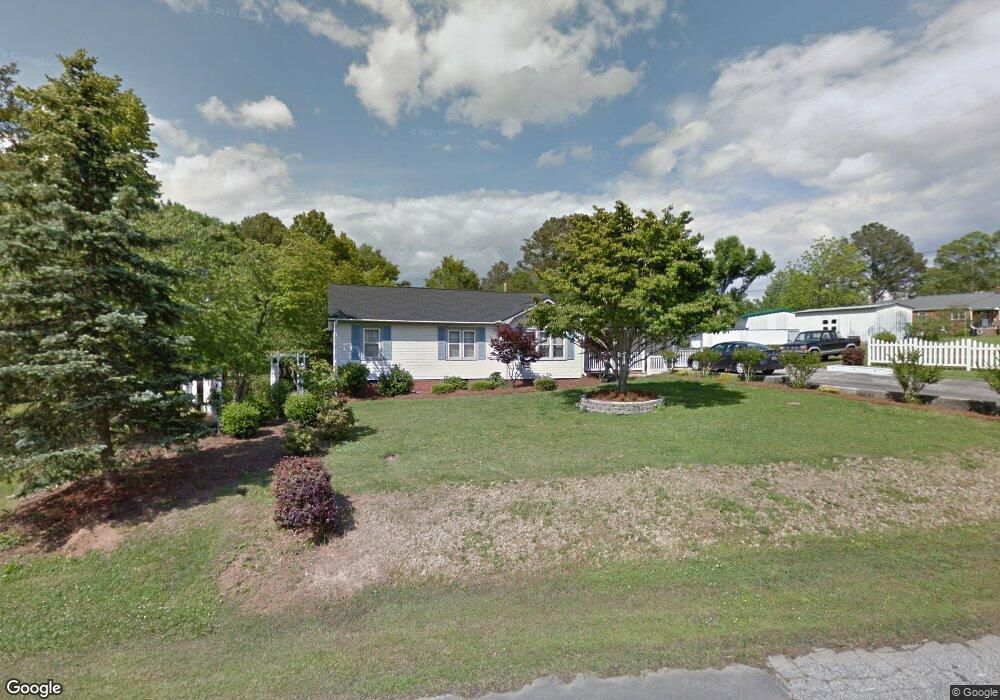
507 N Wylie St Lancaster, SC 29720
Estimated Value: $225,000 - $249,481
--
Bed
2
Baths
1,580
Sq Ft
$149/Sq Ft
Est. Value
About This Home
This home is located at 507 N Wylie St, Lancaster, SC 29720 and is currently estimated at $236,120, approximately $149 per square foot. 507 N Wylie St is a home located in Lancaster County with nearby schools including North Elementary School, A.R. Rucker Middle School, and Lancaster High School.
Ownership History
Date
Name
Owned For
Owner Type
Purchase Details
Closed on
Oct 18, 2018
Sold by
Mandaro Ronnye and Mandaro Joseph H
Bought by
Ingram Cuttino Lisa Michelle
Current Estimated Value
Purchase Details
Closed on
Apr 19, 2017
Sold by
Edwards Hilda
Bought by
Mandaro Ronnye and Mandaro Joseph H
Home Financials for this Owner
Home Financials are based on the most recent Mortgage that was taken out on this home.
Original Mortgage
$118,650
Interest Rate
4.21%
Mortgage Type
New Conventional
Purchase Details
Closed on
Feb 18, 2008
Sold by
Carter Nell
Bought by
Edwards Hilda
Create a Home Valuation Report for This Property
The Home Valuation Report is an in-depth analysis detailing your home's value as well as a comparison with similar homes in the area
Home Values in the Area
Average Home Value in this Area
Purchase History
| Date | Buyer | Sale Price | Title Company |
|---|---|---|---|
| Ingram Cuttino Lisa Michelle | $126,000 | None Available | |
| Mandaro Ronnye | $124,900 | -- | |
| Edwards Hilda | $93,000 | None Available |
Source: Public Records
Mortgage History
| Date | Status | Borrower | Loan Amount |
|---|---|---|---|
| Previous Owner | Mandaro Ronnye | $118,650 |
Source: Public Records
Tax History Compared to Growth
Tax History
| Year | Tax Paid | Tax Assessment Tax Assessment Total Assessment is a certain percentage of the fair market value that is determined by local assessors to be the total taxable value of land and additions on the property. | Land | Improvement |
|---|---|---|---|---|
| 2024 | -- | $5,264 | $600 | $4,664 |
| 2023 | $0 | $5,264 | $600 | $4,664 |
| 2022 | $0 | $5,264 | $600 | $4,664 |
| 2021 | $3,140 | $5,264 | $600 | $4,664 |
| 2020 | $3,140 | $4,940 | $600 | $4,340 |
| 2019 | $3,140 | $0 | $0 | $0 |
| 2018 | $2,411 | $7,410 | $900 | $6,510 |
| 2017 | $302 | $0 | $0 | $0 |
| 2016 | $311 | $0 | $0 | $0 |
| 2015 | $334 | $0 | $0 | $0 |
| 2014 | $334 | $0 | $0 | $0 |
| 2013 | $334 | $0 | $0 | $0 |
Source: Public Records
Map
Nearby Homes
- 601 Laurel Ct
- 405 N Woodland Dr
- 406 Gillsbrook Rd
- 414 W Springs St
- 000 Woodland Dr
- 704 Marion Sims Dr
- 463 W Barr St
- 613 Davis St
- 906 Forest Dr
- 109 N York St
- 958 Sherwood Cir
- 119 Barron Blvd
- 981 Sherwood Cir
- 2 Elm St
- 304 E Barr St
- 106 N Market St
- 310 Elm St
- 314 S French St
- 416 Clinton Ave
- 436 Clinton Ave
- 509 N Wylie St
- 503 N Wylie St
- 505 N Jackson Rd
- 603 N Jackson Rd
- 406 Rosewood Ct
- 404 Rosewood Ct
- 502 Laurel Ct
- 601 N Wylie St
- 506 Laurel Ct
- 508 N Jackson Rd
- 602 N Wylie St
- 503 N Jackson Rd
- 502 N Wylie St
- 418 Laurel Ct Unit 5
- 603 N Wylie St
- 503 Laurel Ct
- 503 Laurel Ct Unit 7
- 405 Rosewood Ct
- 407 Rosewood Ct
- 604 N Wylie St