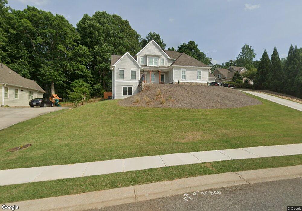
507 Tower Trace Canton, GA 30115
Union Hill NeighborhoodEstimated Value: $749,000 - $807,983
4
Beds
4
Baths
3,479
Sq Ft
$224/Sq Ft
Est. Value
About This Home
This home is located at 507 Tower Trace, Canton, GA 30115 and is currently estimated at $778,492, approximately $223 per square foot. 507 Tower Trace is a home located in Cherokee County with nearby schools including Avery Elementary School, Creekland Middle School, and Creekview High School.
Ownership History
Date
Name
Owned For
Owner Type
Purchase Details
Closed on
Aug 27, 2021
Sold by
Barber Scott
Bought by
Hull Charles Alexander and Hull Barbara Ann
Current Estimated Value
Home Financials for this Owner
Home Financials are based on the most recent Mortgage that was taken out on this home.
Original Mortgage
$235,000
Outstanding Balance
$212,898
Interest Rate
2.8%
Mortgage Type
New Conventional
Estimated Equity
$565,594
Purchase Details
Closed on
Mar 13, 2020
Sold by
Morris George E
Bought by
Barber Scott and Barber Kelley
Purchase Details
Closed on
Aug 25, 2010
Sold by
Riverstone Dev Group Inc
Bought by
Morris George E and Morris Barbara J
Create a Home Valuation Report for This Property
The Home Valuation Report is an in-depth analysis detailing your home's value as well as a comparison with similar homes in the area
Home Values in the Area
Average Home Value in this Area
Purchase History
| Date | Buyer | Sale Price | Title Company |
|---|---|---|---|
| Hull Charles Alexander | $541,250 | -- | |
| Barber Scott | $75,000 | -- | |
| Morris George E | $35,000 | -- |
Source: Public Records
Mortgage History
| Date | Status | Borrower | Loan Amount |
|---|---|---|---|
| Open | Hull Charles Alexander | $235,000 |
Source: Public Records
Tax History
| Year | Tax Paid | Tax Assessment Tax Assessment Total Assessment is a certain percentage of the fair market value that is determined by local assessors to be the total taxable value of land and additions on the property. | Land | Improvement |
|---|---|---|---|---|
| 2025 | $2,048 | $303,440 | $48,800 | $254,640 |
| 2024 | $4,704 | $344,840 | $62,000 | $282,840 |
| 2023 | $3,459 | $301,040 | $49,600 | $251,440 |
| 2022 | $2,459 | $216,520 | $41,360 | $175,160 |
| 2021 | $852 | $30,000 | $30,000 | $0 |
| 2020 | $852 | $30,000 | $30,000 | $0 |
| 2019 | $852 | $30,000 | $30,000 | $0 |
| 2018 | $858 | $30,000 | $30,000 | $0 |
| 2017 | $838 | $75,000 | $30,000 | $0 |
| 2016 | $838 | $72,000 | $28,800 | $0 |
| 2015 | $247 | $21,000 | $8,400 | $0 |
| 2014 | $247 | $21,000 | $8,400 | $0 |
Source: Public Records
Map
Nearby Homes
- 134 Royal Oaks Dr
- 306 Crown Ct
- 254 Lingefelt Ln
- 250 Randall Creek Dr
- 1076 Pinyan Ln
- 120 Prescott Manor Dr
- 501 Middlebrooke Trace
- 337 Mcdaniel Place
- 411 Royal Crescent Ln E
- 129 Prescott Manor Dr
- 241 Royal Crescent Terrace
- 328 Mcdaniel Place
- 405 Royal Crescent Ln E
- 112 Idylwilde Way
- 417 Darnell Rd
- 704 Hickory Hollow Walk
- 646 Royal Crest Ct
- 642 Royal Crest Ct
- 127 Crest Brooke Dr
- 515 Cobblestone Ct
- 505 Tower Trace
- 511 Tower Trace
- 509 Tower Trace
- 93 Tower Trace
- 506 Tower Trace
- 504 Tower Trace
- 130 Royal Oaks Dr
- 132 Royal Oaks Dr
- 128 Royal Oaks Dr
- 513 Tower Trace
- 601 Knights Bridge Dr
- 126 Royal Oaks Dr
- 512 Tower Trace
- 514 Tower Trace
- 516 Tower Trace
- 135 Royal Oaks Dr
- 300 Crown Ct
- 124 Royal Oaks Dr
- 124 Royal Oaks Dr Unit 18
- 136 Royal Oaks Dr Unit 24
Your Personal Tour Guide
Ask me questions while you tour the home.