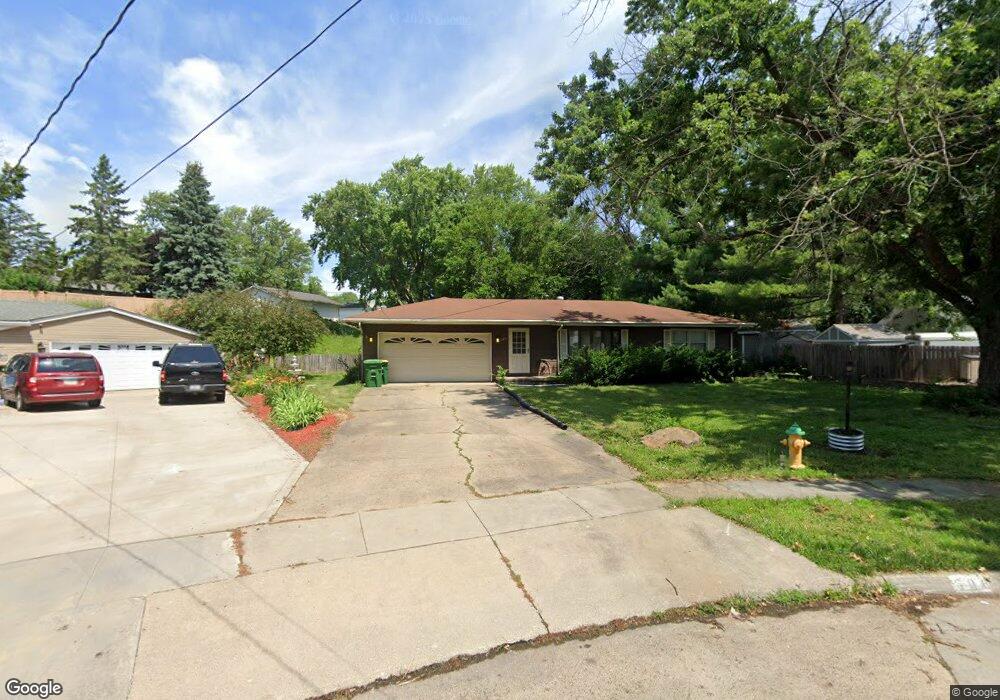
508 Gepke Pkwy Des Moines, IA 50320
Warren County NeighborhoodEstimated Value: $235,000 - $256,000
3
Beds
2
Baths
1,304
Sq Ft
$187/Sq Ft
Est. Value
About This Home
This home is located at 508 Gepke Pkwy, Des Moines, IA 50320 and is currently estimated at $243,243, approximately $186 per square foot. 508 Gepke Pkwy is a home located in Warren County with nearby schools including Studebaker Elementary School, Mccombs Middle School, and Lincoln High School.
Ownership History
Date
Name
Owned For
Owner Type
Purchase Details
Closed on
Aug 1, 2006
Sold by
Gavin Michael and Gavin Linda
Bought by
Wood Brent J
Current Estimated Value
Home Financials for this Owner
Home Financials are based on the most recent Mortgage that was taken out on this home.
Original Mortgage
$34,000
Outstanding Balance
$20,596
Interest Rate
6.83%
Mortgage Type
New Conventional
Estimated Equity
$222,647
Create a Home Valuation Report for This Property
The Home Valuation Report is an in-depth analysis detailing your home's value as well as a comparison with similar homes in the area
Home Values in the Area
Average Home Value in this Area
Purchase History
| Date | Buyer | Sale Price | Title Company |
|---|---|---|---|
| Wood Brent J | $200,250 | None Available |
Source: Public Records
Mortgage History
| Date | Status | Borrower | Loan Amount |
|---|---|---|---|
| Open | Wood Brent J | $34,000 | |
| Previous Owner | Gavin Michael | $25,189 |
Source: Public Records
Tax History Compared to Growth
Tax History
| Year | Tax Paid | Tax Assessment Tax Assessment Total Assessment is a certain percentage of the fair market value that is determined by local assessors to be the total taxable value of land and additions on the property. | Land | Improvement |
|---|---|---|---|---|
| 2024 | $2,398 | $201,600 | $17,500 | $184,100 |
| 2023 | $2,382 | $201,600 | $17,500 | $184,100 |
| 2022 | $2,376 | $170,400 | $17,500 | $152,900 |
| 2021 | $2,436 | $170,400 | $17,500 | $152,900 |
| 2020 | $2,436 | $159,900 | $17,500 | $142,400 |
| 2019 | $2,426 | $159,900 | $17,500 | $142,400 |
| 2018 | $2,412 | $0 | $0 | $0 |
| 2017 | $2,286 | $0 | $0 | $0 |
| 2016 | $2,236 | $133,400 | $0 | $0 |
| 2015 | $2,236 | $0 | $0 | $0 |
| 2014 | $2,250 | $134,800 | $0 | $0 |
Source: Public Records
Map
Nearby Homes
- 579 Greenfield Pkwy
- 335 Palomino Pkwy
- 8066 Pilmer Dr
- 500 E County Line Rd
- 8053 Ridgeview Dr
- 8110 Warren Dr
- 01 County Line Rd
- 00 County Line Rd
- 7807 SE 2nd St
- 154 Crossroads Dr
- 6901 SE 14th St Unit 75
- 6901 SE 14th St Unit 30
- 6901 SE 14th St Unit 245
- 1 Border St
- 7707 SW 10th Place
- 7500 SE Bloomfield Rd Unit 40
- 920 Amos Ave
- 7085 Bloomfield Rd Unit 200
- 1010 Amos Ave
- 7460 Southview Dr