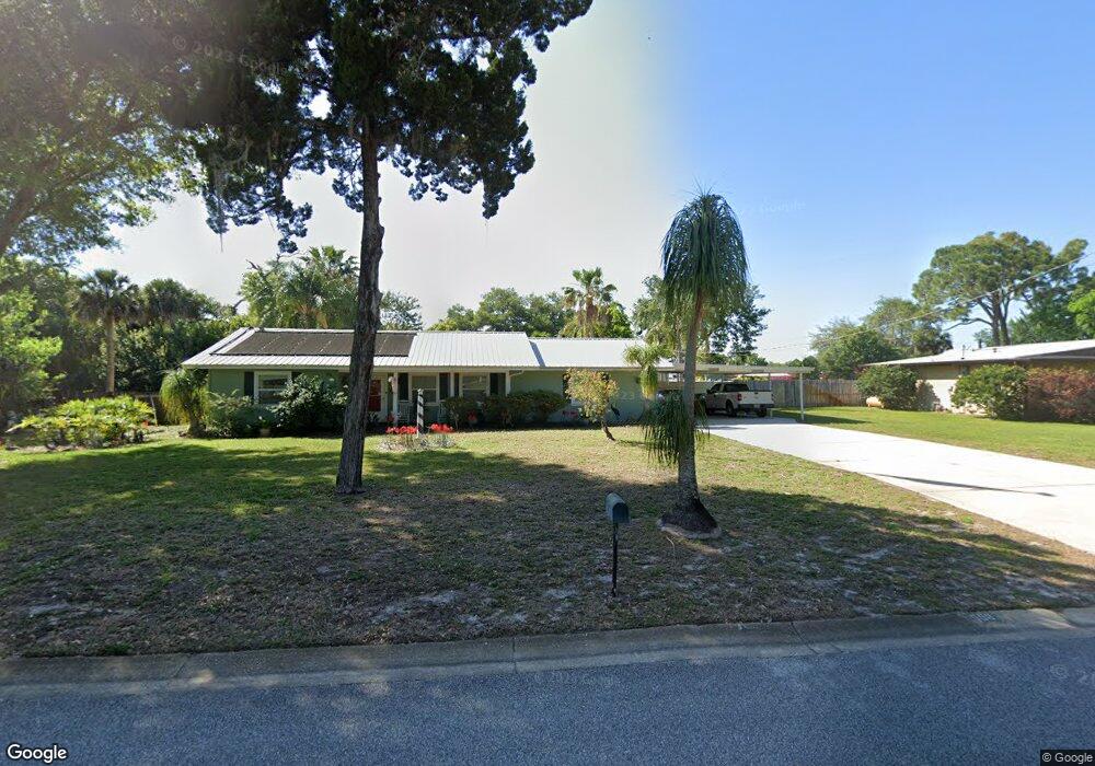
508 Lenore Ave Titusville, FL 32796
Estimated Value: $197,000 - $268,000
3
Beds
2
Baths
1,254
Sq Ft
$194/Sq Ft
Est. Value
About This Home
This home is located at 508 Lenore Ave, Titusville, FL 32796 and is currently estimated at $242,659, approximately $193 per square foot. 508 Lenore Ave is a home located in Brevard County with nearby schools including Mims Elementary School, James Madison Middle School, and Astronaut High School.
Ownership History
Date
Name
Owned For
Owner Type
Purchase Details
Closed on
Sep 18, 2002
Sold by
Jones Lester H and Jones Leatrice F
Bought by
Edwards Charles L and Edwards Esther J
Current Estimated Value
Home Financials for this Owner
Home Financials are based on the most recent Mortgage that was taken out on this home.
Original Mortgage
$59,375
Outstanding Balance
$24,912
Interest Rate
6.3%
Estimated Equity
$217,747
Purchase Details
Closed on
Oct 16, 2000
Sold by
Jones Lester H and Jones Leatrice F
Bought by
Jones Lester H
Create a Home Valuation Report for This Property
The Home Valuation Report is an in-depth analysis detailing your home's value as well as a comparison with similar homes in the area
Home Values in the Area
Average Home Value in this Area
Purchase History
| Date | Buyer | Sale Price | Title Company |
|---|---|---|---|
| Edwards Charles L | $62,500 | -- | |
| Jones Lester H | -- | -- |
Source: Public Records
Mortgage History
| Date | Status | Borrower | Loan Amount |
|---|---|---|---|
| Open | Edwards Charles L | $59,375 |
Source: Public Records
Tax History Compared to Growth
Tax History
| Year | Tax Paid | Tax Assessment Tax Assessment Total Assessment is a certain percentage of the fair market value that is determined by local assessors to be the total taxable value of land and additions on the property. | Land | Improvement |
|---|---|---|---|---|
| 2025 | $787 | $74,700 | -- | -- |
| 2024 | $763 | $72,600 | -- | -- |
| 2023 | $763 | $70,490 | $0 | $0 |
| 2022 | $707 | $68,440 | $0 | $0 |
| 2021 | $722 | $66,450 | $0 | $0 |
| 2020 | $726 | $65,540 | $0 | $0 |
| 2019 | $744 | $64,070 | $0 | $0 |
| 2018 | $754 | $62,880 | $0 | $0 |
| 2017 | $758 | $61,590 | $0 | $0 |
| 2016 | $680 | $60,330 | $15,500 | $44,830 |
| 2015 | $703 | $59,920 | $15,500 | $44,420 |
| 2014 | $704 | $59,450 | $15,500 | $43,950 |
Source: Public Records
Map
Nearby Homes
- 424 Lenore Ave
- 7.26 Route 1
- 1636 Violet Ave
- 2015 Malinda Ln
- 502 Vaughn St
- 610 East Ct
- 1615 Violet Ave
- 614 West Ct
- Tbd N Washington Ave
- 1539 Violet Ave
- 0000 Buffalo Rd
- 0000 Unknown N Park Ave
- 2135 Mayfair Way Unit Lot 71
- 2135 Mayfair Way Unit 84
- 2135 Mayfair Way Unit 98
- 870 Century Medical Dr
- 1115 Jones St
- 105 McNeela Dr Unit 105
- 671 N Dixie Ave Unit 18A
- 130 Forrell Ave
- 500 Lenore Ave
- 520 Lenore Ave
- 507 Lincoln Ave
- 515 Lincoln Ave
- 501 Lincoln Ave
- 511 Lenore Ave
- 505 Lenore Ave
- 525 Lenore Ave
- 523 Lenore Ave
- 528 Lenore Ave
- 525 Lincoln Ave
- 527 Lenore Ave
- 434 Lenore Ave
- 430 Lenore Ave
- 533 Lenore Ave
- 506 Lincoln Ave
- 435 Lenore Ave
- 565 Lincoln Ave
- 520 Lincoln Ave
- 429 Lincoln Ave