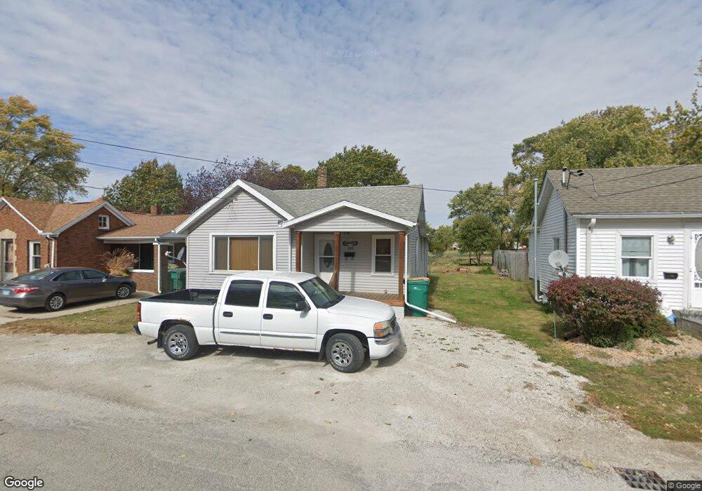
508 Sangamon St Streator, IL 61364
Estimated Value: $55,820 - $100,000
--
Bed
--
Bath
802
Sq Ft
$102/Sq Ft
Est. Value
About This Home
This home is located at 508 Sangamon St, Streator, IL 61364 and is currently estimated at $81,955, approximately $102 per square foot. 508 Sangamon St is a home located in LaSalle County with nearby schools including Kimes Elementary School, Northlawn Junior High School, and Streator Township High School.
Ownership History
Date
Name
Owned For
Owner Type
Purchase Details
Closed on
Feb 11, 2016
Sold by
Lasalle County Sheriff
Bought by
Chalkey Dennis W
Current Estimated Value
Purchase Details
Closed on
Jun 9, 2010
Sold by
Wahl Patricia A
Bought by
Pearson Ronald A
Home Financials for this Owner
Home Financials are based on the most recent Mortgage that was taken out on this home.
Original Mortgage
$63,500
Interest Rate
5.13%
Mortgage Type
Purchase Money Mortgage
Purchase Details
Closed on
Dec 7, 2007
Sold by
Quick Marvin L
Bought by
Wahl Patricia A
Create a Home Valuation Report for This Property
The Home Valuation Report is an in-depth analysis detailing your home's value as well as a comparison with similar homes in the area
Home Values in the Area
Average Home Value in this Area
Purchase History
| Date | Buyer | Sale Price | Title Company |
|---|---|---|---|
| Chalkey Dennis W | $10,500 | -- | |
| Pearson Ronald A | $60,000 | First American Title | |
| Wahl Patricia A | $12,000 | None Available |
Source: Public Records
Mortgage History
| Date | Status | Borrower | Loan Amount |
|---|---|---|---|
| Previous Owner | Pearson Ronald A | $63,500 |
Source: Public Records
Tax History Compared to Growth
Tax History
| Year | Tax Paid | Tax Assessment Tax Assessment Total Assessment is a certain percentage of the fair market value that is determined by local assessors to be the total taxable value of land and additions on the property. | Land | Improvement |
|---|---|---|---|---|
| 2024 | -- | $12,342 | $1,947 | $10,395 |
| 2023 | -- | $10,598 | $1,672 | $8,926 |
| 2022 | $0 | $9,259 | $1,461 | $7,798 |
| 2021 | $0 | $8,737 | $1,379 | $7,358 |
| 2020 | $213 | $8,462 | $1,336 | $7,126 |
| 2019 | $213 | $7,926 | $1,251 | $6,675 |
| 2018 | $213 | $7,555 | $1,192 | $6,363 |
| 2017 | $425 | $7,515 | $1,186 | $6,329 |
| 2016 | $994 | $8,067 | $1,273 | $6,794 |
| 2015 | $1,068 | $7,941 | $1,253 | $6,688 |
| 2012 | -- | $9,126 | $1,440 | $7,686 |
Source: Public Records
Map
Nearby Homes
- 1012 Cable St
- 804 E 12th St
- 305 E 12th St
- 801 S Monroe St
- 717 S Monroe St
- 921 Maple St
- 709 S Park St
- 1107 Arthur St
- 701 Lundy St
- 511 S Bloomington St
- 708 Lundy St
- 804 Lundy St
- 709 E Livingston St
- 312 S Everett St
- 312 S Monroe St
- 523 Montgomery St
- 705 E Wilson St
- 408 Powell St
- 218 S Vermillion St
- 804 E Wilson St
- 510 Sangamon St
- 506 Sangamon St
- 504 Sangamon St
- 507 Sangamon St
- 502 Sangamon St
- 505 Sangamon St
- 1107 Milner St
- 509 Sangamon St
- 1103 Milner St
- 1107 Sansom St
- 503 Sangamon St
- 1109 Sansom St
- 1101 Milner St
- 1201 Sansom St
- 1105 Sansom St
- 415 Sangamon St
- 1205 Sansom St
- 1106 Milner St
- 1104 Milner St
- 1104 Milner St