Estimated Value: $319,000 - $330,000
3
Beds
2
Baths
1,677
Sq Ft
$194/Sq Ft
Est. Value
About This Home
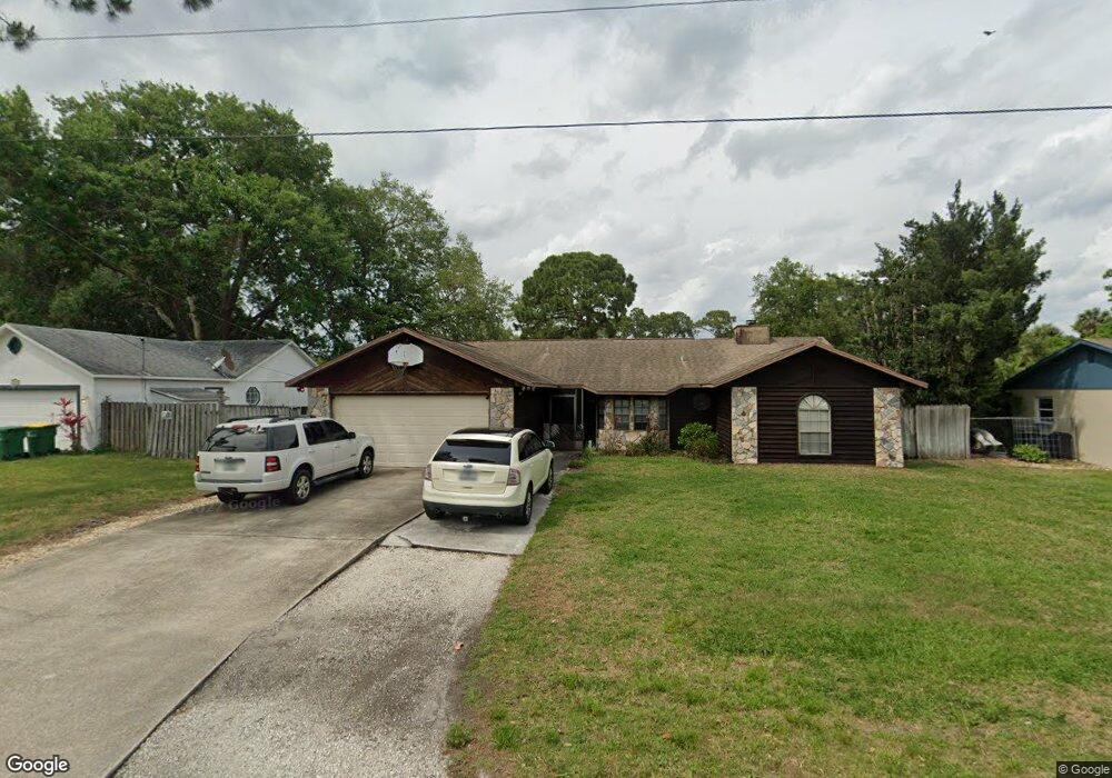
This home is located at 5080 Carter St, Cocoa, FL 32927 and is currently estimated at $324,555, approximately $193 per square foot. 5080 Carter St is a home located in Brevard County with nearby schools including Atlantis Elementary School, Space Coast Junior/Senior High School, and Sculptor Charter School.
Ownership History
Date
Name
Owned For
Owner Type
Purchase Details
Closed on
Jul 27, 2001
Sold by
Human Don Dewayne and Human Kathy
Bought by
Roberts Shane
Current Estimated Value
Home Financials for this Owner
Home Financials are based on the most recent Mortgage that was taken out on this home.
Original Mortgage
$94,248
Outstanding Balance
$36,189
Interest Rate
7.09%
Estimated Equity
$288,366
Create a Home Valuation Report for This Property
The Home Valuation Report is an in-depth analysis detailing your home's value as well as a comparison with similar homes in the area
Home Values in the Area
Average Home Value in this Area
Purchase History
| Date | Buyer | Sale Price | Title Company |
|---|---|---|---|
| Roberts Shane | $92,400 | -- |
Source: Public Records
Mortgage History
| Date | Status | Borrower | Loan Amount |
|---|---|---|---|
| Open | Roberts Shane | $94,248 |
Source: Public Records
Tax History Compared to Growth
Tax History
| Year | Tax Paid | Tax Assessment Tax Assessment Total Assessment is a certain percentage of the fair market value that is determined by local assessors to be the total taxable value of land and additions on the property. | Land | Improvement |
|---|---|---|---|---|
| 2025 | $1,403 | $102,030 | -- | -- |
| 2024 | $1,325 | $99,160 | -- | -- |
| 2023 | $1,325 | $93,090 | $0 | $0 |
| 2022 | $1,234 | $90,380 | $0 | $0 |
| 2021 | $1,228 | $87,750 | $0 | $0 |
| 2020 | $1,164 | $86,540 | $0 | $0 |
| 2019 | $1,098 | $84,600 | $0 | $0 |
| 2018 | $1,089 | $83,030 | $0 | $0 |
| 2017 | $1,079 | $81,330 | $0 | $0 |
| 2016 | $1,077 | $79,660 | $18,000 | $61,660 |
| 2015 | $1,086 | $79,110 | $15,000 | $64,110 |
| 2014 | $1,085 | $78,490 | $11,000 | $67,490 |
Source: Public Records
Map
Nearby Homes
- 5090 Market St
- 5155 Mayflower St
- 7155 Export Ave
- 6840 Anecia Ave
- 6735 Grissom Pkwy
- 7275 Durban Ave
- 4859 Horton St
- 5170 Everett St
- 7065 Hundred Acre Dr
- 7302 Bumelia Dr
- 7310 Joshua Place
- 7230 Venus Ave
- 7035 Jasmine Ave
- 4760 Ivan St
- 7635 Fringe Place
- 7545 Fringe Place
- 5149 Arlington Rd Unit 104
- 00 Unknown
- 0000 Grissom Pkwy
- 6615 Dock Ave
- 5090 Carter St
- 5095 Mayflower St
- 5105 Mayflower St
- 5085 Mayflower St
- 5100 Carter St
- 5060 Carter St
- 5085 Carter St
- 5075 Carter St
- 5095 Carter St
- 5115 Mayflower St
- 5075 Mayflower St
- 5065 Carter St
- 5050 Carter St
- 5110 Carter St
- 5105 Carter St
- 5125 Mayflower St
- 5055 Carter St
- 5115 Carter St
- 5040 Carter St
- 5120 Carter St