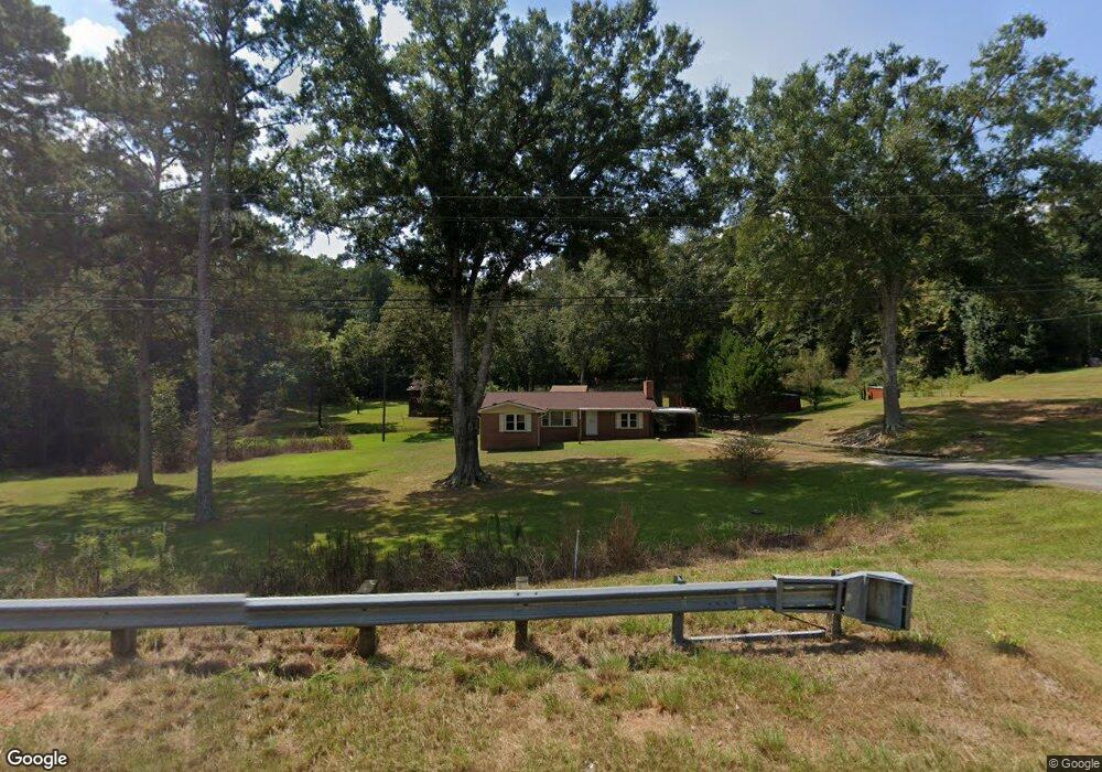
5085 Us Highway 27 Franklin, GA 30217
Estimated Value: $233,130 - $384,000
3
Beds
2
Baths
1,362
Sq Ft
$215/Sq Ft
Est. Value
About This Home
This home is located at 5085 Us Highway 27, Franklin, GA 30217 and is currently estimated at $292,283, approximately $214 per square foot. 5085 Us Highway 27 is a home located in Heard County with nearby schools including Heard County High School.
Ownership History
Date
Name
Owned For
Owner Type
Purchase Details
Closed on
Jul 27, 2012
Sold by
Buchanan Curtis
Bought by
Heistand Matthew C
Current Estimated Value
Home Financials for this Owner
Home Financials are based on the most recent Mortgage that was taken out on this home.
Original Mortgage
$79,591
Outstanding Balance
$55,163
Interest Rate
3.68%
Mortgage Type
New Conventional
Estimated Equity
$237,120
Purchase Details
Closed on
Apr 25, 2012
Sold by
Buchanan Martha Jean
Bought by
Buchanan Curtis
Purchase Details
Closed on
Jul 8, 2002
Sold by
Buchanan Curtis and Martha Jean D
Bought by
Department Of Transportation
Purchase Details
Closed on
Jun 8, 1993
Sold by
Bank Of Heard County
Bought by
Buchanan Curtis and Martha Jean
Purchase Details
Closed on
Apr 24, 1969
Bought by
Buchanan Curtis
Create a Home Valuation Report for This Property
The Home Valuation Report is an in-depth analysis detailing your home's value as well as a comparison with similar homes in the area
Home Values in the Area
Average Home Value in this Area
Purchase History
| Date | Buyer | Sale Price | Title Company |
|---|---|---|---|
| Heistand Matthew C | $78,000 | -- | |
| Buchanan Curtis | -- | -- | |
| Department Of Transportation | -- | -- | |
| Buchanan Curtis | $45,000 | -- | |
| Buchanan Curtis | -- | -- |
Source: Public Records
Mortgage History
| Date | Status | Borrower | Loan Amount |
|---|---|---|---|
| Open | Heistand Matthew C | $79,591 |
Source: Public Records
Tax History Compared to Growth
Tax History
| Year | Tax Paid | Tax Assessment Tax Assessment Total Assessment is a certain percentage of the fair market value that is determined by local assessors to be the total taxable value of land and additions on the property. | Land | Improvement |
|---|---|---|---|---|
| 2024 | $852 | $42,247 | $6,625 | $35,622 |
| 2023 | $686 | $32,881 | $5,521 | $27,360 |
| 2022 | $653 | $31,285 | $3,537 | $27,748 |
| 2021 | $540 | $24,571 | $3,537 | $21,034 |
| 2020 | $549 | $24,727 | $3,537 | $21,190 |
| 2019 | $549 | $24,727 | $3,537 | $21,190 |
| 2018 | $560 | $24,727 | $3,537 | $21,190 |
| 2017 | $543 | $24,066 | $3,376 | $20,690 |
| 2016 | $522 | $23,115 | $3,376 | $19,739 |
| 2015 | -- | $22,236 | $5,946 | $16,291 |
| 2014 | -- | $22,242 | $5,946 | $16,296 |
| 2013 | -- | $27,534 | $5,945 | $21,588 |
Source: Public Records
Map
Nearby Homes
- Tr 5 Unit 19.018 ac Pike Roa
- Tr 4 Unit 15.976 ac Pike Roa
- 915 Pea Ridge Rd
- 1221 US Highway 27
- TR 4 15.976 AC Pike Rd
- TR 5 19.018 AC Pike Rd
- 0 Dr Fisher Rd Unit 10583815
- 00 Tuscan Hills Rd
- 0 Tuscan Hills Rd Unit 10641286
- 000 Us Highway 27
- 319 +/- AC Georgia 100
- 140+/- AC Georgia 100
- 0 Georgia 100 Unit 10604110
- 284 Newnan St
- 211 Main St
- 441 Newnan St
- 325 Newnan St
- 92 Holliday Rd
- 2176 Franklin Pkwy
- 3939 Bevis Rd
- 5131 Us Highway 27
- 5015 Us Highway 27
- 5010 Us Highway 27
- 5154 Us Highway 27
- 5154 Us Highway 27
- 150 Byrd Rd
- 4911 U S 27
- 4911 Us Highway 27
- 165 Byrd Rd
- 127 Byrd Rd
- 4847 Us Highway 27
- 232 Byrd Rd
- 200 Byrd Rd
- 5400 Us Highway 27
- 4774 Us Highway 27
- 0 Byrd Rd Unit 7013067
- 4757 Us Highway 27
- 5555 Us Highway 27
- 5555 Us Highway 27
- 5555 Us Highway 27