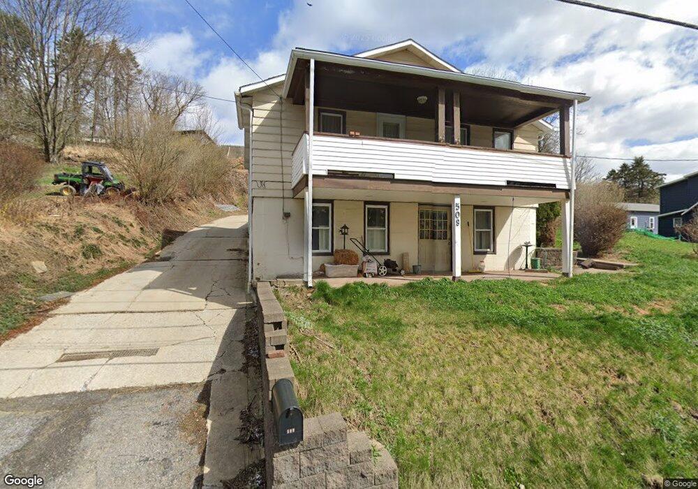
509 Benshoff Hill Rd Johnstown, PA 15906
Estimated Value: $45,869 - $141,000
--
Bed
--
Bath
--
Sq Ft
0.29
Acres
About This Home
This home is located at 509 Benshoff Hill Rd, Johnstown, PA 15906 and is currently estimated at $93,717. 509 Benshoff Hill Rd is a home located in Cambria County with nearby schools including Ferndale Elementary School, Ferndale Area Junior/Senior High School, and CENTER FOR ACHIEVEMENT.
Ownership History
Date
Name
Owned For
Owner Type
Purchase Details
Closed on
Dec 17, 2013
Sold by
Arleen C Arleen C and Svencer Arleen C
Bought by
Svencer Derrick M
Current Estimated Value
Home Financials for this Owner
Home Financials are based on the most recent Mortgage that was taken out on this home.
Original Mortgage
$38,000
Outstanding Balance
$9,932
Interest Rate
3.37%
Mortgage Type
Purchase Money Mortgage
Estimated Equity
$83,785
Create a Home Valuation Report for This Property
The Home Valuation Report is an in-depth analysis detailing your home's value as well as a comparison with similar homes in the area
Home Values in the Area
Average Home Value in this Area
Purchase History
| Date | Buyer | Sale Price | Title Company |
|---|---|---|---|
| Svencer Derrick M | $47,500 | Stc Settlement |
Source: Public Records
Mortgage History
| Date | Status | Borrower | Loan Amount |
|---|---|---|---|
| Open | Svencer Derrick M | $38,000 |
Source: Public Records
Tax History Compared to Growth
Tax History
| Year | Tax Paid | Tax Assessment Tax Assessment Total Assessment is a certain percentage of the fair market value that is determined by local assessors to be the total taxable value of land and additions on the property. | Land | Improvement |
|---|---|---|---|---|
| 2025 | $484 | $10,700 | $1,680 | $9,020 |
| 2024 | $1,517 | $10,700 | $1,680 | $9,020 |
| 2023 | $1,479 | $10,700 | $1,680 | $9,020 |
| 2022 | $1,447 | $10,700 | $1,680 | $9,020 |
| 2021 | $1,447 | $10,700 | $1,680 | $9,020 |
| 2020 | $1,436 | $10,700 | $1,680 | $9,020 |
| 2019 | $1,404 | $10,700 | $1,680 | $9,020 |
| 2018 | $1,372 | $10,700 | $1,680 | $9,020 |
| 2017 | $1,346 | $10,700 | $1,680 | $9,020 |
| 2016 | $369 | $10,700 | $1,680 | $9,020 |
| 2015 | $316 | $10,700 | $1,680 | $9,020 |
| 2014 | $316 | $10,700 | $1,680 | $9,020 |
Source: Public Records
Map
Nearby Homes
- 519 Benshoff Hill Rd
- 0 Bear St Unit Lot
- 0 Castle St
- 158 Batzel Rd
- 318 Vaughn St
- 440 Boyer St
- 77 Boyer St
- 0 Mary Ann Ct
- 108 Biffs Alley
- 820 Virginia Ave
- 419 Beatrice Ave
- 939 Virginia Ave
- 715 Virginia Ave
- 153-155 C St
- 81-83 Fairfield Ave
- 199 D St
- 154 Sheridan St
- 247 Beatrice Ave
- 560 Dorothy Ave
- 551 Dorothy Ave
- 497 Benshoff Hill Rd
- 512 Benshoff Hill Rd
- 135 Guard St
- 489 Benshoff Hill Rd
- 204 Earl St
- 121 Guard St
- 481 Benshoff Hill Rd
- 127 Guard St
- 127 Guard St
- 520 Benshoff Hill Rd
- 139 Guard St
- 202 Earl St
- 523 Benshoff Hill Rd
- 473 Benshoff Hill Rd
- 198 Earl St
- 190 Earl St
- 230 Earl St
- 547 Benshoff Hill Rd
- 549 Benshoff Hill Rd
- 205 Earl St