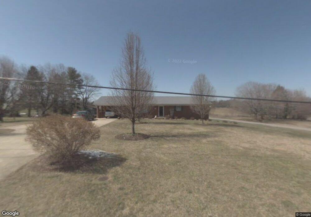
509 Dunbar Rd Chuckey, TN 37641
Estimated Value: $235,182 - $318,000
--
Bed
1
Bath
1,484
Sq Ft
$188/Sq Ft
Est. Value
About This Home
This home is located at 509 Dunbar Rd, Chuckey, TN 37641 and is currently estimated at $278,796, approximately $187 per square foot. 509 Dunbar Rd is a home with nearby schools including South Central Elementary School and David Crockett High School.
Ownership History
Date
Name
Owned For
Owner Type
Purchase Details
Closed on
Sep 25, 2017
Sold by
Burgner Shelia and Burgner Roger
Bought by
Laws Michael Kevin and Laws Beverly Leann
Current Estimated Value
Home Financials for this Owner
Home Financials are based on the most recent Mortgage that was taken out on this home.
Original Mortgage
$100,000
Outstanding Balance
$83,707
Interest Rate
3.9%
Mortgage Type
New Conventional
Estimated Equity
$195,089
Purchase Details
Closed on
Oct 26, 2016
Sold by
Hensley Wesley
Bought by
Burgner Shelia
Purchase Details
Closed on
Jun 5, 2014
Sold by
Masters James
Bought by
Hensley Wesley and Hensley Janet
Home Financials for this Owner
Home Financials are based on the most recent Mortgage that was taken out on this home.
Original Mortgage
$118,000
Interest Rate
4.28%
Mortgage Type
New Conventional
Purchase Details
Closed on
Jul 10, 2013
Sold by
Broyles Ronnie
Bought by
Masters James and Masters Betty
Create a Home Valuation Report for This Property
The Home Valuation Report is an in-depth analysis detailing your home's value as well as a comparison with similar homes in the area
Home Values in the Area
Average Home Value in this Area
Purchase History
| Date | Buyer | Sale Price | Title Company |
|---|---|---|---|
| Laws Michael Kevin | $100,000 | Reliable Title & Escrow Llc | |
| Burgner Shelia | $119,451 | -- | |
| Hensley Wesley | $130,000 | -- | |
| Masters James | $110,500 | -- |
Source: Public Records
Mortgage History
| Date | Status | Borrower | Loan Amount |
|---|---|---|---|
| Open | Laws Michael Kevin | $100,000 | |
| Previous Owner | Hensley Wesley | $118,000 |
Source: Public Records
Tax History Compared to Growth
Tax History
| Year | Tax Paid | Tax Assessment Tax Assessment Total Assessment is a certain percentage of the fair market value that is determined by local assessors to be the total taxable value of land and additions on the property. | Land | Improvement |
|---|---|---|---|---|
| 2024 | $1,147 | $67,075 | $5,625 | $61,450 |
| 2022 | $730 | $33,950 | $4,250 | $29,700 |
| 2021 | $730 | $33,950 | $4,250 | $29,700 |
| 2020 | $730 | $33,950 | $4,250 | $29,700 |
| 2019 | $706 | $33,950 | $4,250 | $29,700 |
| 2018 | $706 | $29,650 | $4,250 | $25,400 |
| 2017 | $706 | $29,650 | $4,250 | $25,400 |
| 2016 | $706 | $29,650 | $4,250 | $25,400 |
| 2015 | $587 | $29,650 | $4,250 | $25,400 |
| 2014 | $587 | $29,650 | $4,250 | $25,400 |
Source: Public Records
Map
Nearby Homes
- 153 Greene County Line Rd
- 2851 Highway 107
- 3059 Tennessee 107
- 165 Horse Creek Rd
- 279 Donald Broyles Rd
- 103 Lilly Painter Rd
- 1761 Corby Bridge Rd
- 131 Brown Dr
- 1851 Corby Bridge Rd
- TBD Bill Gourley Rd
- 290 Bill Mauk Rd
- 290 Bill Mauk Rd
- 324 Bill Mauk Rd
- 39.26 Ac Pleasant Hill Rd
- 230 Fishpond Rd
- 151 Frank Stanton Rd
- 1942 Bailey Bridge Rd
- 7540 Erwin Hwy
- 213 Fox Rd
- 236 Brobeck Hill Rd
- 513 Dunbar Rd
- 508 Broyles Rd
- 403 Dunbar Rd
- 211 W Broyles Rd
- 206 W Broyles Rd
- 218 W Broyles Rd
- 111 W Broyles Rd
- 390 Dunbar Rd
- 388 Dunbar Rd
- 379 Dunbar Rd
- 247 Liberty Church Dr
- 227 Liberty Church Dr
- 239 W Broyles Rd
- 350 Pepper Mill Rd
- 259 Liberty Church Dr
- 240 (LOT 1 Broyles Rd
- 343 Pepper Mill Rd
- 341 Pepper Mill Rd
- 207 Liberty Church Dr
- 252 Liberty Church Dr