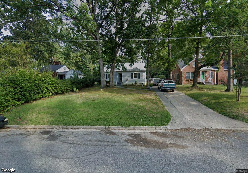
509 E Farriss Ave High Point, NC 27262
Greater High Point NeighborhoodEstimated Value: $162,000 - $264,000
3
Beds
2
Baths
1,626
Sq Ft
$128/Sq Ft
Est. Value
About This Home
This home is located at 509 E Farriss Ave, High Point, NC 27262 and is currently estimated at $207,351, approximately $127 per square foot. 509 E Farriss Ave is a home located in Guilford County with nearby schools including Kirkman Park Elementary School, Penn-Griffin School for the Arts, and T.W. Andrews High School.
Ownership History
Date
Name
Owned For
Owner Type
Purchase Details
Closed on
Mar 23, 2016
Sold by
Crandall Margaret D
Bought by
Ramsey Gary Glenn and Ramsey Maria Barity
Current Estimated Value
Purchase Details
Closed on
Jul 13, 2001
Sold by
Smith Delia R and Smith Jeffrey Dwayne
Bought by
Crandall Margaret D
Home Financials for this Owner
Home Financials are based on the most recent Mortgage that was taken out on this home.
Original Mortgage
$68,000
Interest Rate
7.23%
Create a Home Valuation Report for This Property
The Home Valuation Report is an in-depth analysis detailing your home's value as well as a comparison with similar homes in the area
Home Values in the Area
Average Home Value in this Area
Purchase History
| Date | Buyer | Sale Price | Title Company |
|---|---|---|---|
| Ramsey Gary Glenn | $51,000 | None Available | |
| Crandall Margaret D | $90,000 | -- |
Source: Public Records
Mortgage History
| Date | Status | Borrower | Loan Amount |
|---|---|---|---|
| Previous Owner | Crandall Margaret D | $68,000 |
Source: Public Records
Tax History
| Year | Tax Paid | Tax Assessment Tax Assessment Total Assessment is a certain percentage of the fair market value that is determined by local assessors to be the total taxable value of land and additions on the property. | Land | Improvement |
|---|---|---|---|---|
| 2025 | $1,680 | $121,900 | $30,000 | $91,900 |
| 2024 | $1,680 | $121,900 | $30,000 | $91,900 |
| 2023 | $1,680 | $121,900 | $30,000 | $91,900 |
| 2022 | $1,643 | $121,900 | $30,000 | $91,900 |
| 2021 | $1,293 | $93,800 | $22,000 | $71,800 |
| 2020 | $1,293 | $93,800 | $22,000 | $71,800 |
| 2019 | $1,293 | $93,800 | $0 | $0 |
| 2018 | $1,286 | $93,800 | $0 | $0 |
| 2017 | $1,286 | $93,800 | $0 | $0 |
| 2016 | $1,264 | $90,100 | $0 | $0 |
| 2015 | $1,270 | $90,100 | $0 | $0 |
| 2014 | $1,292 | $90,100 | $0 | $0 |
Source: Public Records
Map
Nearby Homes
- 511 E Farriss Ave
- 304 Louise Ave
- 721 Forrest St
- 1310 Madison St
- 719 Forrest St
- 916 Forrest St
- 702 E Farriss Ave
- 509 Woodrow Ave
- 1433 Larkin St
- 1428 Futrelle Dr
- 910 E Dayton Ave
- 207 Hillcrest Dr
- 1507 Larkin St
- 1108 Forrest St
- 1110 Forrest St
- 1602 Larkin St
- 613 Woodridge Ln
- 610 Colonial Dr
- 1311 Prescott Place
- 1129 Bridges Dr
- 507 E Farriss Ave
- 503 E Farriss Ave
- 516 Guilford Ave
- 515 E Farriss Ave
- 518 Guilford Ave
- 501 E Farriss Ave
- 520 Guilford Ave
- 517 E Farriss Ave
- 506 E Farriss Ave
- 500 E Farriss Ave
- 512 E Farriss Ave
- 522 Guilford Ave
- 1100 Blain St
- 511 Guilford Ave
- 513 Guilford Ave
- 509 Guilford Ave
- 519 E Farriss Ave
- 515 Guilford Ave
- 514 E Farriss Ave
- 517 Guilford Ave
Your Personal Tour Guide
Ask me questions while you tour the home.