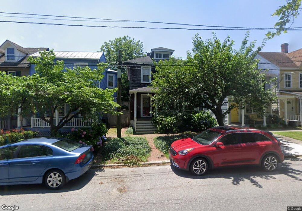
509 High St Chestertown, MD 21620
Estimated Value: $310,000 - $498,000
3
Beds
2
Baths
1,407
Sq Ft
$264/Sq Ft
Est. Value
About This Home
This home is located at 509 High St, Chestertown, MD 21620 and is currently estimated at $371,209, approximately $263 per square foot. 509 High St is a home located in Kent County with nearby schools including Center for Innovation, Kent County Middle School, and Kent County High School.
Ownership History
Date
Name
Owned For
Owner Type
Purchase Details
Closed on
Oct 26, 2011
Sold by
Somers Bruce A and Somers Sharon K
Bought by
Somers Sharon K
Current Estimated Value
Purchase Details
Closed on
Dec 3, 2004
Sold by
Mohler Elisabeth D
Bought by
Somers Bruce A
Purchase Details
Closed on
Oct 1, 2002
Sold by
Hoesly Mark J
Bought by
Mohler Elisabeth D
Purchase Details
Closed on
Feb 6, 2002
Sold by
Mumford Mark L
Bought by
Hoesly Mark J
Purchase Details
Closed on
Feb 28, 2001
Sold by
Us Bank National Association F/K/A
Bought by
Mumford Mark L
Purchase Details
Closed on
Aug 7, 2000
Sold by
Alleger Eugene F
Bought by
Us Bank National Association F/K/A and First Bank National Association Tr
Create a Home Valuation Report for This Property
The Home Valuation Report is an in-depth analysis detailing your home's value as well as a comparison with similar homes in the area
Home Values in the Area
Average Home Value in this Area
Purchase History
| Date | Buyer | Sale Price | Title Company |
|---|---|---|---|
| Somers Sharon K | -- | -- | |
| Somers Sharon K | -- | -- | |
| Somers Bruce A | $329,000 | -- | |
| Mohler Elisabeth D | $89,000 | -- | |
| Hoesly Mark J | $55,000 | -- | |
| Mumford Mark L | $28,500 | -- | |
| Us Bank National Association F/K/A | $67,900 | -- |
Source: Public Records
Tax History Compared to Growth
Tax History
| Year | Tax Paid | Tax Assessment Tax Assessment Total Assessment is a certain percentage of the fair market value that is determined by local assessors to be the total taxable value of land and additions on the property. | Land | Improvement |
|---|---|---|---|---|
| 2025 | $3,705 | $236,400 | $85,200 | $151,200 |
| 2024 | $3,534 | $225,500 | $0 | $0 |
| 2023 | $3,172 | $214,600 | $0 | $0 |
| 2022 | $3,172 | $203,700 | $85,200 | $118,500 |
| 2021 | $3,144 | $202,167 | $0 | $0 |
| 2020 | $3,144 | $200,633 | $0 | $0 |
| 2019 | $3,114 | $199,100 | $85,200 | $113,900 |
| 2018 | $3,094 | $199,100 | $85,200 | $113,900 |
| 2017 | $2,994 | $199,100 | $0 | $0 |
| 2016 | -- | $199,100 | $0 | $0 |
| 2015 | $3,176 | $199,100 | $0 | $0 |
| 2014 | $3,176 | $199,100 | $0 | $0 |
Source: Public Records
Map
Nearby Homes
- 517 High St
- 109 S College Ave
- 611 Cannon St
- 349 High St
- 349 & 351 High St
- 423 Calvert St
- 234 N College Ave
- 200 Washington Ave
- 141 Prospect St
- 222 Mount Vernon Ave
- 206 Cannon St
- 206 S Water St
- 228 S Water St
- 105 High St
- 303 E Campus Ave
- 206 Valley Rd
- 101 Birch Run Rd
- 0 Elm St Unit MDKE2003590
- 37 Landing Ln
- 35 Landing Ln
- 511 High St
- 507 High St
- 513 High St
- 505 High St
- 515 High St
- 98 S Kent St
- 501 High St Unit 3
- 501 High St
- 501 High St Unit 1
- 501 High St Unit A
- 501 High St Unit C
- 501 High St Unit 2
- 0 Radcliffe Rd Unit 1006379690
- 0 Radcliffe Rd Unit 1003383914
- 0 Radcliffe Rd Unit KE9520947
- 0 Radcliffe Rd Unit 1001005491
- 102 S Kent St
- 100 S Kent St
- 517 APT C High St
- 104 S Kent St