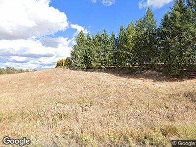
509 S 1st St Fairfield, WA 99012
Estimated Value: $617,000 - $676,000
5
Beds
4
Baths
3,816
Sq Ft
$170/Sq Ft
Est. Value
About This Home
This home is located at 509 S 1st St, Fairfield, WA 99012 and is currently estimated at $649,468, approximately $170 per square foot. 509 S 1st St is a home located in Spokane County with nearby schools including Liberty Elementary/Junior High School and Liberty High School.
Ownership History
Date
Name
Owned For
Owner Type
Purchase Details
Closed on
Jul 23, 2009
Sold by
Denny Chad B and Denny Marie C
Bought by
Anderson Shane E and Anderson Melonie R
Current Estimated Value
Home Financials for this Owner
Home Financials are based on the most recent Mortgage that was taken out on this home.
Original Mortgage
$298,500
Interest Rate
5.59%
Mortgage Type
VA
Purchase Details
Closed on
May 5, 2003
Sold by
Felber Robert S and Felber Dorothy A
Bought by
Denny Chad B and Denny Marie C
Home Financials for this Owner
Home Financials are based on the most recent Mortgage that was taken out on this home.
Original Mortgage
$182,128
Interest Rate
5.71%
Create a Home Valuation Report for This Property
The Home Valuation Report is an in-depth analysis detailing your home's value as well as a comparison with similar homes in the area
Home Values in the Area
Average Home Value in this Area
Purchase History
| Date | Buyer | Sale Price | Title Company |
|---|---|---|---|
| Anderson Shane E | $298,500 | Spokane County Title Co | |
| Denny Chad B | $195,000 | First American Title Ins |
Source: Public Records
Mortgage History
| Date | Status | Borrower | Loan Amount |
|---|---|---|---|
| Open | Anderson Shane E | $52,000 | |
| Open | Anderson Shane E | $340,092 | |
| Closed | Anderson Shane E | $339,857 | |
| Closed | Anderson Shane E | $300,495 | |
| Closed | Anderson Shane E | $298,500 | |
| Previous Owner | Denny Chad B | $168,000 | |
| Previous Owner | Denny Chad B | $13,800 | |
| Previous Owner | Denny Chad B | $182,128 |
Source: Public Records
Tax History Compared to Growth
Tax History
| Year | Tax Paid | Tax Assessment Tax Assessment Total Assessment is a certain percentage of the fair market value that is determined by local assessors to be the total taxable value of land and additions on the property. | Land | Improvement |
|---|---|---|---|---|
| 2024 | $3,776 | $475,800 | $77,000 | $398,800 |
| 2023 | $3,454 | $475,400 | $76,600 | $398,800 |
| 2022 | $3,384 | $453,200 | $54,400 | $398,800 |
| 2021 | $3,240 | $323,800 | $54,400 | $269,400 |
| 2020 | $3,240 | $311,400 | $54,400 | $257,000 |
| 2019 | $2,832 | $284,900 | $42,200 | $242,700 |
| 2018 | $2,970 | $254,200 | $42,200 | $212,000 |
| 2017 | $2,330 | $228,700 | $42,200 | $186,500 |
| 2016 | $2,083 | $223,200 | $42,200 | $181,000 |
| 2015 | $2,046 | $207,300 | $42,200 | $165,100 |
| 2014 | -- | $207,300 | $42,200 | $165,100 |
| 2013 | -- | $0 | $0 | $0 |
Source: Public Records
Map
Nearby Homes
- 406 N Northridge Way
- 11900 E Hays Rd Unit Lot A - Parcel 9030
- TBD E Steptoe View Ln
- 320 S River St
- 511 S 2nd St
- 338 E Emma St
- 105 Sprague St
- 218 Cliff Ct
- 0 E Toll Rd
- 6919 E Spangle Waverly Rd
- 119 N Cowles St
- 126 E Market St
- NNA E Stoughton Rd
- 000 E Horton Rd
- XXX Vacant Land
- NKA Merideth
- Lot C Merideth Rd
- 0 Unassigned Address Rd Unit SAR202513397
- Lot 13 Lone Moose Dr
- Lot 12 Lone Moose Dr
