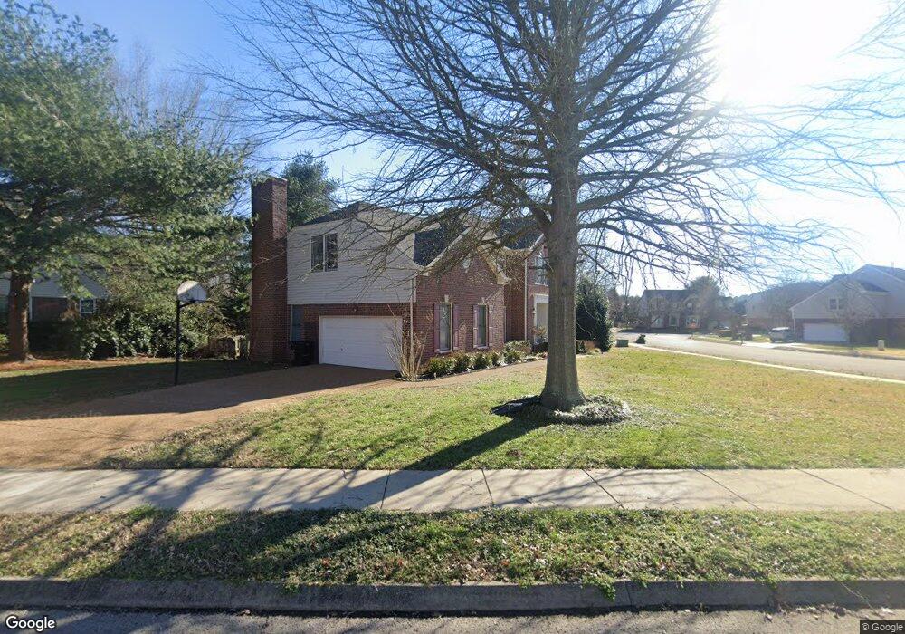
509 Sharpe Dr Franklin, TN 37064
West Franklin NeighborhoodEstimated Value: $777,000 - $872,000
--
Bed
4
Baths
2,953
Sq Ft
$281/Sq Ft
Est. Value
About This Home
This home is located at 509 Sharpe Dr, Franklin, TN 37064 and is currently estimated at $829,893, approximately $281 per square foot. 509 Sharpe Dr is a home located in Williamson County with nearby schools including Poplar Grove K-4, Johnson Elementary School, and Poplar Grove 5-8.
Ownership History
Date
Name
Owned For
Owner Type
Purchase Details
Closed on
Jan 3, 2006
Sold by
Rutledge Phillip Carl
Bought by
Rutledge Cheryl Lynn
Current Estimated Value
Purchase Details
Closed on
Mar 26, 1998
Sold by
Brent Oxspring Phillip and Brent Jennifer D
Bought by
Rutledge Phillip Carl and Rutledge Cheryl Lynn
Home Financials for this Owner
Home Financials are based on the most recent Mortgage that was taken out on this home.
Original Mortgage
$188,000
Interest Rate
7.01%
Purchase Details
Closed on
Aug 18, 1995
Sold by
Zaring Homes Inc
Bought by
Etu Oxspring Phillip Brent
Create a Home Valuation Report for This Property
The Home Valuation Report is an in-depth analysis detailing your home's value as well as a comparison with similar homes in the area
Home Values in the Area
Average Home Value in this Area
Purchase History
| Date | Buyer | Sale Price | Title Company |
|---|---|---|---|
| Rutledge Cheryl Lynn | -- | None Available | |
| Rutledge Phillip Carl | $235,000 | -- | |
| Etu Oxspring Phillip Brent | $227,225 | -- |
Source: Public Records
Mortgage History
| Date | Status | Borrower | Loan Amount |
|---|---|---|---|
| Previous Owner | Rutledge Phillip Carl | $188,000 |
Source: Public Records
Tax History Compared to Growth
Tax History
| Year | Tax Paid | Tax Assessment Tax Assessment Total Assessment is a certain percentage of the fair market value that is determined by local assessors to be the total taxable value of land and additions on the property. | Land | Improvement |
|---|---|---|---|---|
| 2024 | $3,456 | $122,075 | $28,750 | $93,325 |
| 2023 | $3,322 | $122,075 | $28,750 | $93,325 |
| 2022 | $3,322 | $122,075 | $28,750 | $93,325 |
| 2021 | $3,322 | $122,075 | $28,750 | $93,325 |
| 2020 | $3,043 | $94,275 | $22,500 | $71,775 |
| 2019 | $3,043 | $94,275 | $22,500 | $71,775 |
| 2018 | $2,977 | $94,275 | $22,500 | $71,775 |
| 2017 | $2,930 | $94,275 | $22,500 | $71,775 |
| 2016 | $2,920 | $94,275 | $22,500 | $71,775 |
| 2015 | -- | $80,425 | $15,625 | $64,800 |
| 2014 | -- | $80,425 | $15,625 | $64,800 |
Source: Public Records
Map
Nearby Homes
- 305 Abram Ct
- 310 Devonshire Dr
- 527 Antebellum Ct
- 523 Antebellum Ct
- 714 Founders Pointe Blvd
- Azalea Plan at Reese
- Jordan Plan at Reese
- 5029 Owenruth Dr
- 215 Wrennewood Ln
- 5037 Owenruth Dr
- 3042 Blossom Trail Ln
- 4068 Penfield Dr
- 4064 Penfield Dr
- 4072 Penfield Dr
- 4060 Penfield Dr
- 5041 Owenruth Dr
- 1632 Cooper Creek Ln
- 4076 Penfield Dr
- 454 Cardel Ln
- 226 Wrennewood Ln
- 507 Sharpe Dr
- 306 Founders Pointe Blvd
- 603 Rutherford Ln
- 508 Sharpe Dr
- 304 Founders Pointe Blvd
- 605 Rutherford Ln
- 505 Sharpe Dr
- 401 Fontaine Dr
- 607 Rutherford Ln
- 301 Abram Ct
- 303 Abram Ct
- 302 Founders Pointe Blvd
- 503 Sharpe Dr
- 502 Promenade Ct
- 305 Founders Pointe Blvd
- 403 Fontaine Dr
- 504 Promenade Ct
- 500 Promenade Ct
- 400 Fontaine Dr
- 303 Founders Pointe Blvd