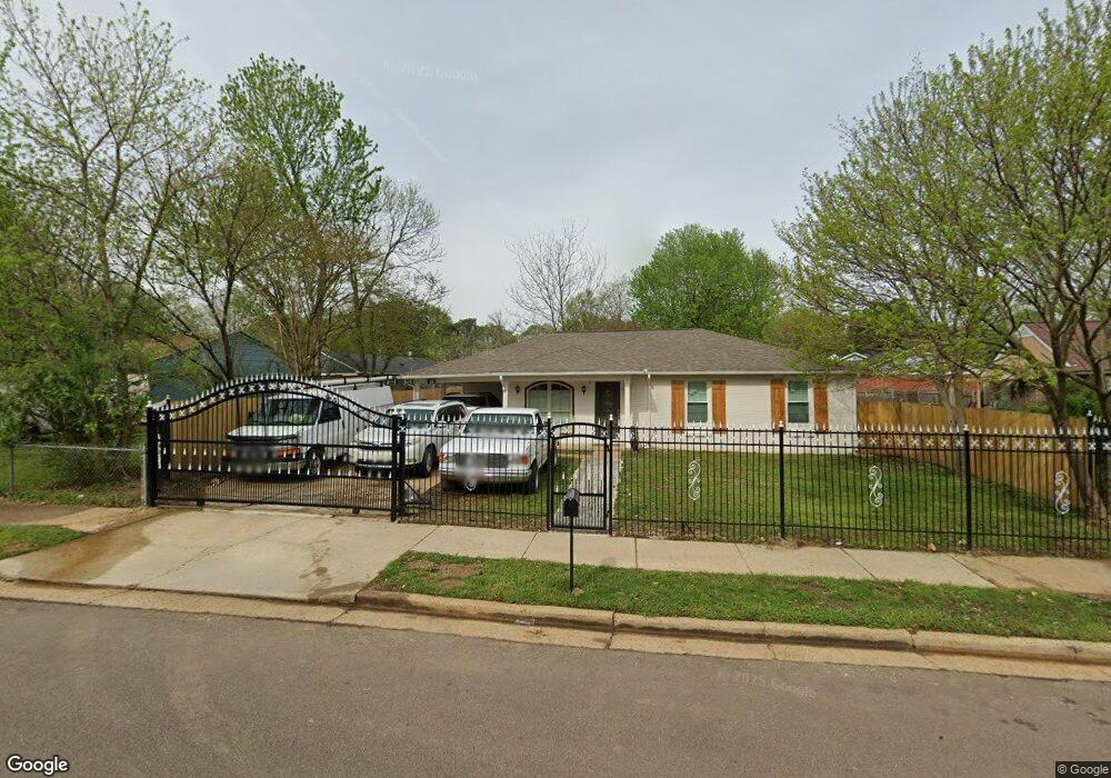
5091 Chantilly Dr Memphis, TN 38127
Estimated Value: $88,000 - $107,000
3
Beds
2
Baths
1,112
Sq Ft
$85/Sq Ft
Est. Value
About This Home
This home is located at 5091 Chantilly Dr, Memphis, TN 38127 and is currently estimated at $94,447, approximately $84 per square foot. 5091 Chantilly Dr is a home located in Shelby County with nearby schools including Northaven Elementary School, Woodstock Middle School, and Trezevant High School.
Ownership History
Date
Name
Owned For
Owner Type
Purchase Details
Closed on
Jul 9, 2020
Sold by
Duarte Beatriz and Duarte Crisoforo
Bought by
Zuniga Ramirez Marvin Esteban and Mondragon Ramirez Maria
Current Estimated Value
Home Financials for this Owner
Home Financials are based on the most recent Mortgage that was taken out on this home.
Original Mortgage
$57,000
Outstanding Balance
$16,182
Interest Rate
3.2%
Mortgage Type
Unknown
Estimated Equity
$78,265
Purchase Details
Closed on
Nov 17, 2011
Sold by
Jackson David Scott and Jackson Donna Marie
Bought by
Secretary Of Housing & Urban Development
Purchase Details
Closed on
Feb 29, 1996
Bought by
Robert Skulark and Robert Bonnie
Create a Home Valuation Report for This Property
The Home Valuation Report is an in-depth analysis detailing your home's value as well as a comparison with similar homes in the area
Home Values in the Area
Average Home Value in this Area
Purchase History
| Date | Buyer | Sale Price | Title Company |
|---|---|---|---|
| Zuniga Ramirez Marvin Esteban | $57,000 | None Available | |
| Secretary Of Housing & Urban Development | $36,840 | None Available | |
| Robert Skulark | $44,000 | -- |
Source: Public Records
Mortgage History
| Date | Status | Borrower | Loan Amount |
|---|---|---|---|
| Open | Zuniga Ramirez Marvin Esteban | $57,000 |
Source: Public Records
Tax History Compared to Growth
Tax History
| Year | Tax Paid | Tax Assessment Tax Assessment Total Assessment is a certain percentage of the fair market value that is determined by local assessors to be the total taxable value of land and additions on the property. | Land | Improvement |
|---|---|---|---|---|
| 2025 | $477 | $24,025 | $2,000 | $22,025 |
| 2024 | $477 | $14,075 | $1,475 | $12,600 |
| 2023 | $477 | $14,075 | $1,475 | $12,600 |
| 2022 | $477 | $14,075 | $1,475 | $12,600 |
| 2021 | $486 | $14,075 | $1,475 | $12,600 |
| 2020 | $352 | $8,700 | $1,475 | $7,225 |
| 2019 | $0 | $8,700 | $1,475 | $7,225 |
| 2018 | $352 | $8,700 | $1,475 | $7,225 |
| 2017 | $358 | $8,700 | $1,475 | $7,225 |
| 2016 | $424 | $9,700 | $0 | $0 |
| 2014 | $424 | $9,700 | $0 | $0 |
Source: Public Records
Map
Nearby Homes
- 5088 Breckenwood Dr
- 936 Chesterton Dr
- 5046 Breckenwood Dr
- 5096 Belfast Dr
- 5090 Belfast Dr
- 5030 Breckenwood Dr
- 901 Chesterton Dr
- 980 N Circle Rd
- 850 Carol Ann Cove
- 5072 Blacksmith Dr
- 810 Northaven Dr
- 881 Northaven Dr
- 5140 Blacksmith Dr
- 759 Brandywine Blvd
- 823 Bitter Creek Cove
- 5338 Cedar Bluff Dr
- 706 Northaven Dr
- 5371 Cedar Bluff Dr
- 5387 Cedar Bluff Dr
- 5387 Cornstalk Cove
- 5095 Corkwood Dr
- 5081 Chantilly Dr
- 5099 Corkwood Dr
- 5066 Breckenwood Dr
- 5072 Breckenwood Dr
- 5103 Corkwood Dr
- 5094 Chantilly Dr
- 5086 Chantilly Dr
- 5076 Breckenwood Dr
- 5098 Chantilly Dr
- 5082 Chantilly Dr
- 5100 Corkwood Dr
- 5056 Breckenwood Dr
- 5104 Chantilly Dr
- 5107 Corkwood Dr
- 5104 Corkwood Dr
- 5108 Chantilly Dr
- 5108 Corkwood Dr
- 5065 Breckenwood Dr
- 5061 Breckenwood Dr