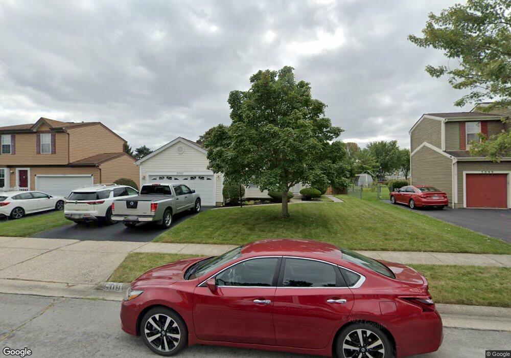
5091 Crockett Dr Hilliard, OH 43026
Cross Creek NeighborhoodEstimated Value: $317,000 - $343,000
3
Beds
2
Baths
1,323
Sq Ft
$251/Sq Ft
Est. Value
About This Home
This home is located at 5091 Crockett Dr, Hilliard, OH 43026 and is currently estimated at $331,774, approximately $250 per square foot. 5091 Crockett Dr is a home located in Franklin County with nearby schools including Hilliard Crossing Elementary School, Hilliard Station Sixth Grade Elementary School, and Hilliard Heritage Middle School.
Ownership History
Date
Name
Owned For
Owner Type
Purchase Details
Closed on
May 31, 2002
Sold by
Donaldson Edward E and Donaldson Sharon L
Bought by
Lewis Timothy and Lewis Cheryl
Current Estimated Value
Home Financials for this Owner
Home Financials are based on the most recent Mortgage that was taken out on this home.
Original Mortgage
$132,000
Outstanding Balance
$65,694
Interest Rate
9.37%
Mortgage Type
Purchase Money Mortgage
Estimated Equity
$266,080
Purchase Details
Closed on
Aug 9, 1990
Bought by
Donaldson Edward E
Create a Home Valuation Report for This Property
The Home Valuation Report is an in-depth analysis detailing your home's value as well as a comparison with similar homes in the area
Home Values in the Area
Average Home Value in this Area
Purchase History
| Date | Buyer | Sale Price | Title Company |
|---|---|---|---|
| Lewis Timothy | $147,000 | -- | |
| Donaldson Edward E | $80,300 | -- |
Source: Public Records
Mortgage History
| Date | Status | Borrower | Loan Amount |
|---|---|---|---|
| Open | Lewis Timothy | $132,000 |
Source: Public Records
Tax History Compared to Growth
Tax History
| Year | Tax Paid | Tax Assessment Tax Assessment Total Assessment is a certain percentage of the fair market value that is determined by local assessors to be the total taxable value of land and additions on the property. | Land | Improvement |
|---|---|---|---|---|
| 2024 | $5,101 | $90,310 | $28,880 | $61,430 |
| 2023 | $4,419 | $90,300 | $28,875 | $61,425 |
| 2022 | $4,066 | $66,540 | $14,180 | $52,360 |
| 2021 | $4,062 | $66,540 | $14,180 | $52,360 |
| 2020 | $4,050 | $66,540 | $14,180 | $52,360 |
| 2019 | $3,802 | $53,340 | $11,340 | $42,000 |
| 2018 | $3,728 | $53,340 | $11,340 | $42,000 |
| 2017 | $3,850 | $53,340 | $11,340 | $42,000 |
| 2016 | $3,914 | $51,070 | $10,920 | $40,150 |
| 2015 | $3,669 | $51,070 | $10,920 | $40,150 |
| 2014 | $3,675 | $51,070 | $10,920 | $40,150 |
| 2013 | $1,773 | $48,615 | $10,395 | $38,220 |
Source: Public Records
Map
Nearby Homes
- 2967 Castlebrook Ave
- 3111 Castlebrook Ave
- 5208 Springdale Blvd
- 5053 Stoneybrook Blvd
- 5041 Stoneybrook Blvd Unit 9E
- 5285 Redlands Dr
- 5213 Frisco Dr
- 5078 Stoneybrook Blvd Unit 2E
- 4995 Singleton Dr
- 4995 Singleton Dr Unit 18c
- 5080 Stoneybrook Blvd Unit 2D
- 5258 Skytrail Dr
- 2759 Lyndley Ct
- 5062 Stoneybrook Blvd Unit 3F
- 4945 Singleton Dr Unit 13C
- 4857 Stoneybrook Blvd Unit 29E
- 4862 Stoneybrook Blvd Unit 24E
- 4843 Stoneybrook Blvd Unit 30E
- 4976 Shady Oak Dr
- 3012 Papin St Unit 39
- 5083 Crockett Dr
- 5099 Crockett Dr
- 5075 Crockett Dr
- 5082 Flagstaff Ct
- 2986 Castlebrook Ave
- 2978 Castlebrook Ave
- 5090 Flagstaff Ct
- 2970 Castlebrook Ave
- 5084 Crockett Dr
- 5092 Crockett Dr
- 5074 Flagstaff Ct
- 5076 Crockett Dr
- 5100 Crockett Dr
- 2991 Phoenix Ave
- 2962 Castlebrook Ave
- 2983 Phoenix Ave
- 5068 Crockett Dr
- 2975 Phoenix Ave
- 5112 Crockett Dr
- 2954 Castlebrook Ave