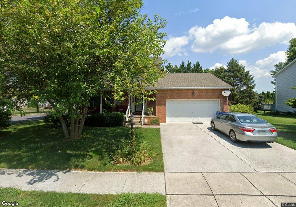
51 Ashfield Dr Unit 10 Littlestown, PA 17340
Estimated Value: $356,000 - $404,000
3
Beds
3
Baths
1,848
Sq Ft
$206/Sq Ft
Est. Value
About This Home
This home is located at 51 Ashfield Dr Unit 10, Littlestown, PA 17340 and is currently estimated at $380,729, approximately $206 per square foot. 51 Ashfield Dr Unit 10 is a home located in Adams County with nearby schools including Rolling Acres El School, Maple Avenue Middle School, and Littlestown Senior High School.
Ownership History
Date
Name
Owned For
Owner Type
Purchase Details
Closed on
Dec 13, 2007
Sold by
Walter Ronald B and Walter Edna May
Bought by
Schumaker Donald W and Schumaker Judith Ann
Current Estimated Value
Home Financials for this Owner
Home Financials are based on the most recent Mortgage that was taken out on this home.
Original Mortgage
$225,600
Outstanding Balance
$142,574
Interest Rate
6.27%
Mortgage Type
New Conventional
Estimated Equity
$238,155
Create a Home Valuation Report for This Property
The Home Valuation Report is an in-depth analysis detailing your home's value as well as a comparison with similar homes in the area
Home Values in the Area
Average Home Value in this Area
Purchase History
| Date | Buyer | Sale Price | Title Company |
|---|---|---|---|
| Schumaker Donald W | $282,000 | -- |
Source: Public Records
Mortgage History
| Date | Status | Borrower | Loan Amount |
|---|---|---|---|
| Open | Schumaker Donald W | $225,600 | |
| Closed | Schumaker Donald W | $28,200 |
Source: Public Records
Tax History Compared to Growth
Tax History
| Year | Tax Paid | Tax Assessment Tax Assessment Total Assessment is a certain percentage of the fair market value that is determined by local assessors to be the total taxable value of land and additions on the property. | Land | Improvement |
|---|---|---|---|---|
| 2025 | $4,721 | $249,400 | $46,600 | $202,800 |
| 2024 | $4,513 | $249,400 | $46,600 | $202,800 |
| 2023 | $4,423 | $249,400 | $46,600 | $202,800 |
| 2022 | $4,421 | $249,400 | $46,600 | $202,800 |
| 2021 | $4,265 | $249,400 | $46,600 | $202,800 |
| 2020 | $4,203 | $249,400 | $46,600 | $202,800 |
| 2019 | $4,114 | $249,400 | $46,600 | $202,800 |
| 2018 | $4,025 | $249,400 | $46,600 | $202,800 |
| 2017 | $3,886 | $249,400 | $46,600 | $202,800 |
| 2016 | -- | $249,400 | $46,600 | $202,800 |
| 2015 | -- | $249,400 | $46,600 | $202,800 |
| 2014 | -- | $249,400 | $46,600 | $202,800 |
Source: Public Records
Map
Nearby Homes
- 43 Ashfield Dr Unit 14
- 5 Manor Cir Unit 103
- 567 Lumber St
- 559 Lumber St
- 535 Lumber St
- 449 Glenwyn Dr
- 349 Basehoar School Rd Unit 5
- 41 Smith Cir
- 211 E King St
- 162 Newark St
- 61 E King St
- LOT 9 Mehring Rd
- 115 Charles St
- 117 Charles St
- 440 N Queen St
- 140 Apple Grove Ln Unit 425
- 135 Apple Grove Ln Unit 438
- 58 N Gala Unit 397
- 129 W King St
- 0 Locust Dr Unit PAAD2015910
- 49 Ashfield Dr Unit 11
- 615 Basehoar School Rd Unit 9
- 1 Ashfield Ct Unit 257
- 625 Basehoar School Rd Unit 8
- 47 Ashfield Dr Unit 12
- 50 Ashfield Dr Unit 56
- 595 Basehoar School Rd Unit 256
- 635 Basehoar School Rd Unit 7
- 4 Ashfield Ct Unit 260
- 681 Basehoar School Rd
- 585 Basehoar School Rd Unit 255
- 45 Ashfield Dr Unit 13
- 3 Ashfield Ct Unit 258
- 46 Ashfield Dr Unit 54
- 645 Basehoar School Rd Unit 6
- 8 Meadowview Dr Unit 43
- 16 Ashfield Dr Unit 44
- 7 Meadowview Dr Unit 42
- 5 Ashfield Ct Unit 259
- 575 Basehoar School Rd Unit 254