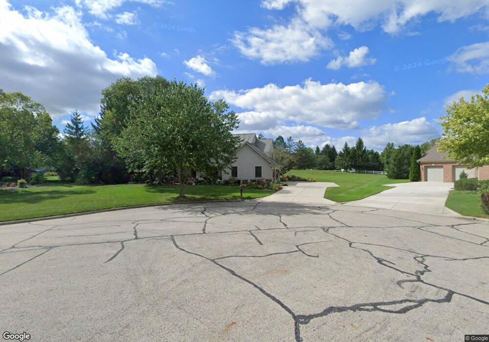
51 Aston Ct Powell, OH 43065
Estimated Value: $753,000 - $800,000
4
Beds
3
Baths
3,246
Sq Ft
$238/Sq Ft
Est. Value
About This Home
This home is located at 51 Aston Ct, Powell, OH 43065 and is currently estimated at $771,085, approximately $237 per square foot. 51 Aston Ct is a home located in Delaware County with nearby schools including Tyler Run Elementary School, Olentangy Liberty Middle School, and Olentangy Liberty High School.
Ownership History
Date
Name
Owned For
Owner Type
Purchase Details
Closed on
Oct 24, 2003
Sold by
Helpbringer Todd B
Bought by
Helpbringer Rose M
Current Estimated Value
Home Financials for this Owner
Home Financials are based on the most recent Mortgage that was taken out on this home.
Original Mortgage
$100,000
Interest Rate
6.02%
Mortgage Type
Purchase Money Mortgage
Create a Home Valuation Report for This Property
The Home Valuation Report is an in-depth analysis detailing your home's value as well as a comparison with similar homes in the area
Home Values in the Area
Average Home Value in this Area
Purchase History
| Date | Buyer | Sale Price | Title Company |
|---|---|---|---|
| Helpbringer Rose M | -- | Service Title Agency |
Source: Public Records
Mortgage History
| Date | Status | Borrower | Loan Amount |
|---|---|---|---|
| Previous Owner | Helpbringer Rose M | $100,000 |
Source: Public Records
Tax History
| Year | Tax Paid | Tax Assessment Tax Assessment Total Assessment is a certain percentage of the fair market value that is determined by local assessors to be the total taxable value of land and additions on the property. | Land | Improvement |
|---|---|---|---|---|
| 2024 | $10,892 | $207,870 | $56,040 | $151,830 |
| 2023 | $10,934 | $207,870 | $56,040 | $151,830 |
| 2022 | $8,935 | $134,680 | $34,930 | $99,750 |
| 2021 | $9,089 | $134,680 | $34,930 | $99,750 |
| 2020 | $9,121 | $134,680 | $34,930 | $99,750 |
| 2019 | $8,794 | $134,680 | $34,930 | $99,750 |
| 2018 | $8,896 | $134,680 | $34,930 | $99,750 |
| 2017 | $8,824 | $134,750 | $33,880 | $100,870 |
| 2016 | $9,550 | $134,750 | $33,880 | $100,870 |
| 2015 | $8,691 | $134,750 | $33,880 | $100,870 |
| 2014 | $8,806 | $134,750 | $33,880 | $100,870 |
| 2013 | $9,012 | $134,750 | $33,880 | $100,870 |
Source: Public Records
Map
Nearby Homes
- 86 Cressingham Ln
- 130 Barrington Place
- 170 Barrington Place
- 269 Ridge Side Dr
- 149 Chedworth Row
- 5552 Jessica Ln W
- 120 S Liberty St
- 1937 Liberty St
- 149 Trail Edge Cir
- 8870 Olentangy River Rd
- 104 Encore Park Bend
- 22 Brookehill Dr
- 22 Liberty Ridge Ave
- 18 Murphys View Place Unit I18
- 11 Murphys View Place
- 97 Murphys Crossing Dr
- 1451 Brittingham Ln
- 1650 Wren Ln
- 424 Whitaker Ave S
- 612 Foxdale Place Unit 612
- 40 Aston Ct
- 526 Wynridge Ct
- 520 Wynridge Ct
- 536 Wynridge Ct
- 46 Aston Ct
- 60 Aston Ct
- 74 Aston Ct
- 517 Wynridge Ct
- 521 Wynridge Ct
- 86 Aston Ct
- 1551 W Powell Rd
- 537 Wynridge Ct
- 20 Timberknoll Loop
- 636 Old Pond Ln
- 30 Timberknoll Loop
- 104 Charterhouse Ct
- 632 Old Pond Ln
- 98 Aston Ct
- 114 Charterhouse Ct
- 110 Aston Ct
Your Personal Tour Guide
Ask me questions while you tour the home.