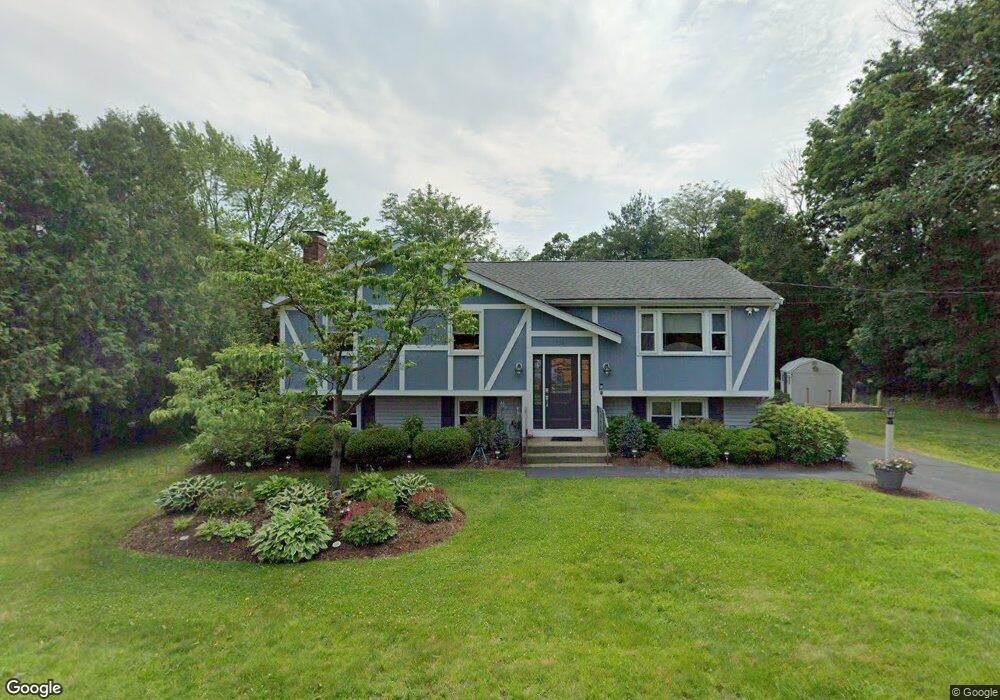
51 Branch St Mansfield, MA 02048
Estimated Value: $595,207 - $701,000
4
Beds
2
Baths
1,144
Sq Ft
$559/Sq Ft
Est. Value
About This Home
This home is located at 51 Branch St, Mansfield, MA 02048 and is currently estimated at $639,552, approximately $559 per square foot. 51 Branch St is a home located in Bristol County with nearby schools including Everett W. Robinson Elementary School, Jordan/Jackson Elementary School, and Harold L. Qualters Middle School.
Ownership History
Date
Name
Owned For
Owner Type
Purchase Details
Closed on
Sep 22, 1988
Sold by
Sawyer Dennis M
Bought by
Moran Michael M
Current Estimated Value
Create a Home Valuation Report for This Property
The Home Valuation Report is an in-depth analysis detailing your home's value as well as a comparison with similar homes in the area
Home Values in the Area
Average Home Value in this Area
Purchase History
| Date | Buyer | Sale Price | Title Company |
|---|---|---|---|
| Moran Michael M | $166,000 | -- |
Source: Public Records
Mortgage History
| Date | Status | Borrower | Loan Amount |
|---|---|---|---|
| Open | Moran Michael M | $170,000 | |
| Closed | Moran Michael M | $140,000 | |
| Closed | Moran Michael M | $37,000 |
Source: Public Records
Tax History
| Year | Tax Paid | Tax Assessment Tax Assessment Total Assessment is a certain percentage of the fair market value that is determined by local assessors to be the total taxable value of land and additions on the property. | Land | Improvement |
|---|---|---|---|---|
| 2025 | $6,880 | $522,400 | $237,000 | $285,400 |
| 2024 | $6,566 | $486,400 | $237,000 | $249,400 |
| 2023 | $6,404 | $454,500 | $237,000 | $217,500 |
| 2022 | $6,197 | $408,500 | $219,400 | $189,100 |
| 2021 | $5,815 | $378,600 | $192,100 | $186,500 |
| 2020 | $5,749 | $374,300 | $182,900 | $191,400 |
| 2019 | $5,231 | $343,700 | $152,300 | $191,400 |
| 2018 | $5,012 | $321,900 | $145,200 | $176,700 |
| 2017 | $4,821 | $321,000 | $141,000 | $180,000 |
| 2016 | $4,766 | $309,300 | $134,300 | $175,000 |
| 2015 | $4,416 | $284,900 | $134,300 | $150,600 |
Source: Public Records
Map
Nearby Homes
- 97 East St
- 44 Fairfield Park Unit 44
- 28 Court St
- 46 Hope St
- 122 Samoset Ave
- 266 N Main St Unit 3
- 150 Rumford Ave Unit 110
- 22 Pleasant St Unit B
- 81 Chilson Ave
- 25 Kingman Ave
- 7 Fieldstone Dr
- 166 Chauncy St
- 1 Deer Path Ln
- 619 N Main St
- 631 East St Unit L101
- 14 Windchime Dr
- 356 Central St
- 4 Erick Rd Unit 90
- 1769 West St
- 212 Mill St
Your Personal Tour Guide
Ask me questions while you tour the home.