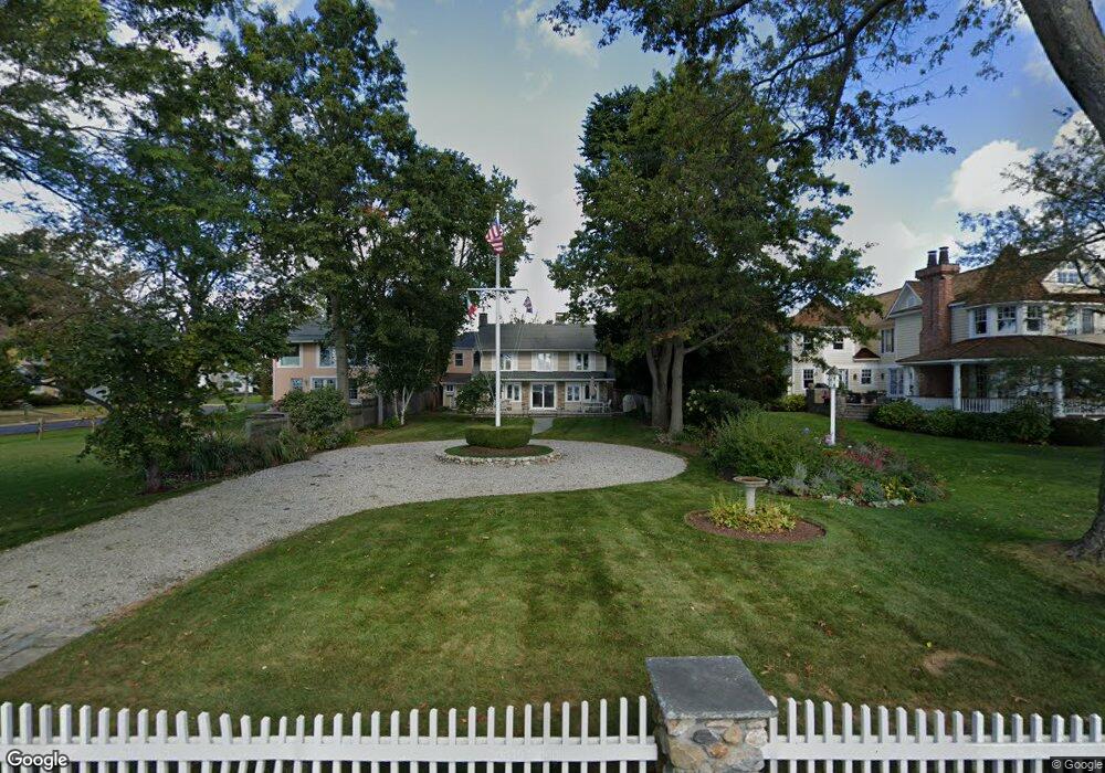
51 Compo Beach Rd Westport, CT 06880
Compo NeighborhoodEstimated Value: $6,556,521 - $6,778,000
3
Beds
4
Baths
2,304
Sq Ft
$2,907/Sq Ft
Est. Value
About This Home
This home is located at 51 Compo Beach Rd, Westport, CT 06880 and is currently estimated at $6,697,174, approximately $2,906 per square foot. 51 Compo Beach Rd is a home located in Fairfield County with nearby schools including Green's Farms School, Bedford Middle School, and Staples High School.
Ownership History
Date
Name
Owned For
Owner Type
Purchase Details
Closed on
Jul 2, 2025
Sold by
Cadoux Peter J and Cadoux Sally G
Bought by
Mcdonough Bart R
Current Estimated Value
Purchase Details
Closed on
May 16, 2022
Sold by
Caputo John N
Bought by
Cadoux Peter J and Cadoux Sally G
Purchase Details
Closed on
May 1, 1996
Sold by
Sherman Donna
Bought by
Caputo John and Caputo Gene
Create a Home Valuation Report for This Property
The Home Valuation Report is an in-depth analysis detailing your home's value as well as a comparison with similar homes in the area
Home Values in the Area
Average Home Value in this Area
Purchase History
| Date | Buyer | Sale Price | Title Company |
|---|---|---|---|
| Mcdonough Bart R | $6,650,000 | -- | |
| Mcdonough Bart R | $6,650,000 | -- | |
| Cadoux Peter J | $2,050,000 | None Available | |
| Cadoux Peter J | $2,050,000 | None Available | |
| Caputo John | $430,000 | -- | |
| Caputo John | $430,000 | -- |
Source: Public Records
Mortgage History
| Date | Status | Borrower | Loan Amount |
|---|---|---|---|
| Previous Owner | Caputo John | $250,000 | |
| Previous Owner | Caputo John | $212,000 | |
| Previous Owner | Caputo John | $100,000 |
Source: Public Records
Tax History Compared to Growth
Tax History
| Year | Tax Paid | Tax Assessment Tax Assessment Total Assessment is a certain percentage of the fair market value that is determined by local assessors to be the total taxable value of land and additions on the property. | Land | Improvement |
|---|---|---|---|---|
| 2025 | $45,975 | $2,437,680 | $963,690 | $1,473,990 |
| 2024 | $34,818 | $1,869,945 | $920,325 | $949,620 |
| 2023 | $20,479 | $1,116,000 | $876,500 | $239,500 |
| 2022 | $20,166 | $1,116,000 | $876,500 | $239,500 |
| 2021 | $20,166 | $1,116,000 | $876,500 | $239,500 |
| 2020 | $17,039 | $1,066,000 | $886,400 | $179,600 |
| 2019 | $17,973 | $1,066,000 | $886,400 | $179,600 |
| 2018 | $17,973 | $1,066,000 | $886,400 | $179,600 |
| 2017 | $17,973 | $1,066,000 | $886,400 | $179,600 |
| 2016 | $17,973 | $1,066,000 | $886,400 | $179,600 |
| 2015 | $19,161 | $1,059,200 | $873,000 | $186,200 |
| 2014 | $19,002 | $1,059,200 | $873,000 | $186,200 |
Source: Public Records
Map
Nearby Homes
- 14 Owenoke Park
- 5 Hidden Hill Rd
- 260 Hillspoint Rd
- 24 Compo Pkwy
- 39 Compo Pkwy
- 11 Sterling Dr
- 216 Hillspoint Rd
- 33 Burnham Hill
- 48 Compo Mill Cove
- 46 Compo Mill Cove
- 46 Compo Mill Cove
- 11 Manitou Ct
- 32 Edgewater Hillside
- 115 Valley Rd
- 6 Stony Point Rd
- 8 Canal Rd
- 61 Edgewater Commons Ln
- 171 & 169 Compo Rd S
- 171 Compo Rd S
- 23 Bridge St
- 2 Roosevelt Rd
- 6 Roosevelt Rd
- 45 Compo Beach Rd
- 53 Compo Beach Rd
- 5 Roosevelt Rd
- 57 Compo Beach Rd
- 9 Roosevelt Rd
- 15 Murvon Ct
- 41 Compo Beach Rd
- 37 Compo Beach Rd
- 12 Roosevelt Rd
- 29 Compo Beach Rd
- 3 Apple Tree Trail
- 9 Murvon Ct
- 11 Roosevelt Rd
- 11 Murvon Ct
- 7 Murvon Ct
- 14 Roosevelt Rd
- 35 Compo Beach Rd
- 16 Roosevelt Rd