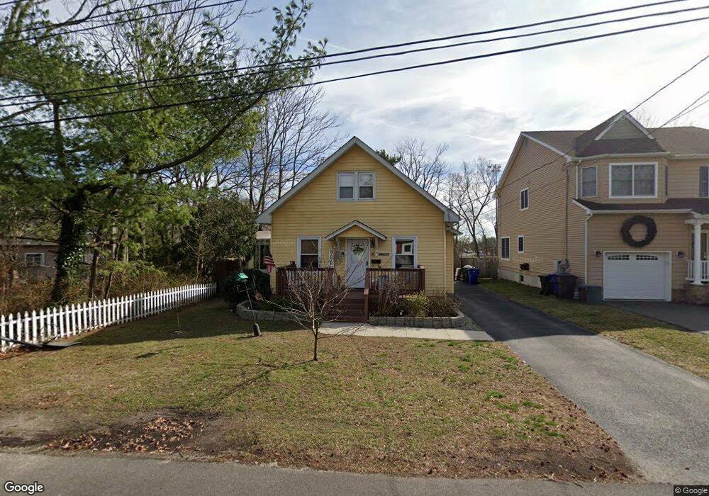
51 Dunham Ave Toms River, NJ 08753
Estimated Value: $440,000 - $539,000
4
Beds
2
Baths
3,408
Sq Ft
$143/Sq Ft
Est. Value
About This Home
This home is located at 51 Dunham Ave, Toms River, NJ 08753 and is currently estimated at $488,971, approximately $143 per square foot. 51 Dunham Ave is a home located in Ocean County with nearby schools including St Joseph Grade School, Ambassador Christian Academy, and Donovan Catholic High School.
Ownership History
Date
Name
Owned For
Owner Type
Purchase Details
Closed on
Oct 15, 2002
Current Estimated Value
Home Financials for this Owner
Home Financials are based on the most recent Mortgage that was taken out on this home.
Original Mortgage
$177,250
Interest Rate
6.34%
Purchase Details
Closed on
Aug 16, 2002
Sold by
Hardman Thomas
Bought by
Cover Scott A and Cover Maureen
Home Financials for this Owner
Home Financials are based on the most recent Mortgage that was taken out on this home.
Original Mortgage
$177,250
Interest Rate
6.34%
Create a Home Valuation Report for This Property
The Home Valuation Report is an in-depth analysis detailing your home's value as well as a comparison with similar homes in the area
Home Values in the Area
Average Home Value in this Area
Purchase History
| Date | Buyer | Sale Price | Title Company |
|---|---|---|---|
| -- | $198,800 | -- | |
| Cover Scott A | $198,750 | -- |
Source: Public Records
Mortgage History
| Date | Status | Borrower | Loan Amount |
|---|---|---|---|
| Previous Owner | Cover Scott A | $177,250 |
Source: Public Records
Tax History Compared to Growth
Tax History
| Year | Tax Paid | Tax Assessment Tax Assessment Total Assessment is a certain percentage of the fair market value that is determined by local assessors to be the total taxable value of land and additions on the property. | Land | Improvement |
|---|---|---|---|---|
| 2025 | $5,554 | $305,000 | $124,000 | $181,000 |
| 2024 | $5,280 | $305,000 | $124,000 | $181,000 |
| 2023 | $5,090 | $305,000 | $124,000 | $181,000 |
| 2022 | $5,090 | $305,000 | $124,000 | $181,000 |
| 2021 | $5,493 | $219,300 | $85,800 | $133,500 |
| 2020 | $5,469 | $219,300 | $85,800 | $133,500 |
| 2019 | $5,233 | $219,300 | $85,800 | $133,500 |
| 2018 | $5,162 | $219,300 | $85,800 | $133,500 |
| 2017 | $5,118 | $219,300 | $85,800 | $133,500 |
| 2016 | $4,985 | $219,300 | $85,800 | $133,500 |
| 2015 | $4,796 | $219,300 | $85,800 | $133,500 |
| 2014 | $4,566 | $219,300 | $85,800 | $133,500 |
Source: Public Records
Map
Nearby Homes
- 28 Melrose Dr Unit 9
- 10 Orchard St
- 219 Hyers St
- 8 Spruce St
- 23 Grant Ave
- 17 Seward Ave
- 16 Field St
- 28 Messenger St
- 103 Park St
- 108 Lien St
- 129 Lien St
- 908 Bowling Green Dr
- 29 Lexington Ave
- 202 Terrace Ave
- 303 Terrace Ave
- 77 E Water St Unit 2
- 77 E Water St Unit 12
- 77 E Water St
- 77 E Water St Unit 18
- 7 Dock St
- 49 Dunham Ave
- 28 Melrose Dr Unit B5
- 28 Melrose Dr
- 28 Melrose Dr
- 28 Melrose Dr
- 28 Melrose Dr
- 28 Melrose Dr
- 28 Melrose Dr
- 28 Melrose Dr
- 28 Melrose Dr
- 28 Melrose Dr
- 28 Melrose Dr
- 28 Melrose Dr Unit D10
- 28 Melrose Dr Unit 101
- 28 Melrose Dr Unit 1
- 28 Melrose Dr Unit 12D
- 28 Melrose Dr Unit 7C
- 28 Melrose Dr Unit 10D
- 43 Dunham Ave
- 329 Hyers St