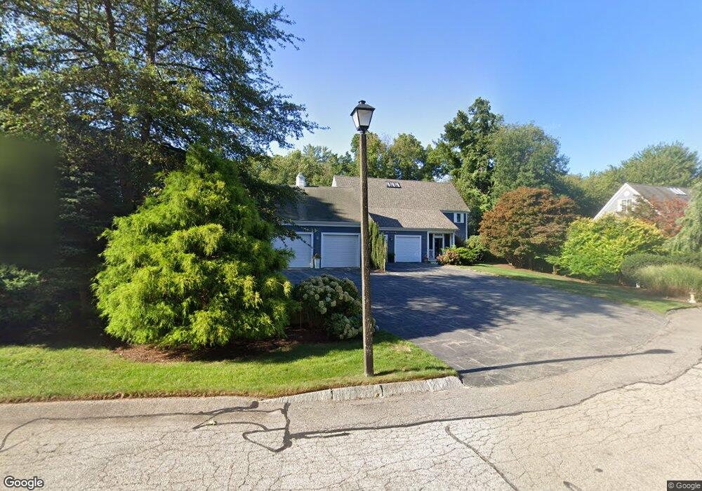
51 Forest Ln Scituate, MA 02066
Estimated Value: $975,000 - $1,019,000
3
Beds
4
Baths
3,533
Sq Ft
$284/Sq Ft
Est. Value
About This Home
This home is located at 51 Forest Ln, Scituate, MA 02066 and is currently estimated at $1,003,003, approximately $283 per square foot. 51 Forest Ln is a home located in Plymouth County with nearby schools including Hatherly Elementary School, Lester J. Gates Middle School, and Scituate High School.
Ownership History
Date
Name
Owned For
Owner Type
Purchase Details
Closed on
May 3, 2018
Sold by
Leibfarth John G and Leibfarth Rose
Bought by
Leibfarth Christopher J and Reardon Jennier
Current Estimated Value
Purchase Details
Closed on
Sep 30, 2005
Sold by
Giagrando Gerald and Giagrando Linda
Bought by
Leibfarth John G and Leibfarth Rose
Purchase Details
Closed on
Apr 30, 1996
Sold by
Bertan Homes Inc
Bought by
Giagrando Gerald and Giagrando Linda
Home Financials for this Owner
Home Financials are based on the most recent Mortgage that was taken out on this home.
Original Mortgage
$100,000
Interest Rate
7.81%
Mortgage Type
Purchase Money Mortgage
Create a Home Valuation Report for This Property
The Home Valuation Report is an in-depth analysis detailing your home's value as well as a comparison with similar homes in the area
Home Values in the Area
Average Home Value in this Area
Purchase History
| Date | Buyer | Sale Price | Title Company |
|---|---|---|---|
| Leibfarth Christopher J | -- | -- | |
| Leibfarth John G | $700,000 | -- | |
| Giagrando Gerald | $335,000 | -- |
Source: Public Records
Mortgage History
| Date | Status | Borrower | Loan Amount |
|---|---|---|---|
| Previous Owner | Giagrando Gerald | $50,000 | |
| Previous Owner | Giagrando Gerald | $25,000 | |
| Previous Owner | Giagrando Gerald | $500,000 | |
| Previous Owner | Giagrando Gerald | $100,000 |
Source: Public Records
Tax History
| Year | Tax Paid | Tax Assessment Tax Assessment Total Assessment is a certain percentage of the fair market value that is determined by local assessors to be the total taxable value of land and additions on the property. | Land | Improvement |
|---|---|---|---|---|
| 2025 | $8,646 | $865,500 | $0 | $865,500 |
| 2024 | $8,562 | $826,400 | $0 | $826,400 |
| 2023 | $8,145 | $721,400 | $0 | $721,400 |
| 2022 | $8,145 | $645,400 | $0 | $645,400 |
| 2021 | $8,410 | $630,900 | $0 | $630,900 |
| 2020 | $8,402 | $622,400 | $0 | $622,400 |
| 2019 | $8,229 | $598,900 | $0 | $598,900 |
| 2018 | $7,979 | $572,000 | $0 | $572,000 |
| 2017 | $7,788 | $552,700 | $0 | $552,700 |
| 2016 | $7,815 | $552,700 | $0 | $552,700 |
| 2015 | $7,240 | $552,700 | $0 | $552,700 |
Source: Public Records
Map
Nearby Homes
- 11 Forest Ln
- 9 Forest Ln Unit 9
- 701 Country Way
- 629 Country Way
- 67 Pratt Rd
- 817 Country Way
- 26 Mordecai Lincoln Rd
- 0 Bates Ln (Lot E Kevin's Way) Unit 73419598
- 71 Ledgewood Dr
- 7 3 Ring Rd
- 27 Ox Pasture Ln
- 453 Clapp Rd
- 449 Clapp Rd
- 451 Clapp Rd
- 453 - 455 Clapp Rd
- 49 Whittier Dr
- 627 First Parish Rd
- 764 First Parish Rd
- 45 Hemlock Way
- 537 First Parish Rd
- 53 Forest Ln
- 51 Forest Ln Unit 51
- 53 Forest Ln Unit 53
- 79 Forest Ln Unit B
- 65 Forest Ln
- 63 Forest Ln
- 65 Forest Ln Unit 65
- 33 Forest Ln
- 40 Forest Ln
- 46 Forest Ln
- 35 Forest Ln
- 58 Forest Ln
- 60 Forest Ln
- 22 Forest Ln
- 24 Forest Ln
- 22 Forest Ln Unit 8B
- 109 Booth Hill Rd
- 109B Booth Hill Rd Unit B
- 109B Booth Hill Rd
- 115 Booth Hill Rd
Your Personal Tour Guide
Ask me questions while you tour the home.