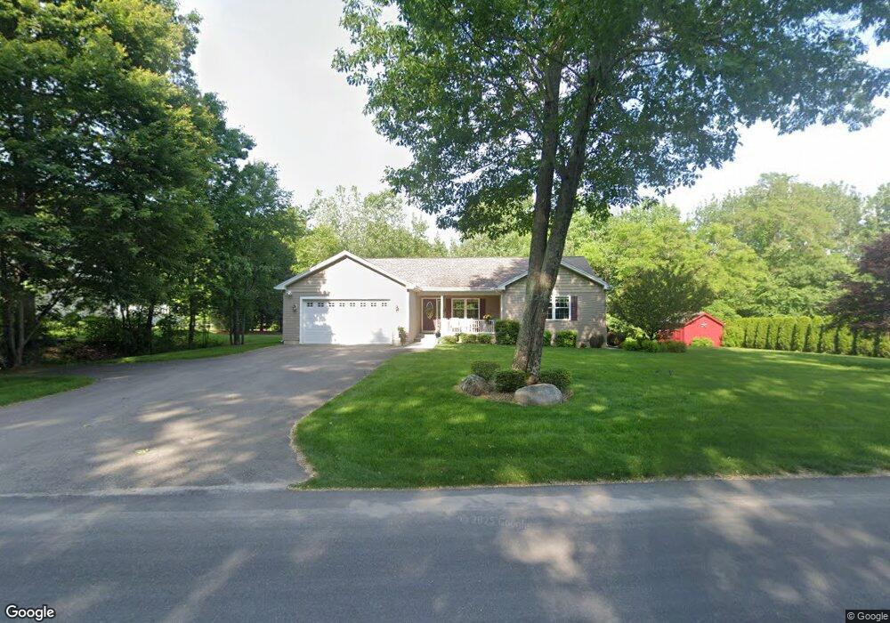
51 Gilbert Rd Southampton, MA 01073
Estimated Value: $521,427
2
Beds
2
Baths
1,485
Sq Ft
$351/Sq Ft
Est. Value
About This Home
This home is located at 51 Gilbert Rd, Southampton, MA 01073 and is currently priced at $521,427, approximately $351 per square foot. 51 Gilbert Rd is a home located in Hampshire County with nearby schools including William E Norris School and White Oak School.
Ownership History
Date
Name
Owned For
Owner Type
Purchase Details
Closed on
Jul 31, 2013
Sold by
Callahan John T and Callahan Linda K
Bought by
Callahan Irt
Current Estimated Value
Purchase Details
Closed on
Oct 18, 2011
Sold by
David Garstka Builders
Bought by
Masse Linda K and Callahan John T
Home Financials for this Owner
Home Financials are based on the most recent Mortgage that was taken out on this home.
Original Mortgage
$146,000
Interest Rate
4.25%
Mortgage Type
Purchase Money Mortgage
Purchase Details
Closed on
Jul 13, 2011
Sold by
Gwinner Edward H
Bought by
David Garstka Builders
Create a Home Valuation Report for This Property
The Home Valuation Report is an in-depth analysis detailing your home's value as well as a comparison with similar homes in the area
Home Values in the Area
Average Home Value in this Area
Purchase History
| Date | Buyer | Sale Price | Title Company |
|---|---|---|---|
| Callahan Irt | -- | -- | |
| Masse Linda K | $322,000 | -- | |
| David Garstka Builders | $102,000 | -- |
Source: Public Records
Mortgage History
| Date | Status | Borrower | Loan Amount |
|---|---|---|---|
| Previous Owner | Masse Linda K | $146,000 |
Source: Public Records
Tax History Compared to Growth
Tax History
| Year | Tax Paid | Tax Assessment Tax Assessment Total Assessment is a certain percentage of the fair market value that is determined by local assessors to be the total taxable value of land and additions on the property. | Land | Improvement |
|---|---|---|---|---|
| 2025 | $6,123 | $432,100 | $117,500 | $314,600 |
| 2024 | $5,955 | $417,900 | $117,500 | $300,400 |
| 2023 | $5,556 | $387,700 | $117,500 | $270,200 |
| 2022 | $5,614 | $372,500 | $117,500 | $255,000 |
| 2021 | $5,498 | $344,300 | $109,400 | $234,900 |
| 2020 | $5,360 | $338,800 | $109,400 | $229,400 |
| 2019 | $5,231 | $320,700 | $109,400 | $211,300 |
| 2018 | $5,011 | $293,900 | $98,100 | $195,800 |
| 2017 | $4,796 | $293,900 | $98,100 | $195,800 |
| 2015 | $4,499 | $286,400 | $90,000 | $196,400 |
Source: Public Records
Map
Nearby Homes
- 119 Brickyard Rd
- Lot 5 Brickyard Rd
- 117 Russellville Rd
- Lot 5 Gil Farm Rd
- Lot 6 Gil Farm Rd
- 369 College Hwy
- 100 Fomer Rd
- 216 College Hwy
- 17 Maple St
- 132 North Rd
- 336 Russellville Rd
- 7 Quigley Rd
- Lot 57 White Loaf Rd
- 45 Jaeger Dr
- 47 Jaeger Dr
- 115 Crooked Ledge Rd
- LOT 3 Brickyard Rd
- 232 Russellville Rd
- 150 Middle Rd
- 94 Pequot Rd (Rear)