Estimated Value: $1,062,000 - $1,251,000
4
Beds
4
Baths
2,800
Sq Ft
$405/Sq Ft
Est. Value
About This Home
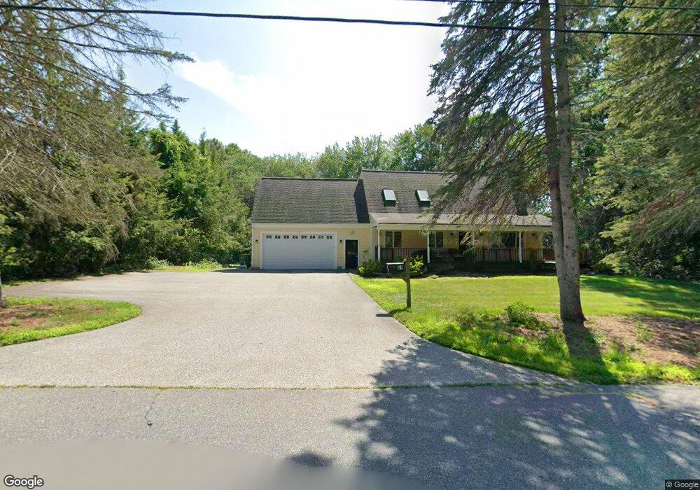
This home is located at 51 Harris St Unit 1, Acton, MA 01720 and is currently estimated at $1,134,158, approximately $405 per square foot. 51 Harris St Unit 1 is a home located in Middlesex County with nearby schools including Acton-Boxborough Regional High School and Oak Meadow Montessori School.
Ownership History
Date
Name
Owned For
Owner Type
Purchase Details
Closed on
Jun 15, 2022
Sold by
51 Harris Street Rt and Moisakis
Bought by
Brooks Adam R and Brooks Whitney L
Current Estimated Value
Home Financials for this Owner
Home Financials are based on the most recent Mortgage that was taken out on this home.
Original Mortgage
$650,000
Outstanding Balance
$616,711
Interest Rate
5.27%
Mortgage Type
Purchase Money Mortgage
Estimated Equity
$517,447
Purchase Details
Closed on
May 22, 2019
Sold by
Moisakis Nicholas and Moisakis Stephanie
Bought by
51 Harris Street Rt and Moisakis
Purchase Details
Closed on
Mar 25, 2016
Sold by
Wells Fargo Bank Na Tr
Bought by
Moisakis Nicholas and Moisakis Stephanie
Purchase Details
Closed on
Dec 11, 2015
Sold by
Sloan John P and Wells Fargo Bank Na Tr
Bought by
Wells Fargo Bank Na Tr
Create a Home Valuation Report for This Property
The Home Valuation Report is an in-depth analysis detailing your home's value as well as a comparison with similar homes in the area
Home Values in the Area
Average Home Value in this Area
Purchase History
| Date | Buyer | Sale Price | Title Company |
|---|---|---|---|
| Brooks Adam R | $1,100,000 | None Available | |
| 51 Harris Street Rt | -- | -- | |
| Moisakis Nicholas | $324,450 | -- | |
| Wells Fargo Bank Na Tr | $519,444 | -- |
Source: Public Records
Mortgage History
| Date | Status | Borrower | Loan Amount |
|---|---|---|---|
| Open | Brooks Adam R | $650,000 |
Source: Public Records
Tax History Compared to Growth
Tax History
| Year | Tax Paid | Tax Assessment Tax Assessment Total Assessment is a certain percentage of the fair market value that is determined by local assessors to be the total taxable value of land and additions on the property. | Land | Improvement |
|---|---|---|---|---|
| 2025 | $17,210 | $1,003,500 | $298,700 | $704,800 |
| 2024 | $16,138 | $968,100 | $298,700 | $669,400 |
| 2023 | $16,531 | $941,400 | $272,000 | $669,400 |
| 2022 | $14,716 | $756,600 | $236,100 | $520,500 |
| 2021 | $14,238 | $703,800 | $218,700 | $485,100 |
| 2020 | $13,062 | $678,900 | $218,700 | $460,200 |
| 2019 | $12,490 | $644,800 | $218,700 | $426,100 |
| 2018 | $12,219 | $630,500 | $218,700 | $411,800 |
| 2017 | $12,017 | $630,500 | $218,700 | $411,800 |
| 2016 | $9,294 | $483,300 | $218,700 | $264,600 |
| 2015 | $9,205 | $483,200 | $218,700 | $264,500 |
| 2014 | $8,937 | $459,500 | $218,700 | $240,800 |
Source: Public Records
Map
Nearby Homes
- 407 Great Rd Unit 9
- 403 Great Rd Unit 5
- 428 Great Rd Unit 10
- 420 Great Rd Unit B3
- 1 Quarry Rd
- 390 Great Rd Unit A2
- 386 Great Rd Unit A8
- 17 Northbriar Rd
- 16 Wampus Ave Unit 32
- 484 Great Rd
- 484 Great Rd
- 159 Skyline Dr Unit 159
- 7 Blue Heron Way
- 601 Old Stone Brook
- 9 Breezy Point Rd
- 484 Great Road -3
- 484 Great Road -4
- 484 Great Road -6
- 237 Brown Bear Crossing Unit 237
- 517 Tumbling Hawk
- 51 Harris St
- 51 Harris St
- 55 Harris St
- 48 Harris St
- 62 Harris St
- 54 Harris St
- 54 Harris St Unit 54
- 50 Harris St
- 63 Harris St
- 58 Harris St
- 42 Harris St
- 52 Harris St Unit 52
- 52R Harris St
- 15 Wyndcliff Dr
- 397 Great Rd Unit 10
- 397 Great Rd Unit 6
- 397 Great Rd Unit 3
- 397 Great Rd Unit 2
- 397 Great Rd Unit 1
- 397 Great Rd Unit 9