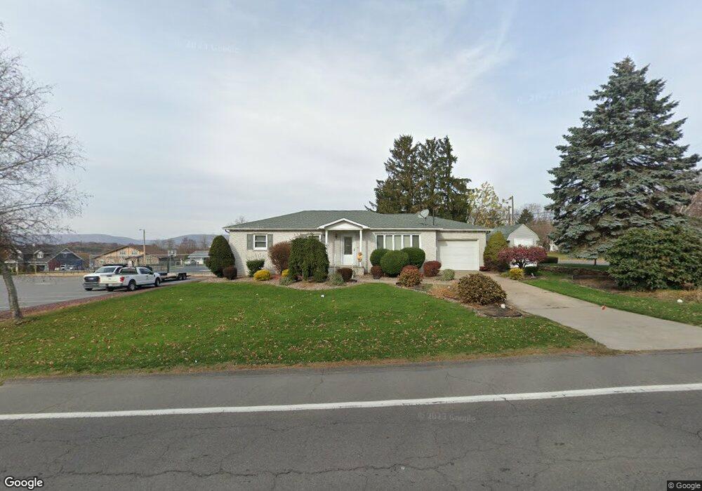
51 Laflin Rd Wilkes Barre, PA 18702
Estimated Value: $191,362 - $314,000
--
Bed
--
Bath
1,232
Sq Ft
$197/Sq Ft
Est. Value
About This Home
This home is located at 51 Laflin Rd, Wilkes Barre, PA 18702 and is currently estimated at $243,091, approximately $197 per square foot. 51 Laflin Rd is a home located in Luzerne County with nearby schools including Leo E. Solomon-Plains Elementary School, Cradock Middle School, and Solomon/Plains Junior High School.
Ownership History
Date
Name
Owned For
Owner Type
Purchase Details
Closed on
Oct 14, 2024
Sold by
Magdalinski Joan Marie
Bought by
Viteritti Linda and Magdalinski Michael
Current Estimated Value
Purchase Details
Closed on
Jan 1, 1960
Bought by
Magdalinski Frank J and Magdalinski Joan
Create a Home Valuation Report for This Property
The Home Valuation Report is an in-depth analysis detailing your home's value as well as a comparison with similar homes in the area
Home Values in the Area
Average Home Value in this Area
Purchase History
| Date | Buyer | Sale Price | Title Company |
|---|---|---|---|
| Viteritti Linda | -- | None Listed On Document | |
| Magdalinski Frank J | $26,500 | -- |
Source: Public Records
Tax History Compared to Growth
Tax History
| Year | Tax Paid | Tax Assessment Tax Assessment Total Assessment is a certain percentage of the fair market value that is determined by local assessors to be the total taxable value of land and additions on the property. | Land | Improvement |
|---|---|---|---|---|
| 2025 | $3,401 | $127,700 | $33,300 | $94,400 |
| 2024 | $3,401 | $127,700 | $33,300 | $94,400 |
| 2023 | $3,401 | $127,700 | $33,300 | $94,400 |
| 2022 | $3,378 | $127,700 | $33,300 | $94,400 |
| 2021 | $3,378 | $127,700 | $33,300 | $94,400 |
| 2020 | $3,378 | $127,700 | $33,300 | $94,400 |
| 2019 | $1,609 | $127,700 | $33,300 | $94,400 |
| 2018 | $3,227 | $127,700 | $33,300 | $94,400 |
| 2017 | $3,151 | $127,700 | $33,300 | $94,400 |
| 2016 | -- | $127,700 | $33,300 | $94,400 |
| 2015 | $2,565 | $127,700 | $33,300 | $94,400 |
| 2014 | $2,565 | $127,700 | $33,300 | $94,400 |
Source: Public Records
Map
Nearby Homes
- 113 Cedarwood Dr
- 53 Laflin Rd
- 111 Cedarwood Dr
- 52 Laflin Rd
- 55 Laflin Rd
- 109 Cedarwood Dr
- 116 Cedarwood Dr
- 110 Cedarwood Dr
- 54 Laflin Rd
- 112 Cedarwood Dr
- 118 Cedarwood Dr
- 43 Laurelwood Dr
- 57 Laflin Rd
- 44 Laflin Rd
- 107 Cedarwood Dr
- 120 Cedarwood Dr
- 41 Laurelwood Dr
- 56 Laflin Rd
- 108 1/2 Cedarwood Dr
- 119 Cedarwood Dr